ISS040-E-103491

| NASA Photo ID | ISS040-E-103491 |
| Focal Length | 70mm |
| Date taken | 2014.08.19 |
| Time taken | 15:24:50 GMT |
Resolutions offered for this image:
1000 x 666 pixels 540 x 360 pixels 4256 x 2832 pixels 720 x 480 pixels 4256 x 2832 pixels 640 x 426 pixels
1000 x 666 pixels 540 x 360 pixels 4256 x 2832 pixels 720 x 480 pixels 4256 x 2832 pixels 640 x 426 pixels


Spacecraft nadir point: 1.8° S, 55.5° W
Photo center point: 2.0° S, 56.5° W
Photo center point by machine learning:
Photo center point: 2.0° S, 56.5° W
Photo center point by machine learning:
Nadir to Photo Center: West
Spacecraft Altitude: 224 nautical miles (415km)
Country or Geographic Name: | BRAZIL |
Features: | AMAZON RIVER, FLOODPLAIN, LAKES, GLINT |
| Features Found Using Machine Learning: | |
Cloud Cover Percentage: | 10 (1-10)% |
Sun Elevation Angle: | 75° |
Sun Azimuth: | 19° |
Camera: | Nikon D3S Electronic Still Camera |
Focal Length: | 70mm |
Camera Tilt: | 15 degrees |
Format: | 4256E: 4256 x 2832 pixel CMOS sensor, 36.0mm x 23.9mm, total pixels: 12.87 million, Nikon FX format |
Film Exposure: | |
| Additional Information | |
| Width | Height | Annotated | Cropped | Purpose | Links |
|---|---|---|---|---|---|
| 1000 pixels | 666 pixels | No | No | Earth From Space collection | Download Image |
| 540 pixels | 360 pixels | Yes | No | Earth From Space collection | Download Image |
| 4256 pixels | 2832 pixels | No | No | Download Image | |
| 720 pixels | 480 pixels | Yes | No | NASA's Earth Observatory web site | Download Image |
| 4256 pixels | 2832 pixels | No | No | Download Image | |
| 640 pixels | 426 pixels | No | No | Download Image |
Download Packaged File
Download a Google Earth KML for this Image
View photo footprint information
Download a GeoTIFF for this photo
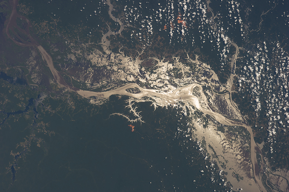
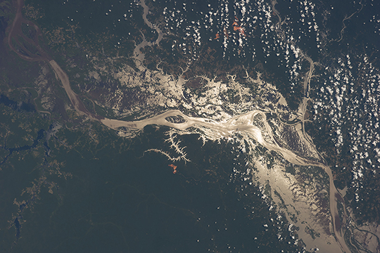
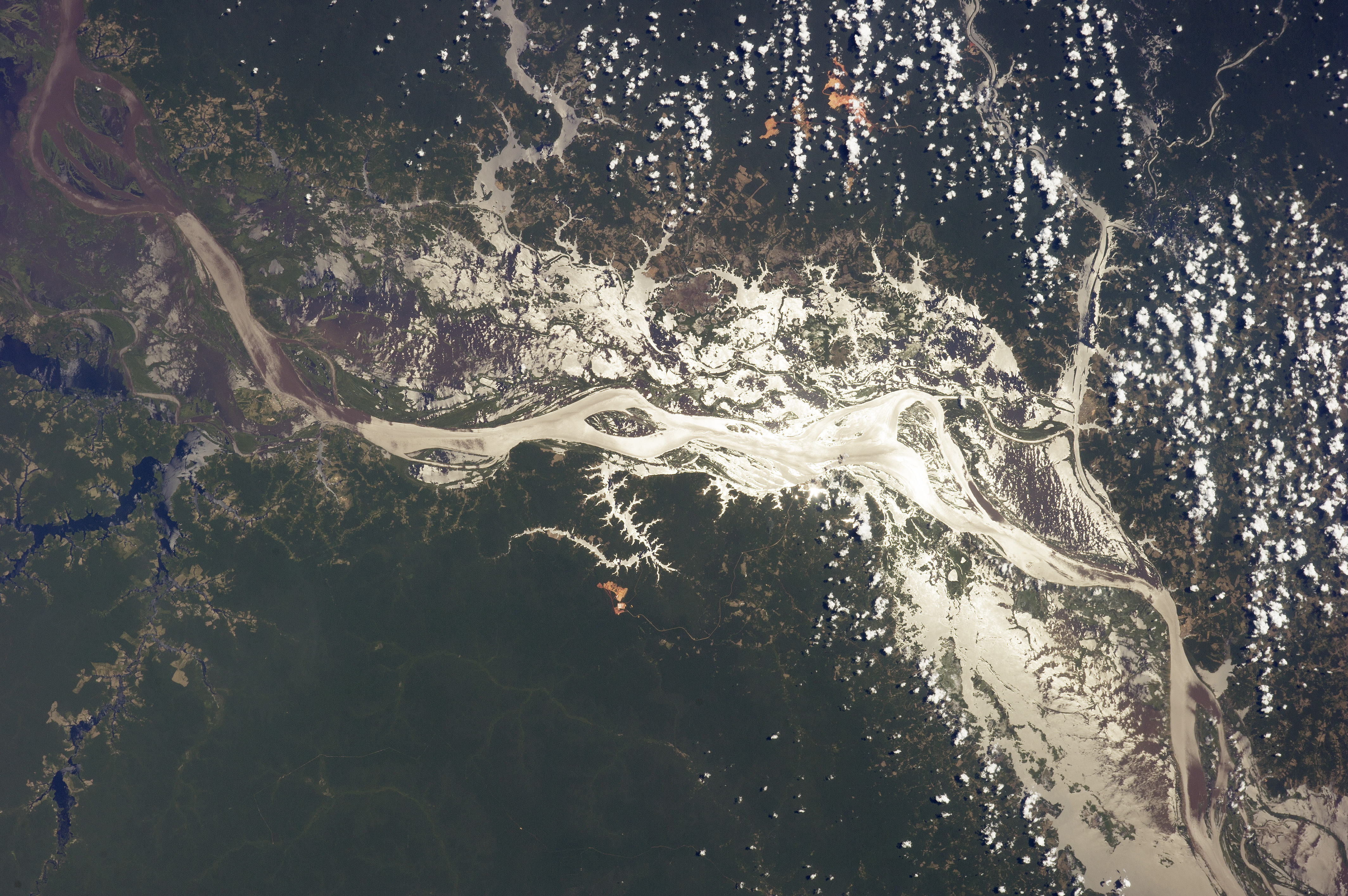
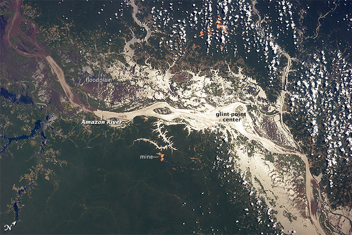
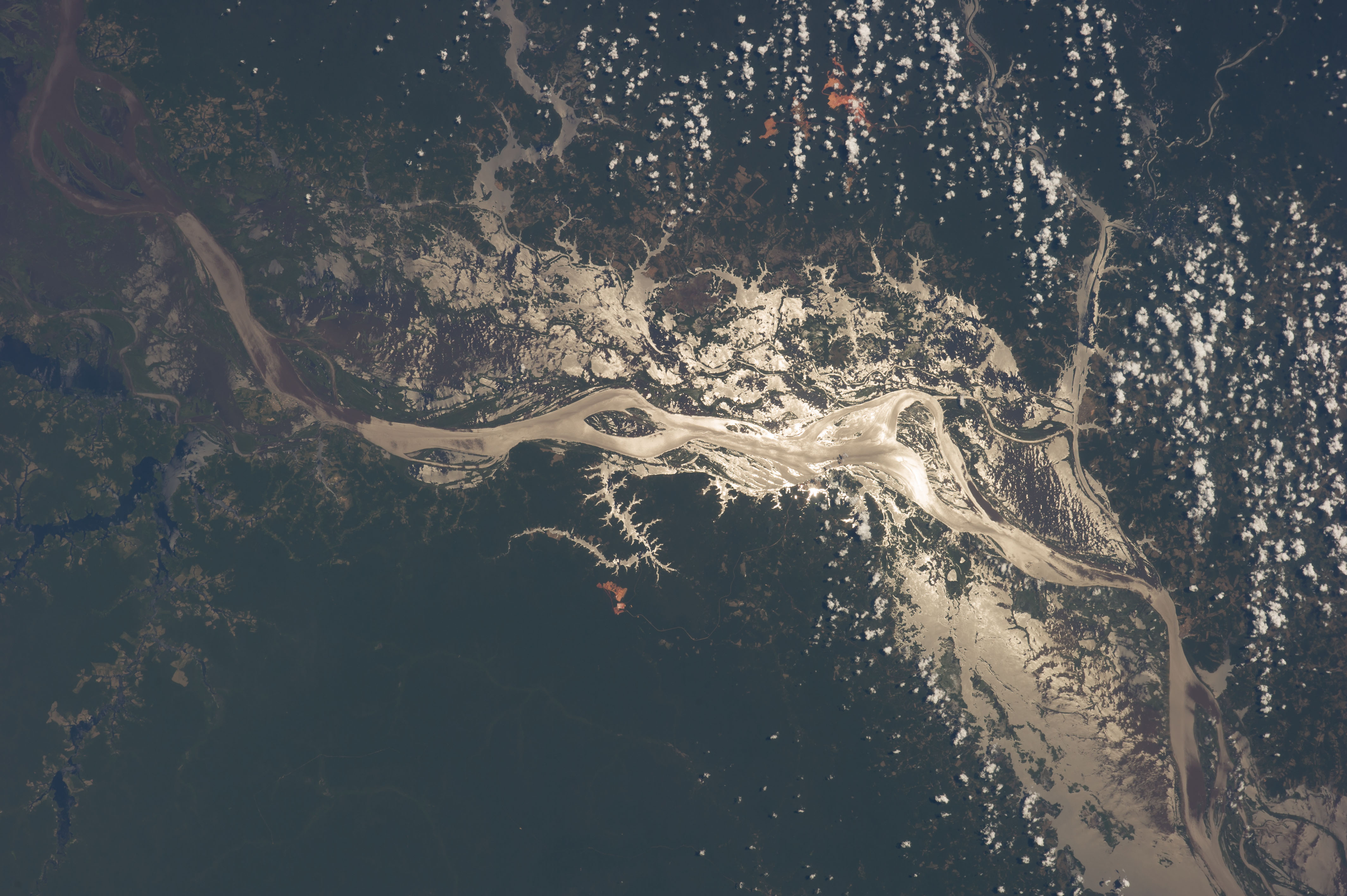
Image Caption: Amazon River, Brazil, in sunglint
Astronauts aboard the International Space Station use the sun's reflection point to reveal features that are otherwise difficult or impossible to see. Viewed from 180 miles (290 km) above the earth's surface, the world's largest river, the Amazon, crosses the image (from the top left to the lower right), snaking its way through its floodplain that is more than 20 miles (32 km) wide. Sunglint from the water surface shows the numerous lakes and side tributaries on the floodplain.
The extensive lakes have a longer history to tell (one lake, lower right, is more than 12 miles, 19 km, wide). The Amazon River cut a canyon tens of meters deep in response to the fall of sea level during the geologically recent glacial stages. Sea level rose again with rapid melting of the ice sheets, and to keep pace the Amazon River bed has also risen - filling the canyon with vast quantities of sediment from the distant Andes Mountains in the process. The continued existence of the lake depressions shows that this filling process is not yet complete.
Numerous lighter-toned patches of deforestation dot the left margin of the image. Small bright red patches on higher ground either side of the floodplain are open-cast mines where the red soils that underlie the rainforest are exposed (image center, image upper margin).
