ISS039-E-1640

| NASA Photo ID | ISS039-E-1640 |
| Focal Length | 400mm |
| Date taken | 2014.03.13 |
| Time taken | 18:49:24 GMT |


Spacecraft nadir point: 29.3° N, 87.4° W
Photo center point: 30.0° N, 90.1° W
Photo center point by machine learning:
Photo center point: 30.0° N, 90.1° W
Photo center point by machine learning:
Nadir to Photo Center: West
Spacecraft Altitude: 221 nautical miles (409km)
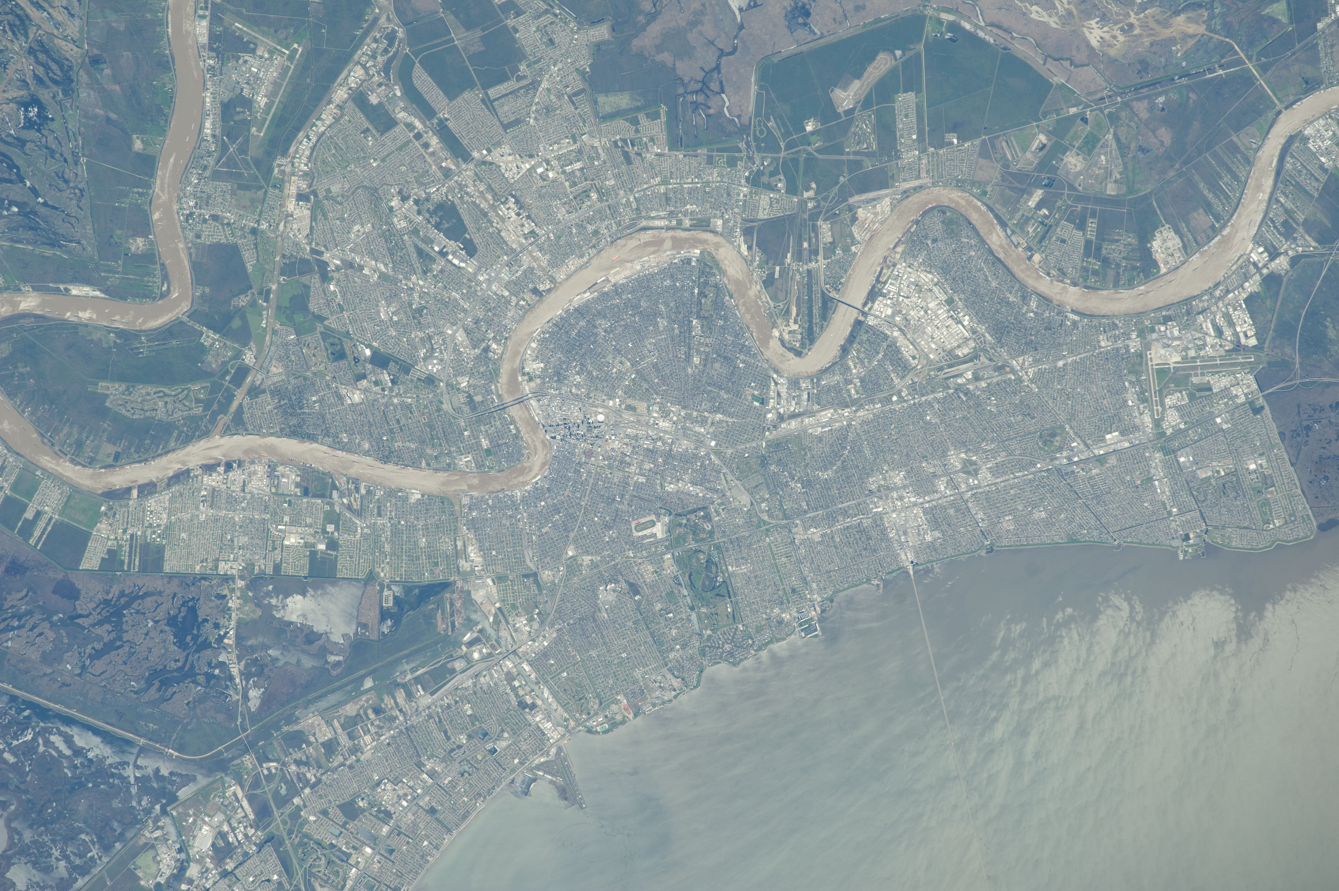
Country or Geographic Name: | USA-LOUISIANA |
Features: | NEW ORLEANS, SUNGLINT ON LAKE PONTCHARTRAIN |
| Features Found Using Machine Learning: | NEW ORLEANS |
Cloud Cover Percentage: | 10 (1-10)% |
Sun Elevation Angle: | 56° |
Sun Azimuth: | 203° |
Camera: | Nikon D3S Electronic Still Camera |
Focal Length: | 400mm |
Camera Tilt: | 37 degrees |
Format: | 4256E: 4256 x 2832 pixel CMOS sensor, 36.0mm x 23.9mm, total pixels: 12.87 million, Nikon FX format |
Film Exposure: | |
| Additional Information | |
| Width | Height | Annotated | Cropped | Purpose | Links |
|---|---|---|---|---|---|
| 4256 pixels | 2832 pixels | No | No | Download Image | |
| 640 pixels | 426 pixels | No | No | Download Image |
Download Packaged File
Download a Google Earth KML for this Image
View photo footprint information
Download a GeoTIFF for this photo
Image Caption: ISS039-E-001640 (13 March 2014) --- From an astronaut's point of view in Earth orbit, it would be difficult to miss the Mississippi River as it meanders through the city of New Orleans. Sunglint on Lake Pontchartrain is visible at lower right in the 400mm image, photographed by one of the Expedition 39 crew members aboard the International Space Station on March 13, 2014.
