ISS039-E-15372

| NASA Photo ID | ISS039-E-15372 |
| Focal Length | 70mm |
| Date taken | 2014.04.20 |
| Time taken | 20:40:42 GMT |
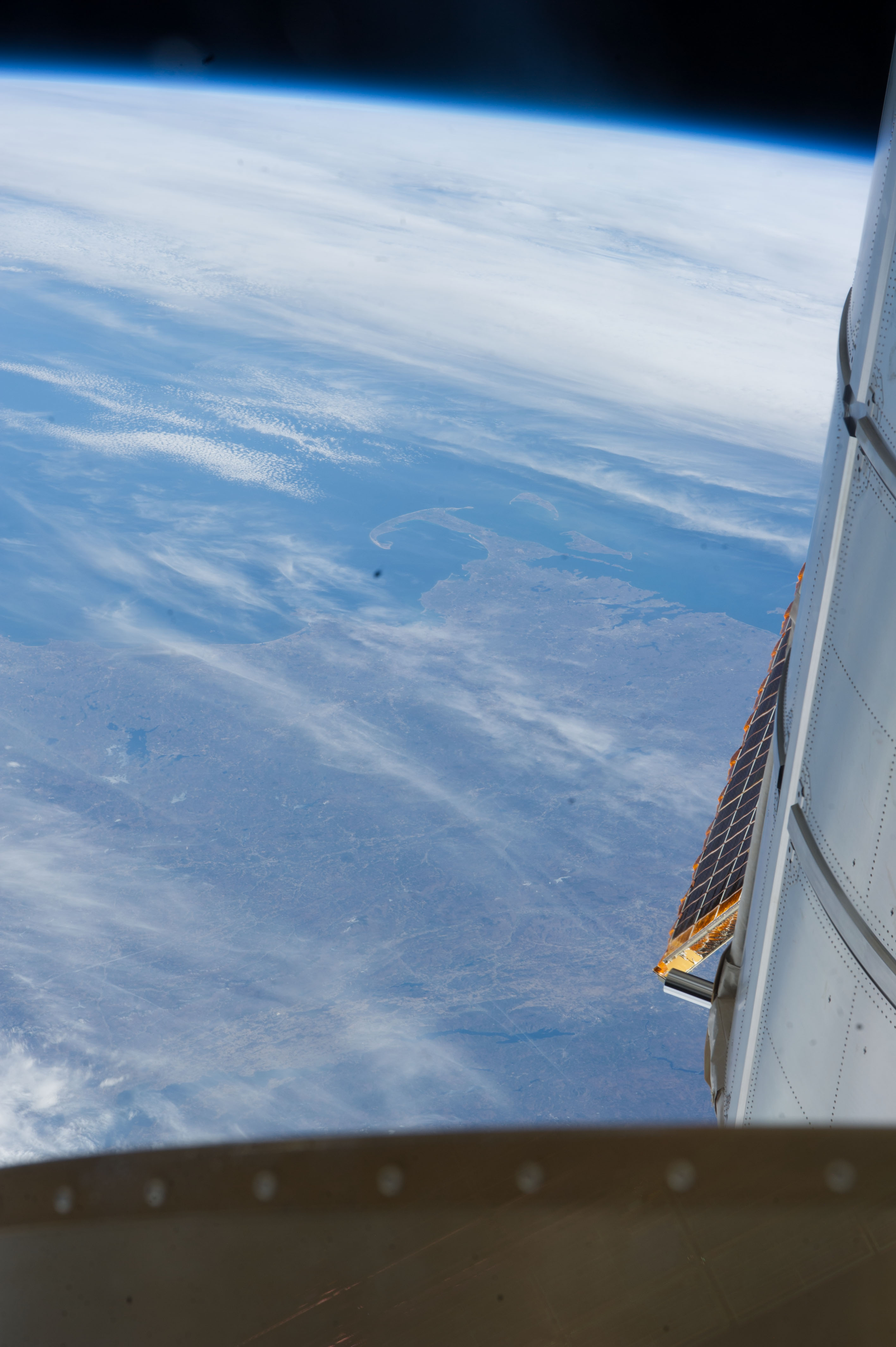

Spacecraft nadir point: 47.3° N, 76.7° W
Photo center point: 42.4° N, 71.3° W
Photo center point by machine learning:
Photo center point: 42.4° N, 71.3° W
Photo center point by machine learning:
Nadir to Photo Center: Southeast
Spacecraft Altitude: 222 nautical miles (411km)
Country or Geographic Name: | USA-MASSACHUSETTS |
Features: | PROVINCETOWN, PROVIDENCE, BOSTON, MASSACHUSETTS, THODE ISLAND, CONNECTICUT |
| Features Found Using Machine Learning: | PAN- |
Cloud Cover Percentage: | 50 (26-50)% |
Sun Elevation Angle: | 33° |
Sun Azimuth: | 250° |
Camera: | Nikon D3S Electronic Still Camera |
Focal Length: | 70mm |
Camera Tilt: | High Oblique |
Format: | 4256E: 4256 x 2832 pixel CMOS sensor, 36.0mm x 23.9mm, total pixels: 12.87 million, Nikon FX format |
Film Exposure: | |
| Additional Information | |
| Width | Height | Annotated | Cropped | Purpose | Links |
|---|---|---|---|---|---|
| 2832 pixels | 4256 pixels | No | No | Download Image | |
| 426 pixels | 640 pixels | No | No | Download Image |
Download Packaged File
Download a Google Earth KML for this Image
View photo footprint information
Download a GeoTIFF for this photo
Image Caption: CATALOGED BY UT-BROWNSVILLE/STARGATE
