ISS039-E-14821

| NASA Photo ID | ISS039-E-14821 |
| Focal Length | 145mm |
| Date taken | 2014.04.22 |
| Time taken | 09:55:38 GMT |
Resolutions offered for this image:
1000 x 657 pixels 540 x 355 pixels 1440 x 960 pixels 720 x 480 pixels 4256 x 2832 pixels 640 x 426 pixels
1000 x 657 pixels 540 x 355 pixels 1440 x 960 pixels 720 x 480 pixels 4256 x 2832 pixels 640 x 426 pixels


Spacecraft nadir point: 51.4° N, 115.9° E
Photo center point: 51.9° N, 105.3° E
Photo center point by machine learning:
Photo center point: 51.9° N, 105.3° E
Photo center point by machine learning:
Nadir to Photo Center: West
Spacecraft Altitude: 222 nautical miles (411km)
Camera: | Nikon D3S Electronic Still Camera |
Focal Length: | 145mm |
Camera Tilt: | High Oblique |
Format: | 4256E: 4256 x 2832 pixel CMOS sensor, 36.0mm x 23.9mm, total pixels: 12.87 million, Nikon FX format |
Film Exposure: | |
| Additional Information | |
| Width | Height | Annotated | Cropped | Purpose | Links |
|---|---|---|---|---|---|
| 1000 pixels | 657 pixels | No | Yes | Earth From Space collection | Download Image |
| 540 pixels | 355 pixels | Yes | Yes | Earth From Space collection | Download Image |
| 1440 pixels | 960 pixels | No | No | NASA's Earth Observatory web site | Download Image |
| 720 pixels | 480 pixels | Yes | Yes | NASA's Earth Observatory web site | Download Image |
| 4256 pixels | 2832 pixels | No | No | Download Image | |
| 640 pixels | 426 pixels | No | No | Download Image |
Download Packaged File
Download a Google Earth KML for this Image
View photo footprint information
Download a GeoTIFF for this photo
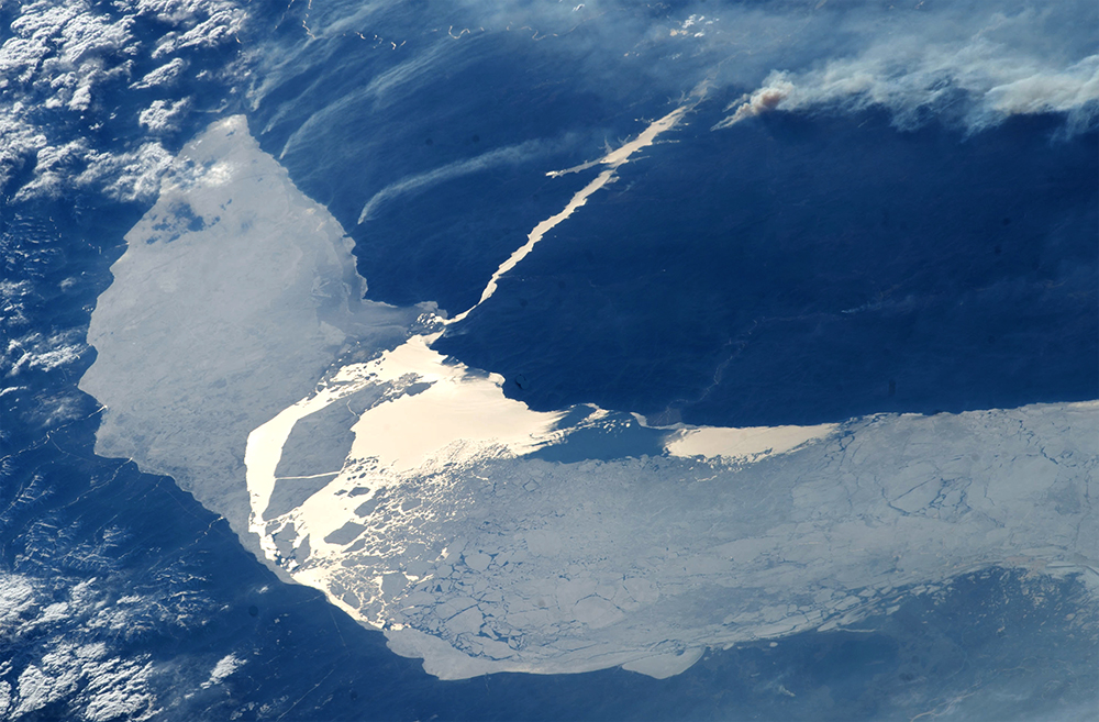
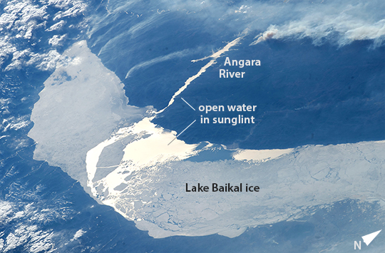
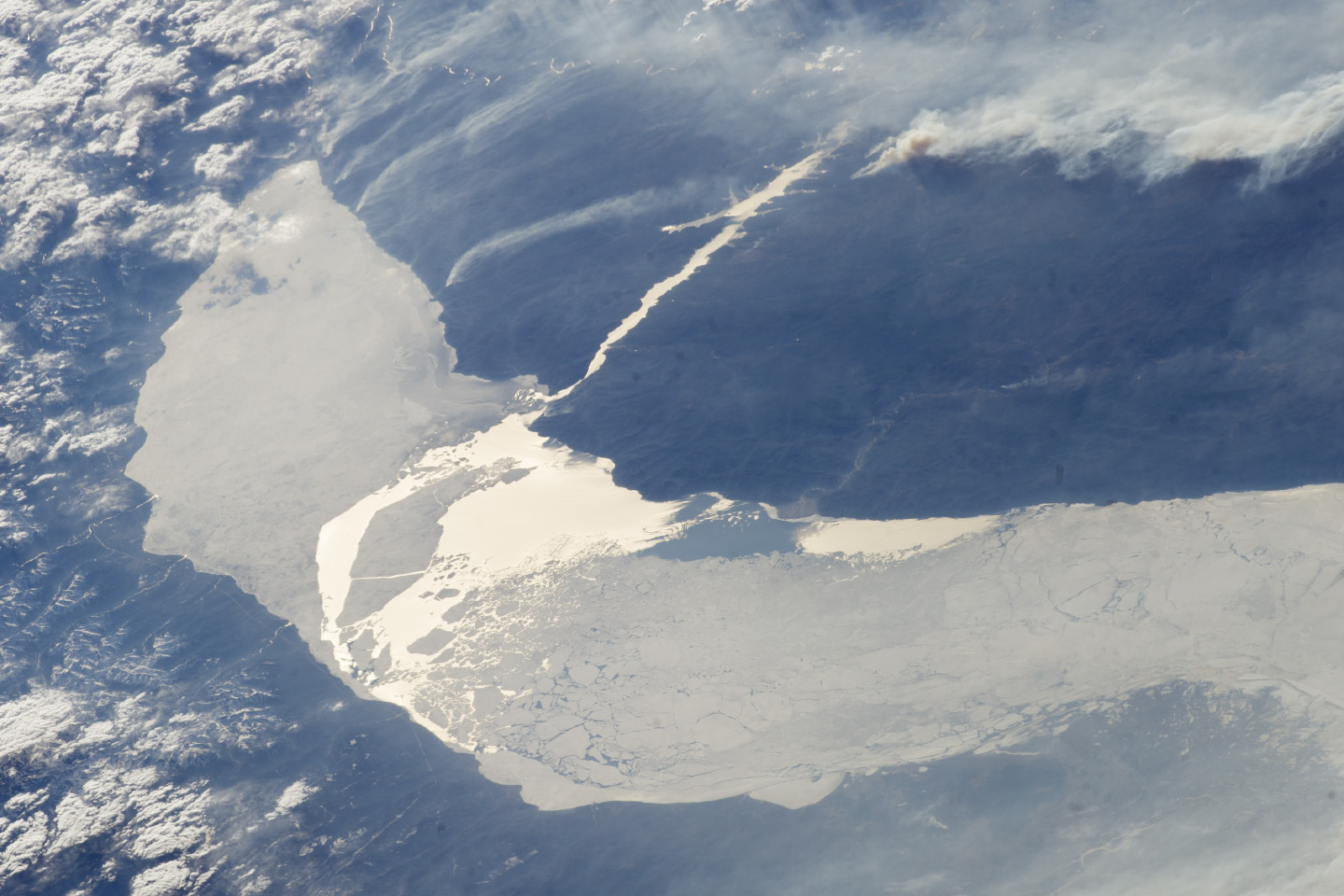
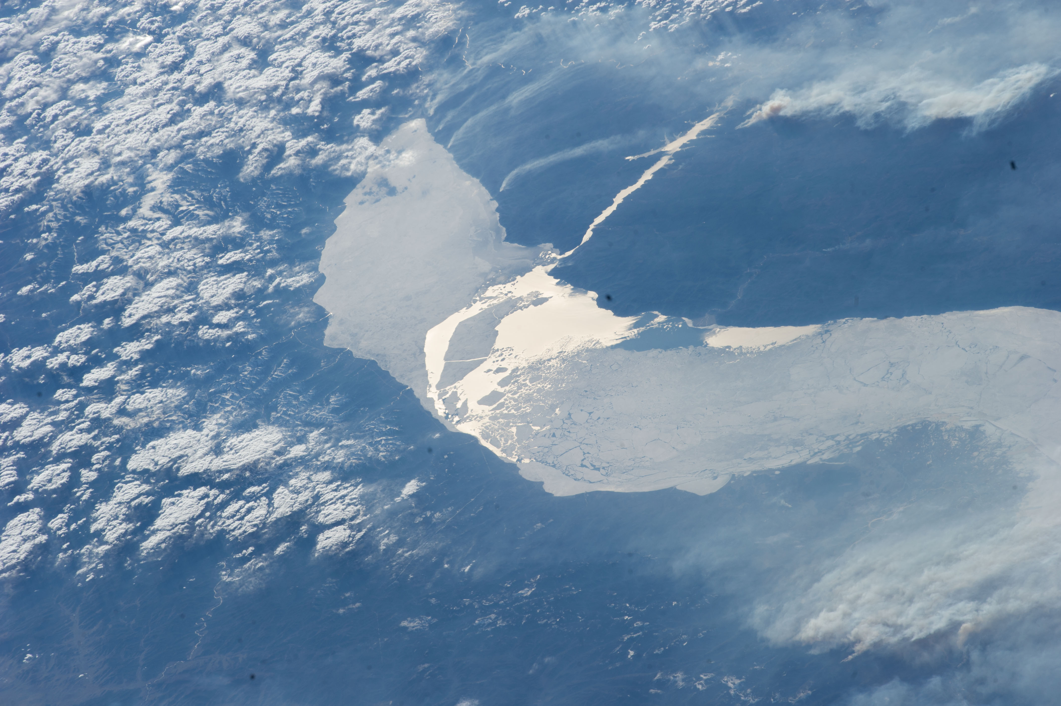
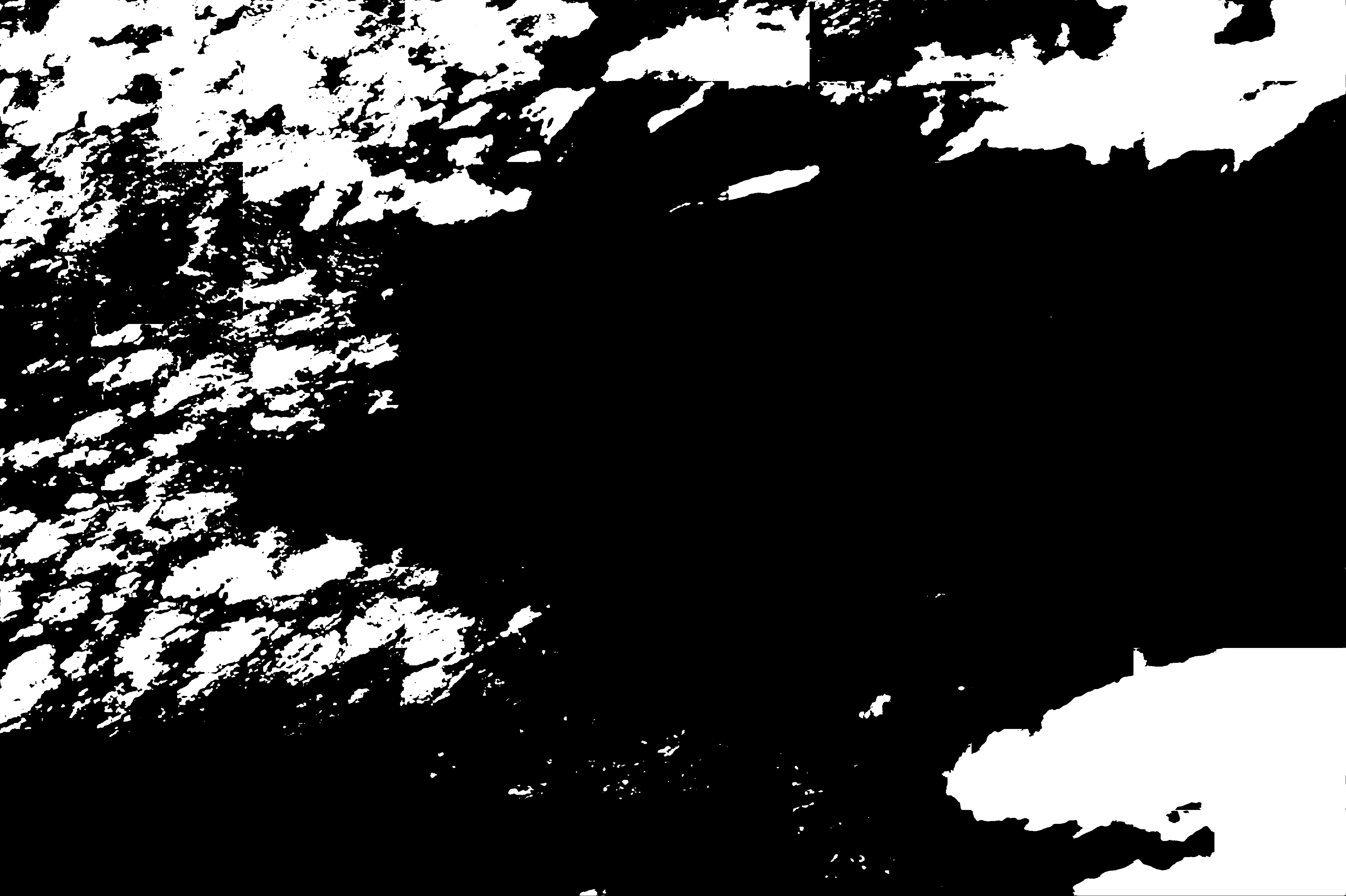
Image Caption: Lake Baikal ice melts, Russia
In this late afternoon shot, the crew aboard the International Space Station looked back toward the setting sun and captured the hook-shaped southern half of Lake Baikal in eastern Russia. Most of the lake is covered with dull gray ice. The brightest point in the center of the image is the reflection of the sun's rays off a small zone of open water where the ice has begun to melt. Broken ice masses appear adjacent to the sunglint point. The sun's rays are also reflected off the water surface of the straight Angara River, the main outlet of the lake.
Lake Baikal is 636 km long (395 mi). It is the deepest lake in the world and holds the largest amount of fresh water. Individual smoke plumes arc away from the north shore (image top left). Large smoke palls from wildfires appear image upper right.
