ISS039-E-13926
| NASA Photo ID | ISS039-E-13926 |
| Focal Length | 80mm |
| Date taken | 2014.04.18 |
| Time taken | 20:35:25 GMT |
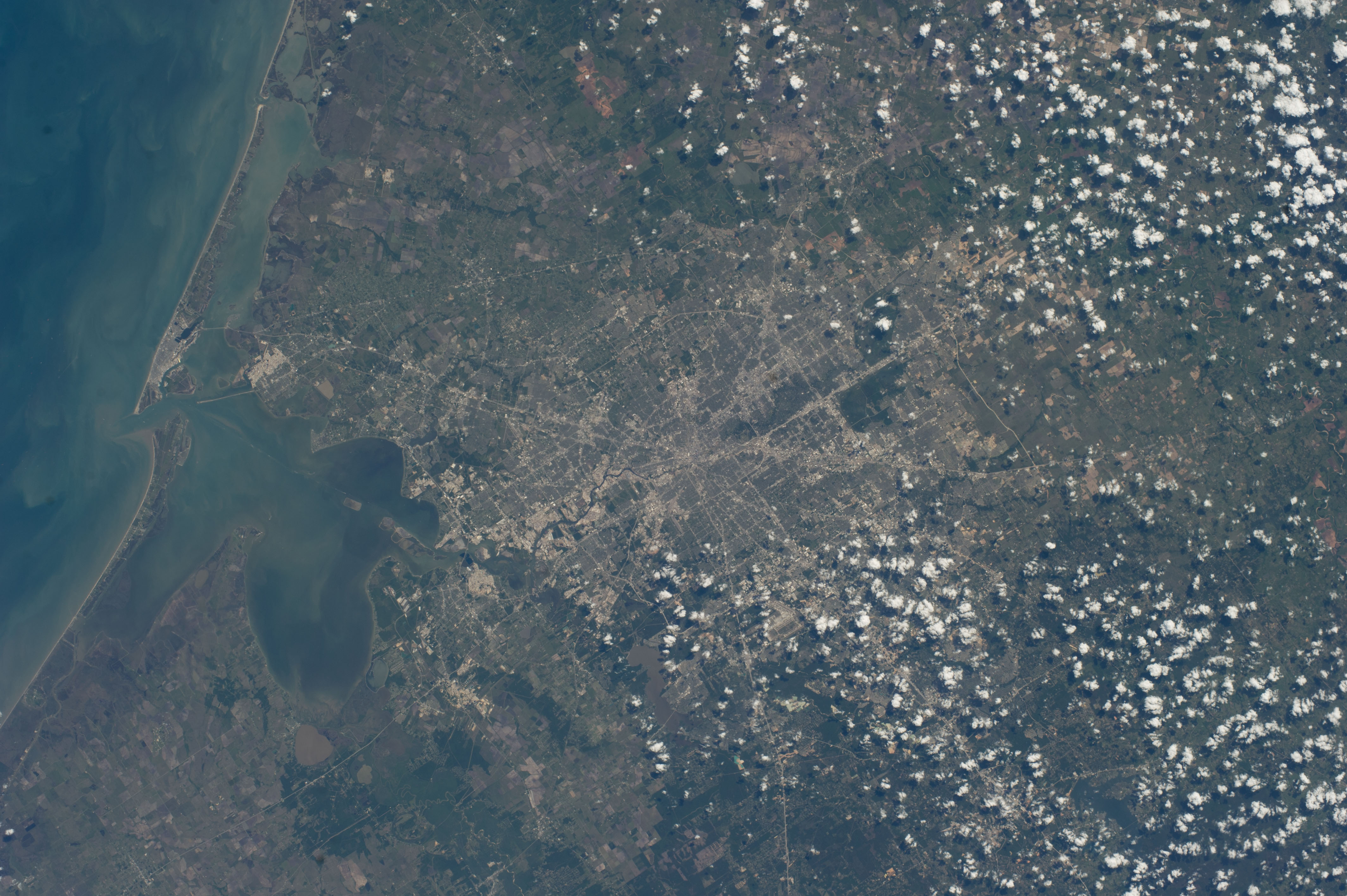

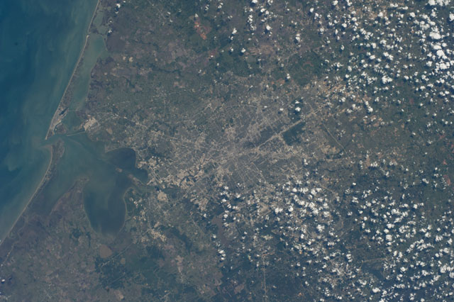
Spacecraft nadir point: 31.4° N, 93.4° W
Photo center point: 29.8° N, 95.4° W
Photo center point by machine learning:
Photo center point: 29.8° N, 95.4° W
Photo center point by machine learning:
Nadir to Photo Center: Southwest
Spacecraft Altitude: 223 nautical miles (413km)
Country or Geographic Name: | USA-TEXAS |
Features: | HOUSTON, TRINITY BAY, GULF OF MEXICO, GALVESTON BAY, GALVESTON, TEXAS CITY, FREEPORT, GALVESTON ISLAND, GOAT ISLAND |
| Features Found Using Machine Learning: | |
Cloud Cover Percentage: | 10 (1-10)% |
Sun Elevation Angle: | 51° |
Sun Azimuth: | 246° |
Camera: | Nikon D3S Electronic Still Camera |
Focal Length: | 80mm |
Camera Tilt: | Low Oblique |
Format: | 4256E: 4256 x 2832 pixel CMOS sensor, 36.0mm x 23.9mm, total pixels: 12.87 million, Nikon FX format |
Film Exposure: | |
| Additional Information | |
| Width | Height | Annotated | Cropped | Purpose | Links |
|---|---|---|---|---|---|
| 4256 pixels | 2832 pixels | No | No | Download Image | |
| 640 pixels | 426 pixels | No | No | Download Image |
Download Packaged File
Download a Google Earth KML for this Image
View photo footprint information
Download a GeoTIFF for this photo
Image Caption: ISS039-E-013926 (18 April 2014) --- One of the Expedition 39 crew members aboard the International Space Station photographed this vertical view of the greater Houston metropolitan area on April 18, 2014. Harris County, Galveston County and several other southeast Texas counties are visible in the scene. Houston's central business district or "downtown" is near center frame and part of the Gulf of Mexico Coast occupies most of the left side of the image.
CATALOGED BY UT-BROWNSVILLE/STARGATE
CATALOGED BY UT-BROWNSVILLE/STARGATE
