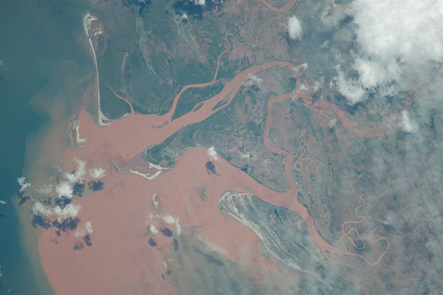
ISS038-E-67054
| NASA Photo ID | ISS038-E-67054 |
| Focal Length | 1000mm |
| Date taken | 2014.02.12 |
| Time taken | 10:25:54 GMT |


Spacecraft nadir point: 19.9° S, 42.6° E
Photo center point: 19.7° S, 44.4° E
Photo center point by machine learning:
Photo center point: 19.7° S, 44.4° E
Photo center point by machine learning:
Nadir to Photo Center: East
Spacecraft Altitude: 227 nautical miles (420km)
Country or Geographic Name: | MADAGASCAR |
Features: | MANIA RIVER, MOZAMBIQUE CHANNEL, JUNGLE |
| Features Found Using Machine Learning: | |
Cloud Cover Percentage: | 10 (1-10)% |
Sun Elevation Angle: | 74° |
Sun Azimuth: | 290° |
Camera: | Nikon D3X Electronic Still Camera |
Focal Length: | 1000mm |
Camera Tilt: | Low Oblique |
Format: | 6048E: 6048 x 4032 pixel CMOS sensor, 35.9mm x 24.0mm, total pixels: 25.72 million, Nikon FX format |
Film Exposure: | |
| Additional Information | |
| Width | Height | Annotated | Cropped | Purpose | Links |
|---|---|---|---|---|---|
| 6048 pixels | 4032 pixels | No | No | Download Image | |
| 640 pixels | 427 pixels | No | No | Download Image |
Download Packaged File
Download a Google Earth KML for this Image
View photo footprint information
Download a GeoTIFF for this photo
Image Caption: CATALOGED BY UT-BROWNSVILLE/STARGATE
