ISS038-E-38300

| NASA Photo ID | ISS038-E-38300 |
| Focal Length | 24mm |
| Date taken | 2014.01.30 |
| Time taken | 13:16:18 GMT |
1000 x 665 pixels 540 x 359 pixels 1440 x 960 pixels 720 x 480 pixels 4256 x 2832 pixels 640 x 426 pixels

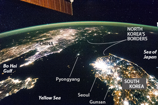
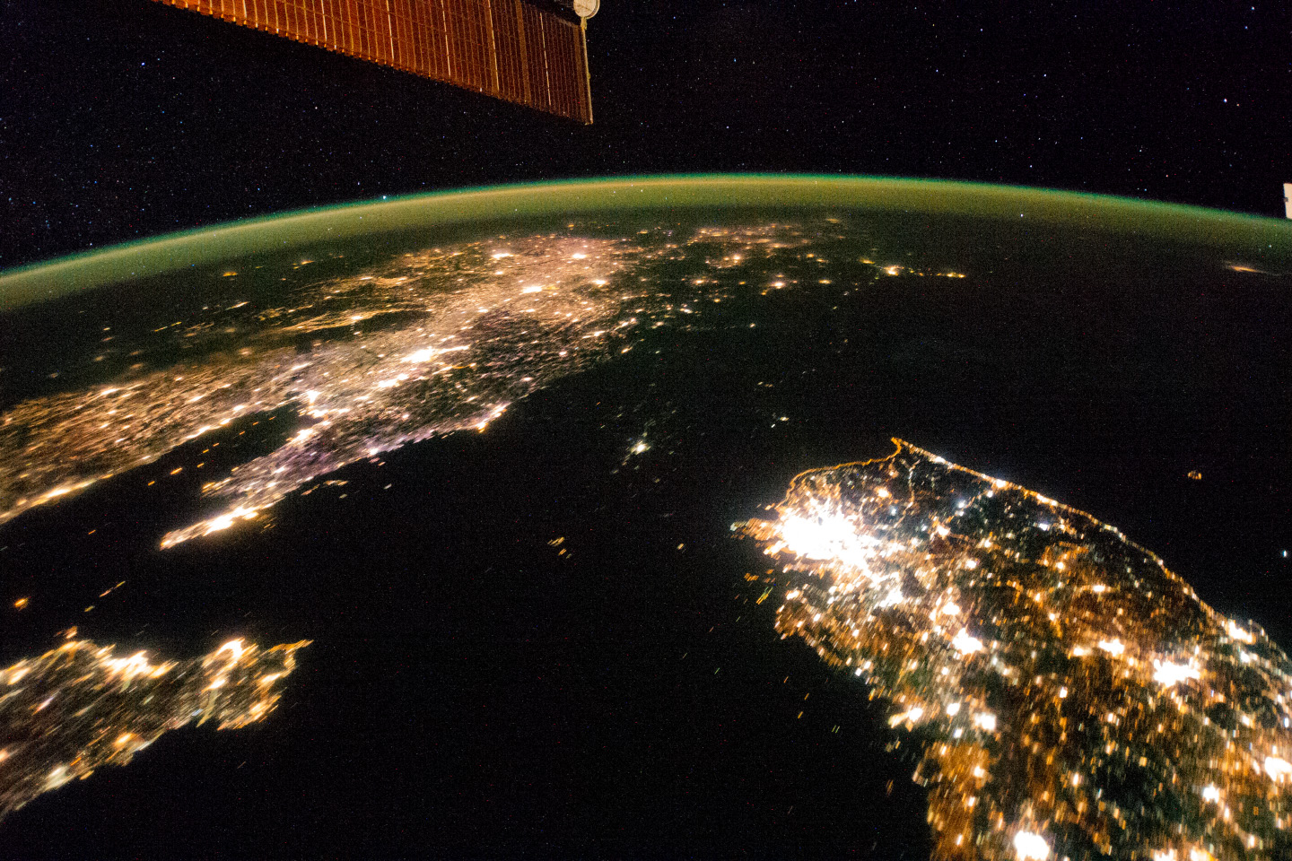

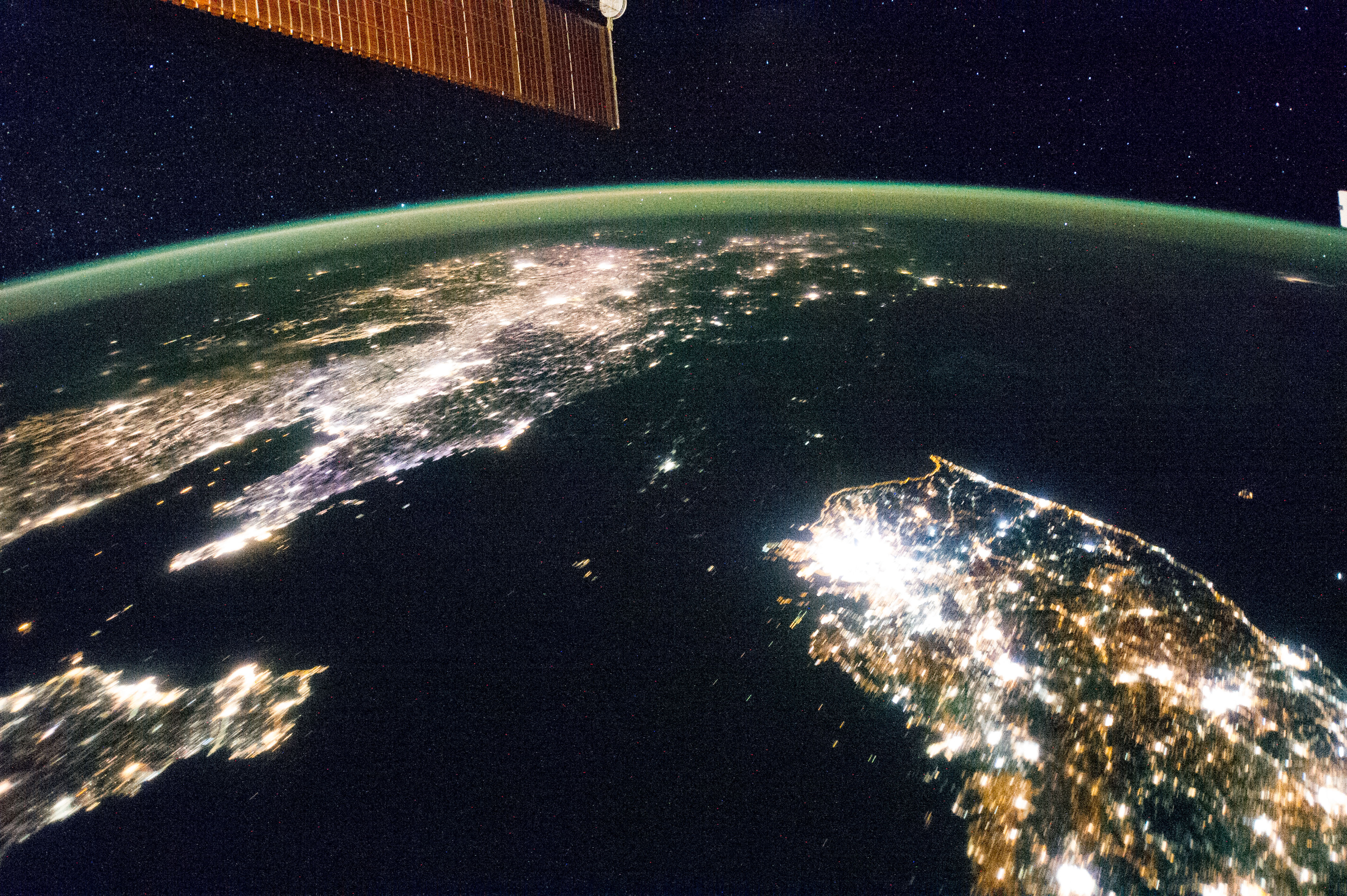
Photo center point: 39.0° N, 125.5° E
Photo center point by machine learning:
Country or Geographic Name: | NORTH KOREA |
Features: | PAN--NORTH & SOUTH KOREA AT NIGHT |
| Features Found Using Machine Learning: | PAN- |
Cloud Cover Percentage: | 10 (1-10)% |
Sun Elevation Angle: | -51° |
Sun Azimuth: | 283° |
Camera: | Nikon D3S Electronic Still Camera |
Focal Length: | 24mm |
Camera Tilt: | High Oblique |
Format: | 4256E: 4256 x 2832 pixel CMOS sensor, 36.0mm x 23.9mm, total pixels: 12.87 million, Nikon FX format |
Film Exposure: | |
| Additional Information | |
| Width | Height | Annotated | Cropped | Purpose | Links |
|---|---|---|---|---|---|
| 1000 pixels | 665 pixels | No | No | Earth From Space collection | Download Image |
| 540 pixels | 359 pixels | Yes | No | Earth From Space collection | Download Image |
| 1440 pixels | 960 pixels | No | No | NASA's Earth Observatory web site | Download Image |
| 720 pixels | 480 pixels | Yes | No | NASA's Earth Observatory web site | Download Image |
| 4256 pixels | 2832 pixels | No | No | Download Image | |
| 640 pixels | 426 pixels | No | No | Download Image |
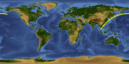
Flying over East Asia, astronauts on the International Space Station (ISS) took this night image of the Korean Peninsula. Unlike daylight images, city lights at night illustrate dramatically the relative economic importance of cities, as gauged by relative size. In this north-looking view, it is immediately obvious that greater Seoul is a major city and that the port of Gunsan is minor by comparison. There are 25.6 million people in the Seoul metropolitan area - more than half of South Korea's citizens - while Gunsan's population is 280,000.
North Korea is almost completely dark compared to neighboring South Korea and China. The darkened land appears as if it were a patch of water joining the Yellow Sea to the Sea of Japan. Its capital city, Pyongyang, appears like a small island, despite a population of 3.26 million (as of 2008). The light emission from Pyongyang is equivalent to the smaller towns in South Korea.
Coastlines are often very apparent in night imagery, as shown by South Korea's eastern shoreline. But the coast of North Korea is difficult to detect. These differences are illustrated in per capita power consumption in the two countries, with South Korea at 10,162 kilowatt hours and North Korea at 739 kilowatt hours.
You can view time-lapse videos of East Asia, as viewed from the ISS on January 30, 2014, by clicking here (standard resolution) and here (high-definition).
