ISS038-E-26862
| NASA Photo ID | ISS038-E-26862 |
| Focal Length | 180mm |
| Date taken | 2014.01.08 |
| Time taken | 15:41:16 GMT |
Resolutions offered for this image:
1000 x 665 pixels 540 x 359 pixels 1440 x 960 pixels 720 x 480 pixels 4256 x 2832 pixels 640 x 426 pixels
1000 x 665 pixels 540 x 359 pixels 1440 x 960 pixels 720 x 480 pixels 4256 x 2832 pixels 640 x 426 pixels


Spacecraft nadir point: 16.9° N, 6.9° W
Photo center point: 17.2° N, 11.6° W
Photo center point by machine learning:
Photo center point: 17.2° N, 11.6° W
Photo center point by machine learning:
Nadir to Photo Center: West
Spacecraft Altitude: 225 nautical miles (417km)
Country or Geographic Name: | MAURITANIA |
Features: | PLATEAU EDGE, MESAS, DUNES |
| Features Found Using Machine Learning: | |
Cloud Cover Percentage: | 25 (11-25)% |
Sun Elevation Angle: | 30° |
Sun Azimuth: | 231° |
Camera: | Nikon D3S Electronic Still Camera |
Focal Length: | 180mm |
Camera Tilt: | 52 degrees |
Format: | 4256E: 4256 x 2832 pixel CMOS sensor, 36.0mm x 23.9mm, total pixels: 12.87 million, Nikon FX format |
Film Exposure: | |
| Additional Information | |
| Width | Height | Annotated | Cropped | Purpose | Links |
|---|---|---|---|---|---|
| 1000 pixels | 665 pixels | No | Yes | Earth From Space collection | Download Image |
| 540 pixels | 359 pixels | Yes | Yes | Earth From Space collection | Download Image |
| 1440 pixels | 960 pixels | No | No | NASA's Earth Observatory web site | Download Image |
| 720 pixels | 480 pixels | Yes | No | NASA's Earth Observatory web site | Download Image |
| 4256 pixels | 2832 pixels | No | No | Download Image | |
| 640 pixels | 426 pixels | No | No | Download Image |
Download Packaged File
Download a Google Earth KML for this Image
View photo footprint information
Download a GeoTIFF for this photo
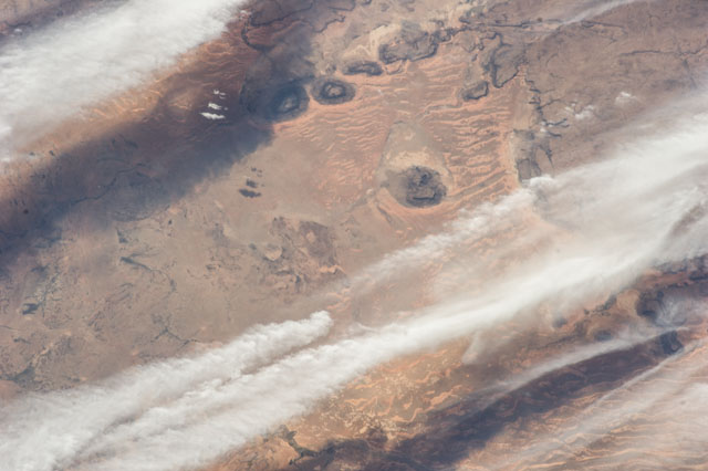
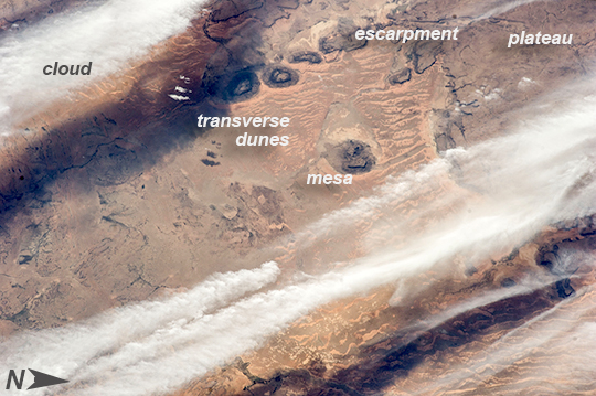
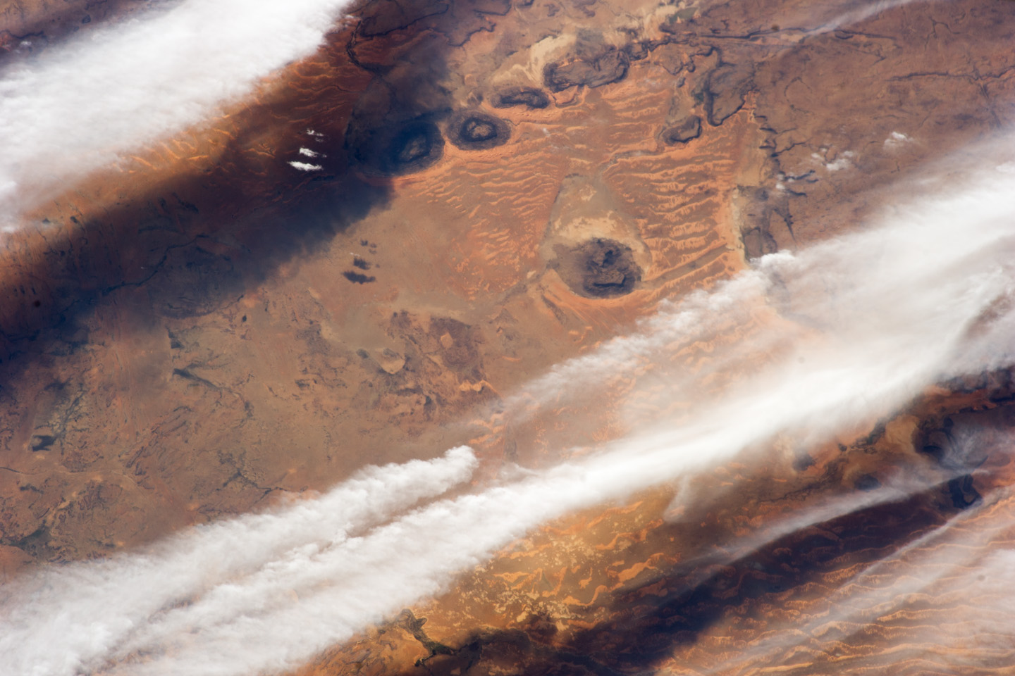
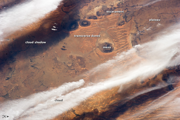
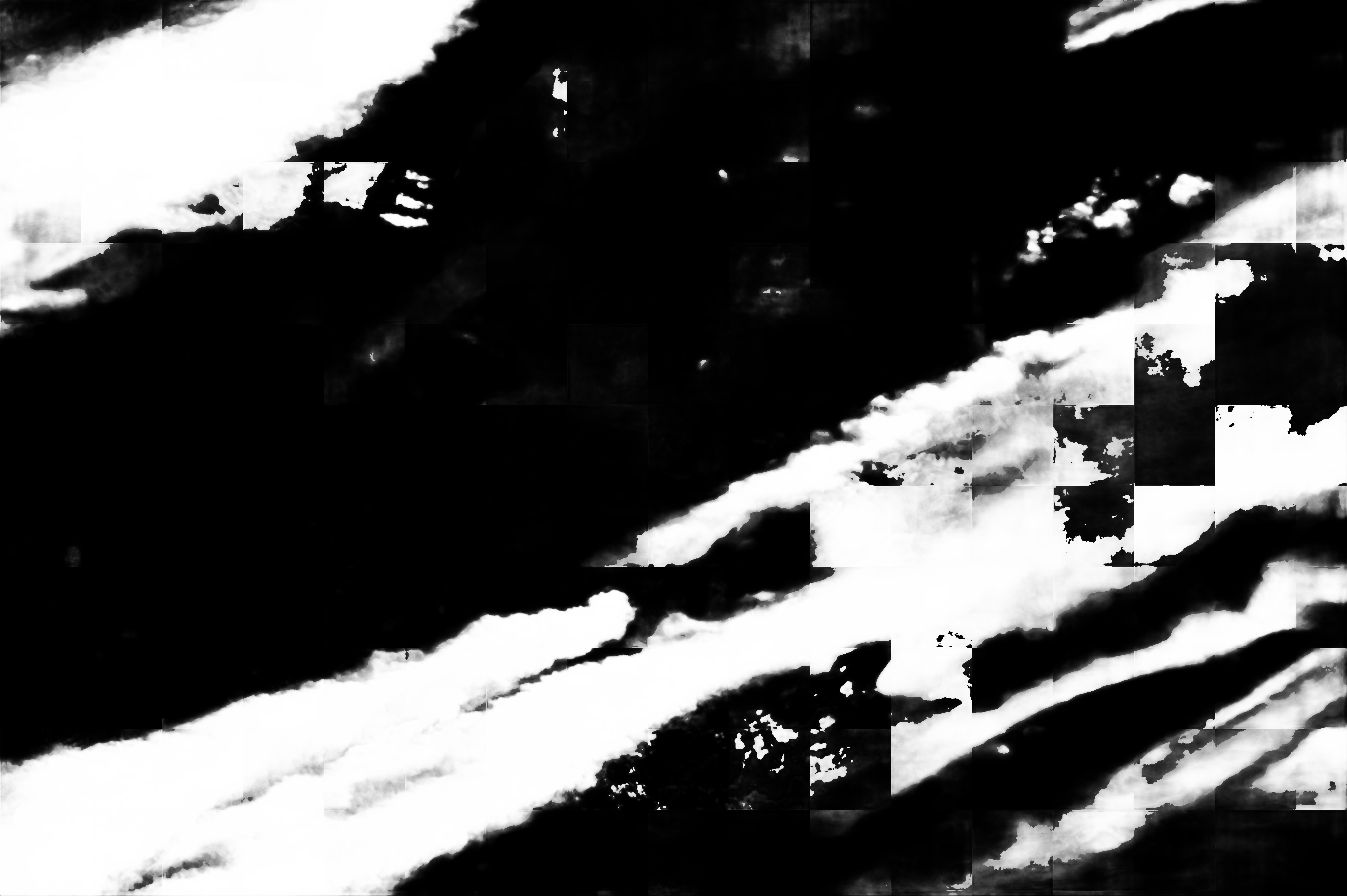
Image Caption: Western Sahara Desert, Mauritania
This astronaut photograph of infrequent cloud bands over southern Mauritania was taken from the International Space Station with an oblique look angle so that the dark cloud shadows are also a prominent part of the view. Beneath the cloud the Aouker plateau of dark sedimentary rocks appears as a ragged, near-vertical escarpment at image top right. Isolated remnants of the plateau appear as dark mesas (flat-topped hills) across the top and near the center of the image. The escarpment is about 250 m high, with a field of orange-colored dunes at the base (image upper right).
Prevailing winds in this part of the Sahara Desert blow from the northeast. The wavy dunes are aligned transverse to these winds. The sand that makes the dunes is blown in from a zone immediately upwind (just out of the bottom of the image) where dry river beds and dry lakes provide large quantities of mobile sand for the wind to transport. This pattern is typical in the western Sahara Desert, where plateau surfaces are mostly dune free and dunefields are located in the surrounding lowlands where the larger rivers deposit quantities of sandy sediment on the few occasions when they flow--sometimes only once in decades.
