ISS038-E-25350
| NASA Photo ID | ISS038-E-25350 |
| Focal Length | 180mm |
| Date taken | 2014.01.02 |
| Time taken | 17:02:20 GMT |


Spacecraft nadir point: 51.7° N, 73.2° W
Photo center point: 51.4° N, 68.8° W
Photo center point by machine learning:
Photo center point: 51.4° N, 68.8° W
Photo center point by machine learning:
Nadir to Photo Center: East
Spacecraft Altitude: 221 nautical miles (409km)
Country or Geographic Name: | CANADA-Q |
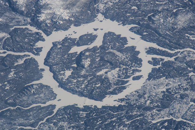
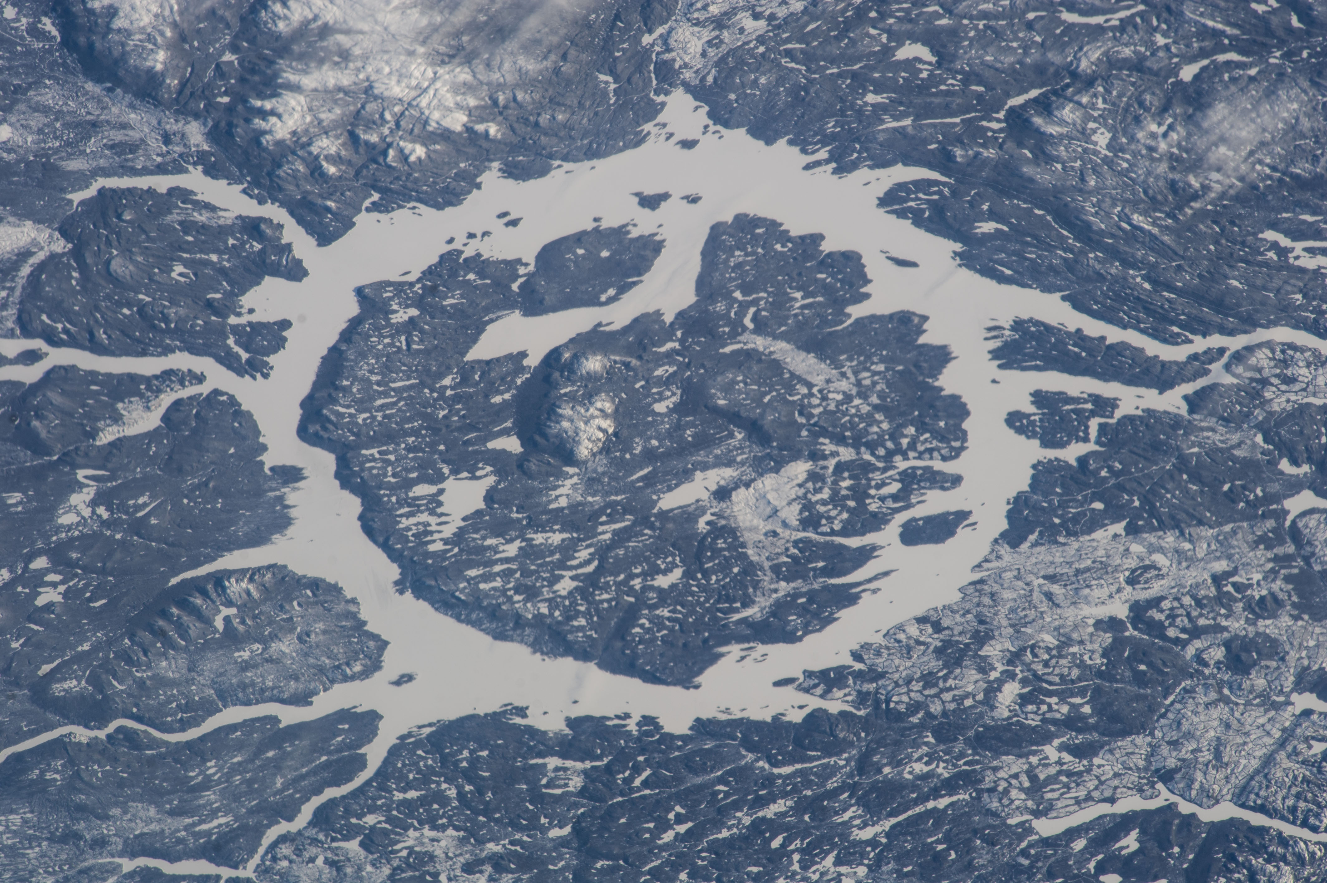
Features: | MANICOUAGAN IMPACT CRATER, ICE, SNOW |
| Features Found Using Machine Learning: | |
Cloud Cover Percentage: | 10 (1-10)% |
Sun Elevation Angle: | 16° |
Sun Azimuth: | 181° |
Camera: | Nikon D3S Electronic Still Camera |
Focal Length: | 180mm |
Camera Tilt: | 50 degrees |
Format: | 4256E: 4256 x 2832 pixel CMOS sensor, 36.0mm x 23.9mm, total pixels: 12.87 million, Nikon FX format |
Film Exposure: | |
| Additional Information | |
| Width | Height | Annotated | Cropped | Purpose | Links |
|---|---|---|---|---|---|
| 4256 pixels | 2832 pixels | No | No | Download Image | |
| 640 pixels | 426 pixels | No | No | Download Image |
Download Packaged File
Download a Google Earth KML for this Image
View photo footprint information
Download a GeoTIFF for this photo
Image Caption: ISS038-E-025350 (2 Jan. 2014) --- One of the Expedition 38 crew members aboard the Earth-orbiting International Space Station recorded this image which features the Manicouagan Crater and reservoir located primarily in Manicouagan Regional County Municipality in the Cote-Nord region of Quebec, Canada. Scientists believe the crater was caused by the impact of a 5 kilometer (3 mile) diameter asteroid about 215.5 million years ago (Triassic Period). The crater is a multiple-ring structure about 100 kilometers (60 miles) across, with its 70 kilometer (40 mile) diameter inner ring as its most prominent feature; it contains a 70 kilometer (40 mile) diameter annular lake, the Manicouagan Reservoir, surrounding an inner island plateau, Rene-Levasseur Island. Because it is so unique and easily recognizable from the sky and space, the crater has been the subject of hundreds of images from astronauts for 45-plus years.
