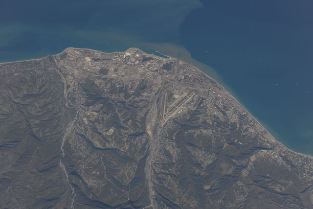
ISS037-E-28032
| NASA Photo ID | ISS037-E-28032 |
| Focal Length | 1000mm |
| Date taken | 2013.11.09 |
| Time taken | 10:33:23 GMT |


Spacecraft nadir point: 41.2° N, 38.1° E
Photo center point: 43.4° N, 40.0° E
Photo center point by machine learning:
Photo center point: 43.4° N, 40.0° E
Photo center point by machine learning:
Nadir to Photo Center: Northeast
Spacecraft Altitude: 222 nautical miles (411km)
Camera: | Nikon D3X Electronic Still Camera |
Focal Length: | 1000mm |
Camera Tilt: | Low Oblique |
Format: | 6048E: 6048 x 4032 pixel CMOS sensor, 35.9mm x 24.0mm, total pixels: 25.72 million, Nikon FX format |
Film Exposure: | |
| Additional Information | |
| Width | Height | Annotated | Cropped | Purpose | Links |
|---|---|---|---|---|---|
| 6048 pixels | 4032 pixels | No | No | Download Image | |
| 640 pixels | 427 pixels | No | No | Download Image |
Download Packaged File
Download a Google Earth KML for this Image
View photo footprint information
Download a GeoTIFF for this photo
Image Caption: CATALOGED BY UT-BROWNSVILLE/STARGATE
