ISS036-E-11050

| NASA Photo ID | ISS036-E-11050 |
| Focal Length | 50mm |
| Date taken | 2013.06.22 |
| Time taken | 09:32:01 GMT |
Resolutions offered for this image:
1000 x 665 pixels 540 x 359 pixels 1440 x 960 pixels 720 x 480 pixels 4256 x 2832 pixels 640 x 426 pixels
1000 x 665 pixels 540 x 359 pixels 1440 x 960 pixels 720 x 480 pixels 4256 x 2832 pixels 640 x 426 pixels


Spacecraft nadir point: 13.9° N, 40.0° E
Photo center point: 20.5° N, 37.0° E
Photo center point by machine learning:
Photo center point: 20.5° N, 37.0° E
Photo center point by machine learning:
Nadir to Photo Center: North
Spacecraft Altitude: 222 nautical miles (411km)
Country or Geographic Name: | SUDAN |
Features: | PAN--DUST PLUME, RED SEA, NILE RIVER |
| Features Found Using Machine Learning: | PAN- |
Cloud Cover Percentage: | 10 (1-10)% |
Sun Elevation Angle: | 80° |
Sun Azimuth: | 347° |
Camera: | Nikon D3S Electronic Still Camera |
Focal Length: | 50mm |
Camera Tilt: | High Oblique |
Format: | 4256E: 4256 x 2832 pixel CMOS sensor, 36.0mm x 23.9mm, total pixels: 12.87 million, Nikon FX format |
Film Exposure: | |
| Additional Information | |
| Width | Height | Annotated | Cropped | Purpose | Links |
|---|---|---|---|---|---|
| 1000 pixels | 665 pixels | No | Yes | Earth From Space collection | Download Image |
| 540 pixels | 359 pixels | Yes | Yes | Earth From Space collection | Download Image |
| 1440 pixels | 960 pixels | No | Yes | NASA's Earth Observatory web site | Download Image |
| 720 pixels | 480 pixels | Yes | No | NASA's Earth Observatory web site | Download Image |
| 4256 pixels | 2832 pixels | No | No | Download Image | |
| 640 pixels | 426 pixels | No | No | Download Image |
Download Packaged File
Download a Google Earth KML for this Image
View photo footprint information
Download a GeoTIFF for this photo
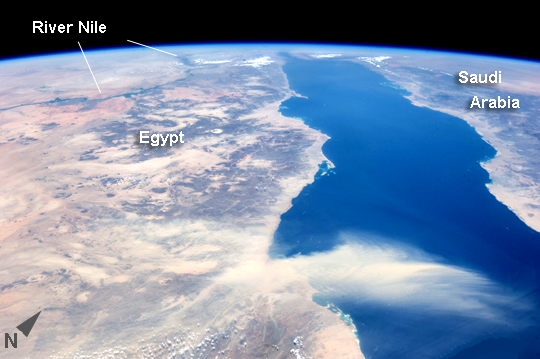
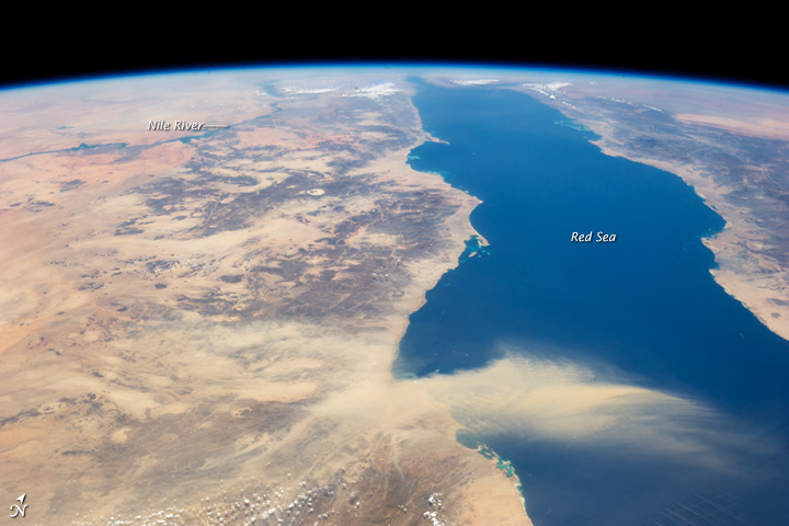
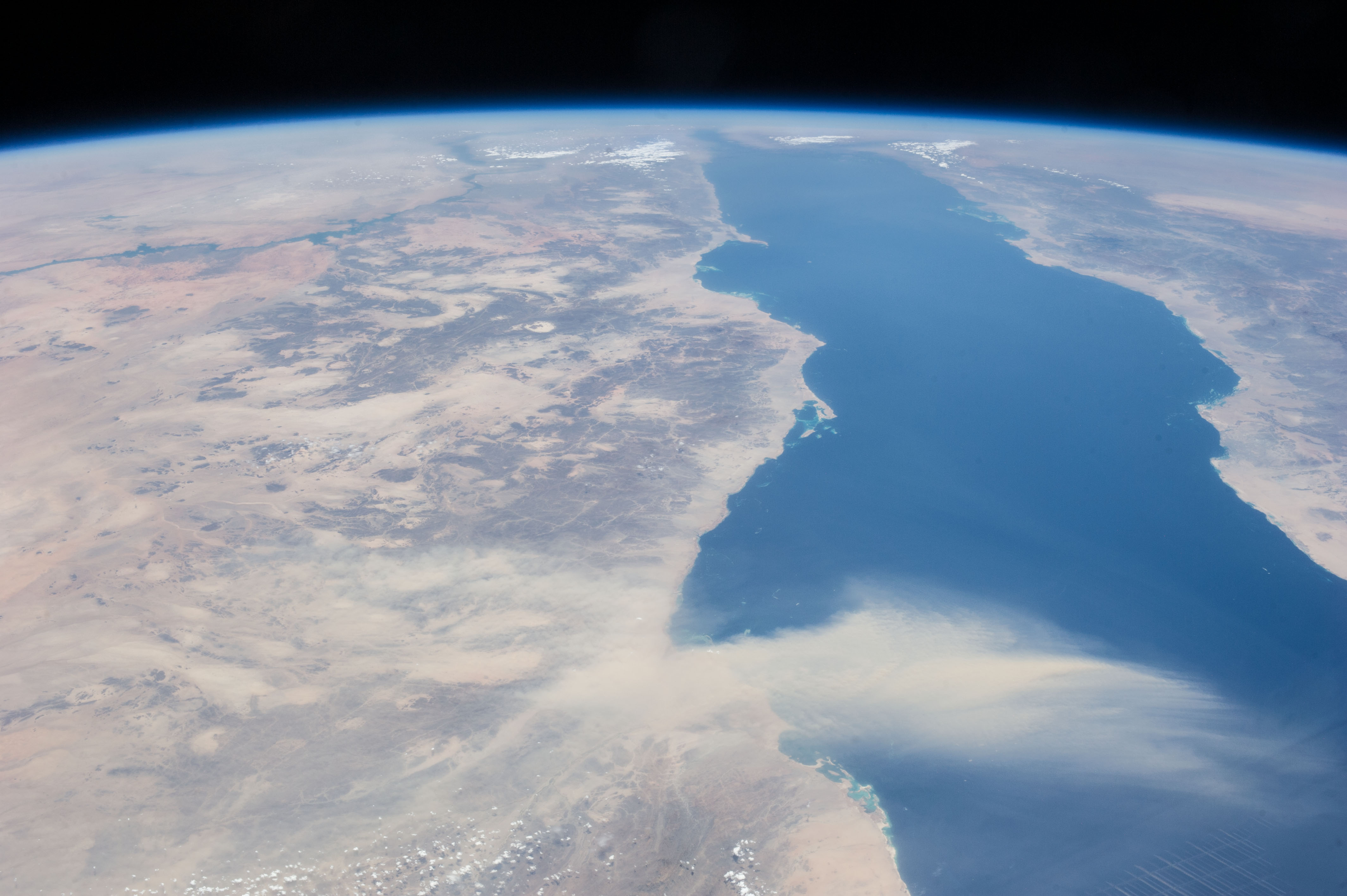
Image Caption: Egyptian Dust Plume, Red Sea
This astronaut photograph provides a panoramic view of most of the length of the Red Sea, with the northernmost end, the Gulf of Suez, just visible at image top center--fully 1900 km (ground distance) from the astronaut on board the International Space Station (ISS). The River Nile snakes its way northward through the Sahara Desert at image top left. Much closer to the camera--but still more than 550 km distant from the ground point above which the ISS is orbiting--is a prominent dust plume surging out over the clear water of the Red Sea (image foreground), reaching most of the way to Saudi Arabia.
The "point source" of this plume is the delta of the southern Egyptian river Khor Baraka. Astronaut images have shown that this delta is a common source for dust plumes, mainly because it is a relatively large area of exposed, loose sand and clay, easily lofted into the air. But the river also cuts through a high range of hills in a narrow valley that channels the wind, making it blow faster.
This dramatic view of the Red Sea shows the generally parallel margins of the opposing coastlines. The rift or depression which now holds the Red Sea has been opening slowly for about 30 million years, and is nearly 300 km wide in the region of the dust plume. The depression only recently filled with seawater within the last ~5 million years. The satisfyingly good fit between the coastlines allows the viewer to visualize quite easily how Africa and Arabia were once a single landmass before the Red Sea rift existed.
