ISS035-E-24919
| NASA Photo ID | ISS035-E-24919 |
| Focal Length | 400mm |
| Date taken | 2013.04.20 |
| Time taken | 09:19:27 GMT |
Resolutions offered for this image:
1000 x 665 pixels 540 x 359 pixels 1440 x 960 pixels 720 x 480 pixels 4256 x 2832 pixels 640 x 426 pixels
1000 x 665 pixels 540 x 359 pixels 1440 x 960 pixels 720 x 480 pixels 4256 x 2832 pixels 640 x 426 pixels

Cloud masks available for this image:
Spacecraft nadir point: 25.1° N, 68.2° E
Photo center point: 24.8° N, 67.3° E
Photo center point by machine learning:
Photo center point: 24.8° N, 67.3° E
Photo center point by machine learning:
Nadir to Photo Center: West
Spacecraft Altitude: 222 nautical miles (411km)
Country or Geographic Name: | PAKISTAN |
Features: | KORANGI, INDUSTRIAL AREAS, INDUS RIVER DELTA, MANGROVES |
| Features Found Using Machine Learning: | |
Cloud Cover Percentage: | 10 (1-10)% |
Sun Elevation Angle: | 60° |
Sun Azimuth: | 249° |
Camera: | Nikon D3S Electronic Still Camera |
Focal Length: | 400mm |
Camera Tilt: | 14 degrees |
Format: | 4256E: 4256 x 2832 pixel CMOS sensor, 36.0mm x 23.9mm, total pixels: 12.87 million, Nikon FX format |
Film Exposure: | |
| Additional Information | |
| Width | Height | Annotated | Cropped | Purpose | Links |
|---|---|---|---|---|---|
| 1000 pixels | 665 pixels | No | Yes | Earth From Space collection | Download Image |
| 540 pixels | 359 pixels | Yes | Yes | Earth From Space collection | Download Image |
| 1440 pixels | 960 pixels | No | Yes | NASA's Earth Observatory web site | Download Image |
| 720 pixels | 480 pixels | Yes | No | NASA's Earth Observatory web site | Download Image |
| 4256 pixels | 2832 pixels | No | No | Download Image | |
| 640 pixels | 426 pixels | No | No | Download Image |
Download Packaged File
Download a Google Earth KML for this Image
View photo footprint information
Download a GeoTIFF for this photo
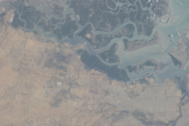
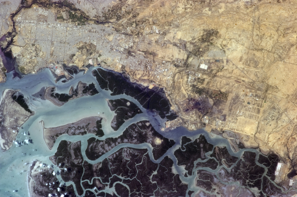
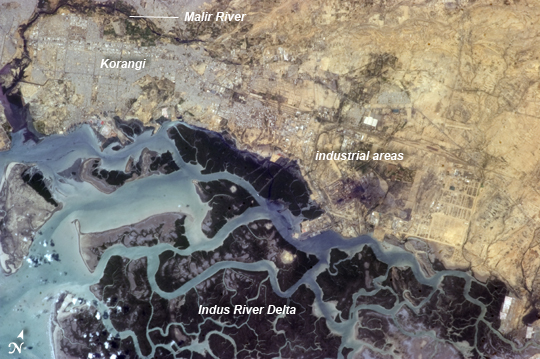
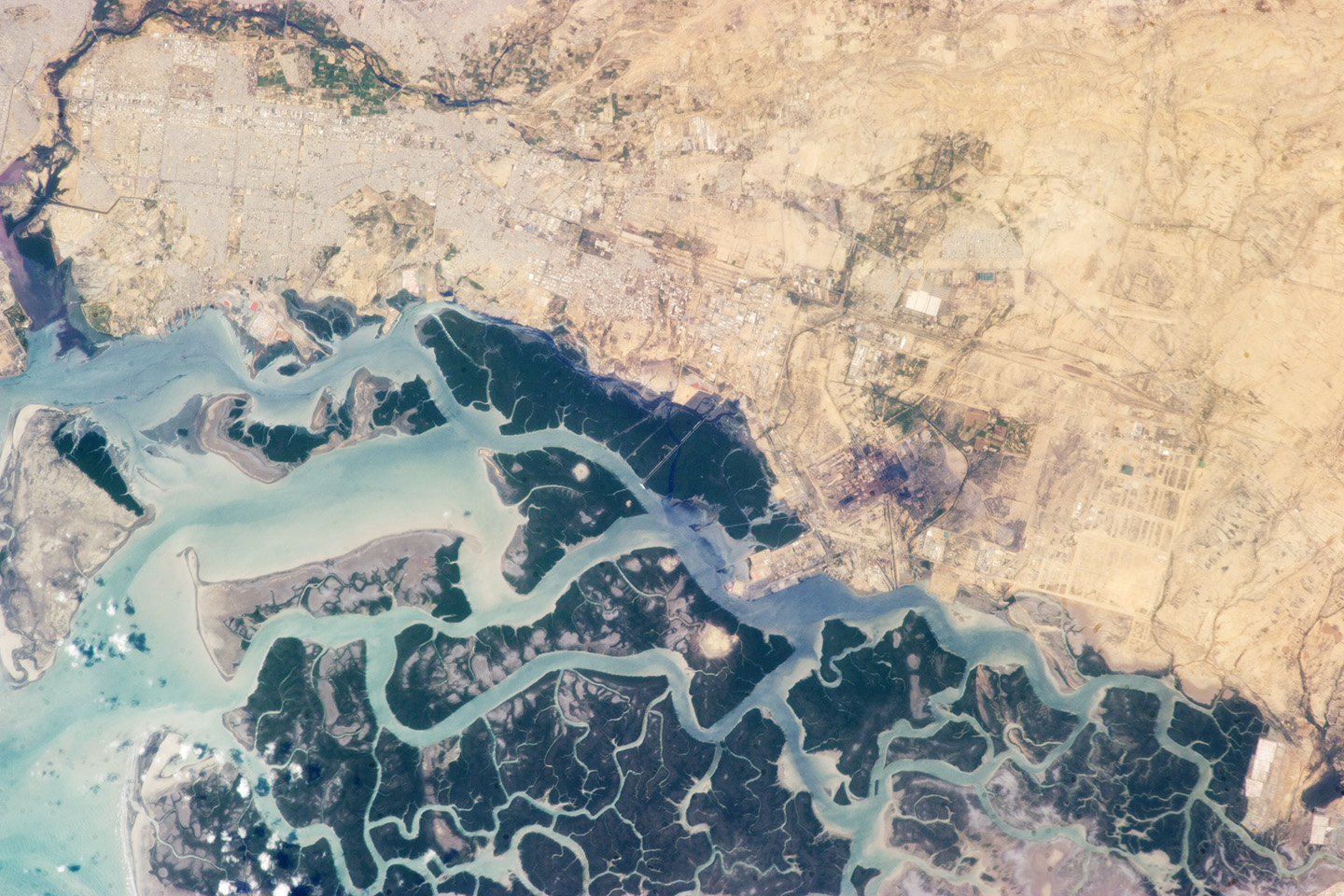
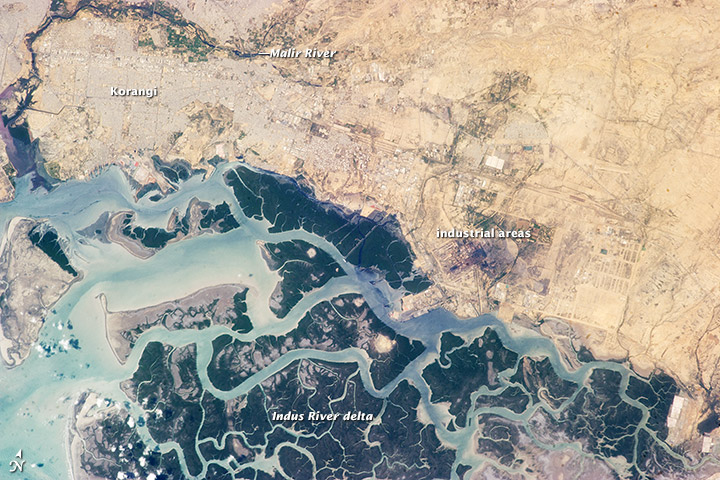
Image Caption: Korangi, Pakistan
Note: This caption refers to the image versions labeled "NASA's Earth Observatory web site".
Korangi (or Korangi Town) is part of the Karachi metropolitan area of coastal Pakistan. This astronaut photograph from the International Space Station highlights the contrast between the highly urbanized and industrialized Korangi area (image top and image right) to dense green mangrove forests and waterways of the Indus River Delta to the south (image bottom and image left). Away from the river delta, vegetation cover reduces rapidly to the northeast (image top right).
To the north and west, Korangi Town is bordered by the Malir River, one of two rivers (the other being the Lyari River, not shown) that pass through the Karachi metropolitan area. The river course of the Malir is marked by green riparian vegetation, which stands out vividly from orbit against the surrounding gray to tan urban areas.
One of the largest industrial areas in Pakistan is located in Korangi (known as the Korangi Industrial Area, or KIA) - this region is visible at image center, and is marked by large buildings and lots, many having large white-roofed structures. A conspicuously dark region to the right of image center marks the location of steel works; while bare soil and built materials are present, significant vegetation cover also contributes to the dark tone. In addition to steel, the KIA also includes textile, pharmaceutical, automobile, chemical, and flour industry facilities.
