ISS034-E-016601
| NASA Photo ID | ISS034-E-016601 |
| Focal Length | 24mm |
| Date taken | 2013.01.04 |
| Time taken | 05:56:04 GMT |

Cloud masks available for this image:
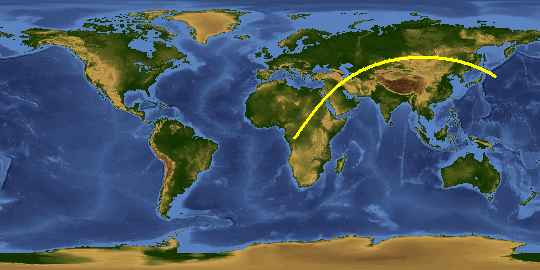
Spacecraft nadir point: 39.4° N, 149.4° E
Photo center point:
Photo center point by machine learning:
Photo center point:
Photo center point by machine learning:
Nadir to Photo Center:
Spacecraft Altitude: 213 nautical miles (394km)
Country or Geographic Name: | |
Features: | |
| Features Found Using Machine Learning: | PAN- |
Cloud Cover Percentage: | 57 (51-75)% |
Sun Elevation Angle: | 8° |
Sun Azimuth: | 232° |
Camera: | NIKON D3S S/N: 2007931 |
Focal Length: | 24mm |
Camera Tilt: | |
Format: | |
Film Exposure: | |
| Additional Information | |
This photo is one of the photos used to create this time-lapse video:
| Width | Height | Annotated | Cropped | Purpose | Links |
|---|---|---|---|---|---|
| 4256 pixels | 2832 pixels | No | No | Download Image | |
| 640 pixels | 426 pixels | No | No | Download Image |
Download Packaged File
Download a Google Earth KML for this Image
View photo footprint information
Download a GeoTIFF for this photo
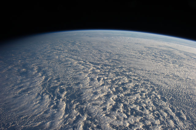
Image Caption: ISS034-E-016601 (4 Jan. 2013) --- On Jan. 4 a large presence of stratocumulus clouds was the central focus of camera lenses which remained aimed at the clouds as the Expedition 34 crew members aboard the International Space Station flew above the northwestern Pacific Ocean about 460 miles east of northern Honshu, Japan. This is a descending pass with a panoramic view looking southeast in late afternoon light with the terminator (upper left). The cloud pattern is typical for this part of the world. The low clouds carry cold air over a warmer sea with no discernable storm pattern.
