ISS033-E-22852
| NASA Photo ID | ISS033-E-22852 |
| Focal Length | 400mm |
| Date taken | 2012.11.18 |
| Time taken | 02:40:43 GMT |
Resolutions offered for this image:
1000 x 650 pixels 540 x 351 pixels 1440 x 1080 pixels 720 x 540 pixels 4256 x 2832 pixels 640 x 426 pixels
1000 x 650 pixels 540 x 351 pixels 1440 x 1080 pixels 720 x 540 pixels 4256 x 2832 pixels 640 x 426 pixels

Cloud masks available for this image:
Spacecraft nadir point: 30.3° N, 131.8° E
Photo center point: 32.9° N, 131.1° E
Photo center point by machine learning:
Photo center point: 32.9° N, 131.1° E
Photo center point by machine learning:
Nadir to Photo Center: North
Spacecraft Altitude: 226 nautical miles (419km)
Country or Geographic Name: | JAPAN |
Features: | NAKA-DAKE VOLCANO, ASO CALDERA, MINAMIASO, AGRICULTURE |
| Features Found Using Machine Learning: | |
Cloud Cover Percentage: | 10 (1-10)% |
Sun Elevation Angle: | 40° |
Sun Azimuth: | 175° |
Camera: | Nikon D3S Electronic Still Camera |
Focal Length: | 400mm |
Camera Tilt: | 36 degrees |
Format: | 4256E: 4256 x 2832 pixel CMOS sensor, 36.0mm x 23.9mm, total pixels: 12.87 million, Nikon FX format |
Film Exposure: | |
| Additional Information | |
| Width | Height | Annotated | Cropped | Purpose | Links |
|---|---|---|---|---|---|
| 1000 pixels | 650 pixels | No | Yes | Earth From Space collection | Download Image |
| 540 pixels | 351 pixels | Yes | Yes | Earth From Space collection | Download Image |
| 1440 pixels | 1080 pixels | No | Yes | NASA's Earth Observatory web site | Download Image |
| 720 pixels | 540 pixels | Yes | Yes | NASA's Earth Observatory web site | Download Image |
| 4256 pixels | 2832 pixels | No | No | Download Image | |
| 640 pixels | 426 pixels | No | No | Download Image |
Download Packaged File
Download a Google Earth KML for this Image
View photo footprint information
Download a GeoTIFF for this photo
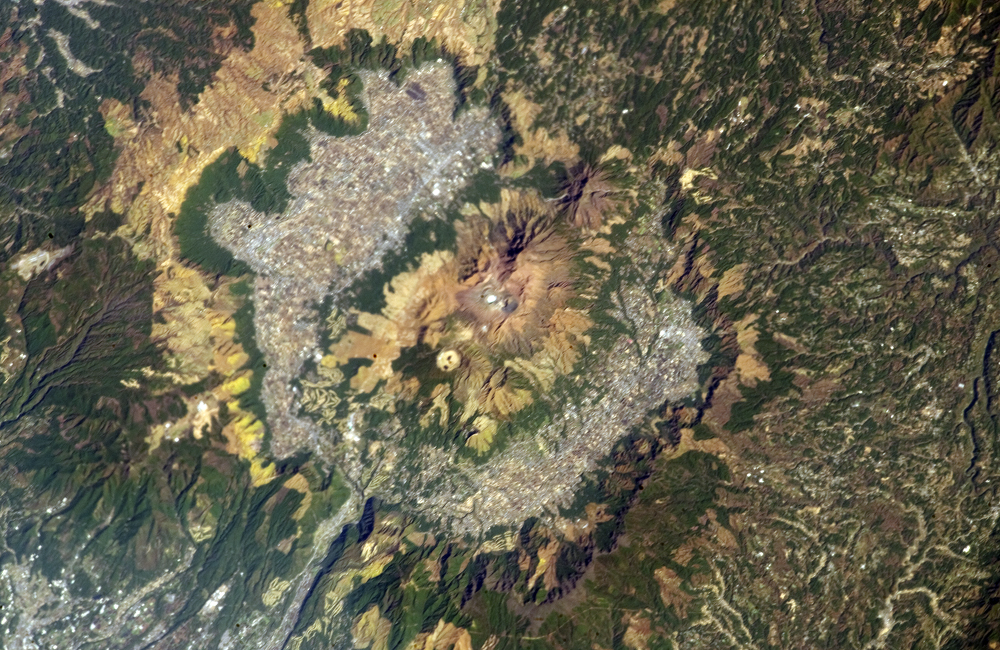
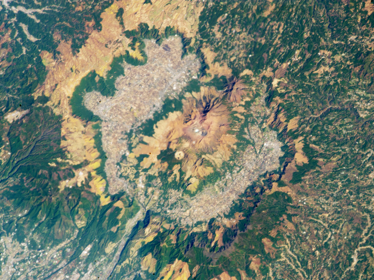
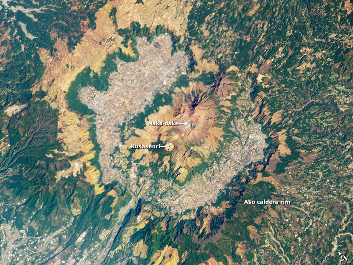
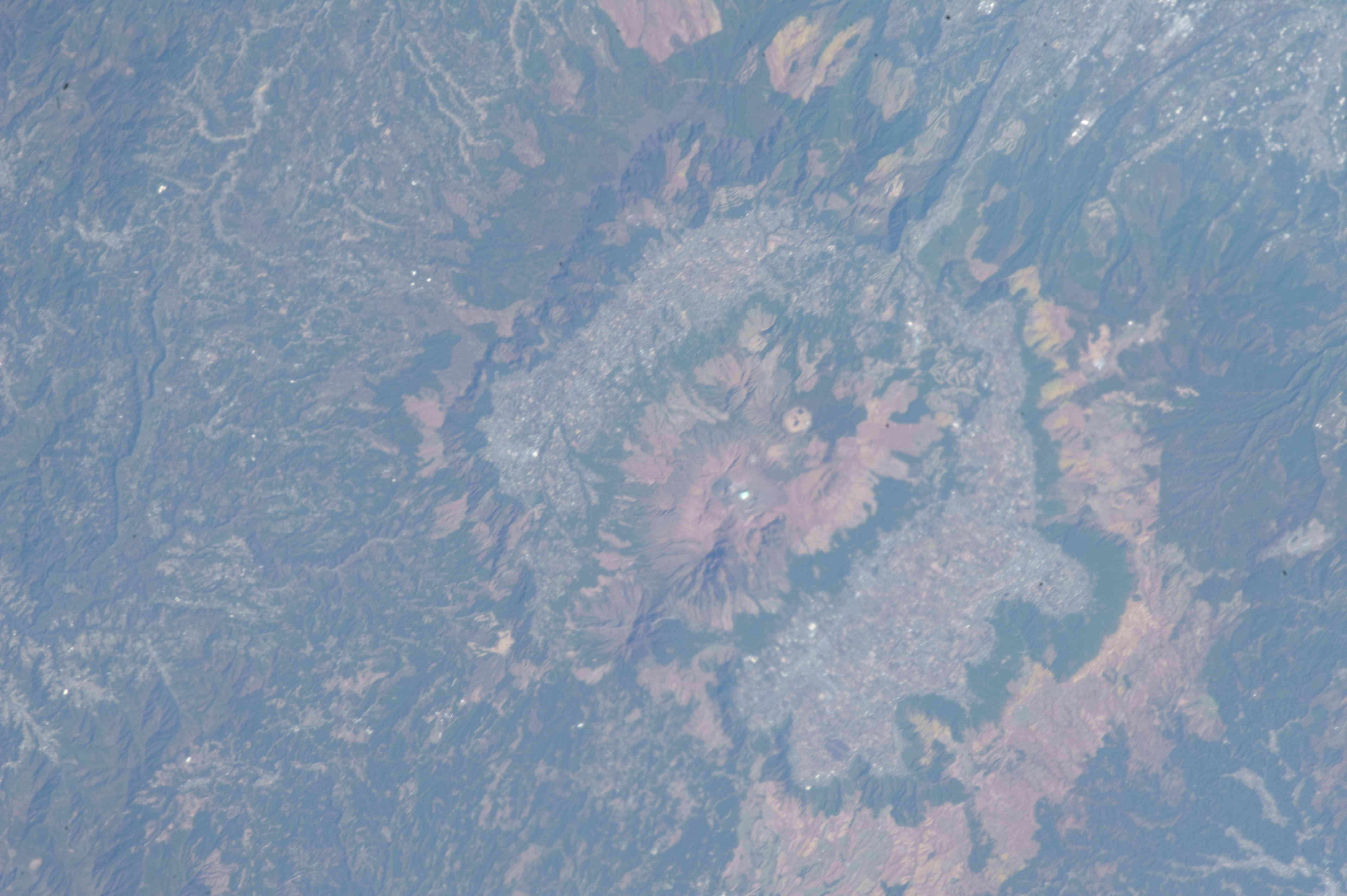
Image Caption: Aso Caldera, Kyushu, Japan
Note: This caption refers to the image versions labeled "NASA's Earth Observatory web site".
This astronaut photograph highlights the 24-km wide Aso caldera on the Japanese Island of Kyushu, formed during four explosive eruptions that took place from 300,000 to 90,000 years ago. These major eruptions produced pyroclastic flows and airfall tephra that covered much of Kyushu. As the eruptions emptied the magma chambers beneath the ancient volcanoes, they collapsed - forming the caldera. Shadows highlight the caldera rim at image right, while green vegetation covers slopes between the rim and caldera floor at image left.
Volcanic activity continued in the caldera following its formation, represented by 17 younger volcanoes including Naka-dake at image center. Naka-dake is one of Japan's most active volcanoes, with ash plumes produced from the summit crater as recently as June 2011. Another prominent crater, Kusasenri, is visible to the west of Naka-dake. This crater is the site of the Aso Volcano Museum as well as pasture for cows and horses.
The Aso caldera floor is largely occupied by urban and agricultural land uses that present a gray to white speckled appearance in the image. Fields and cities surround the younger volcanic structures in the caldera center to the north, west, and south. Tan to yellow-brown regions along the crater rim, and along the lower slopes of the younger volcanic highlands in the central caldera, are lacking the dense tree cover indicated by greener areas in the image.
