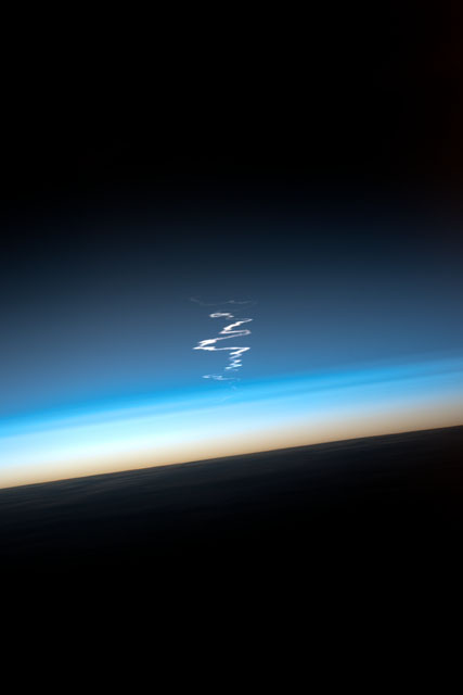
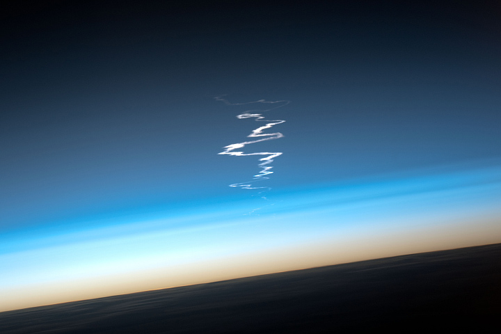
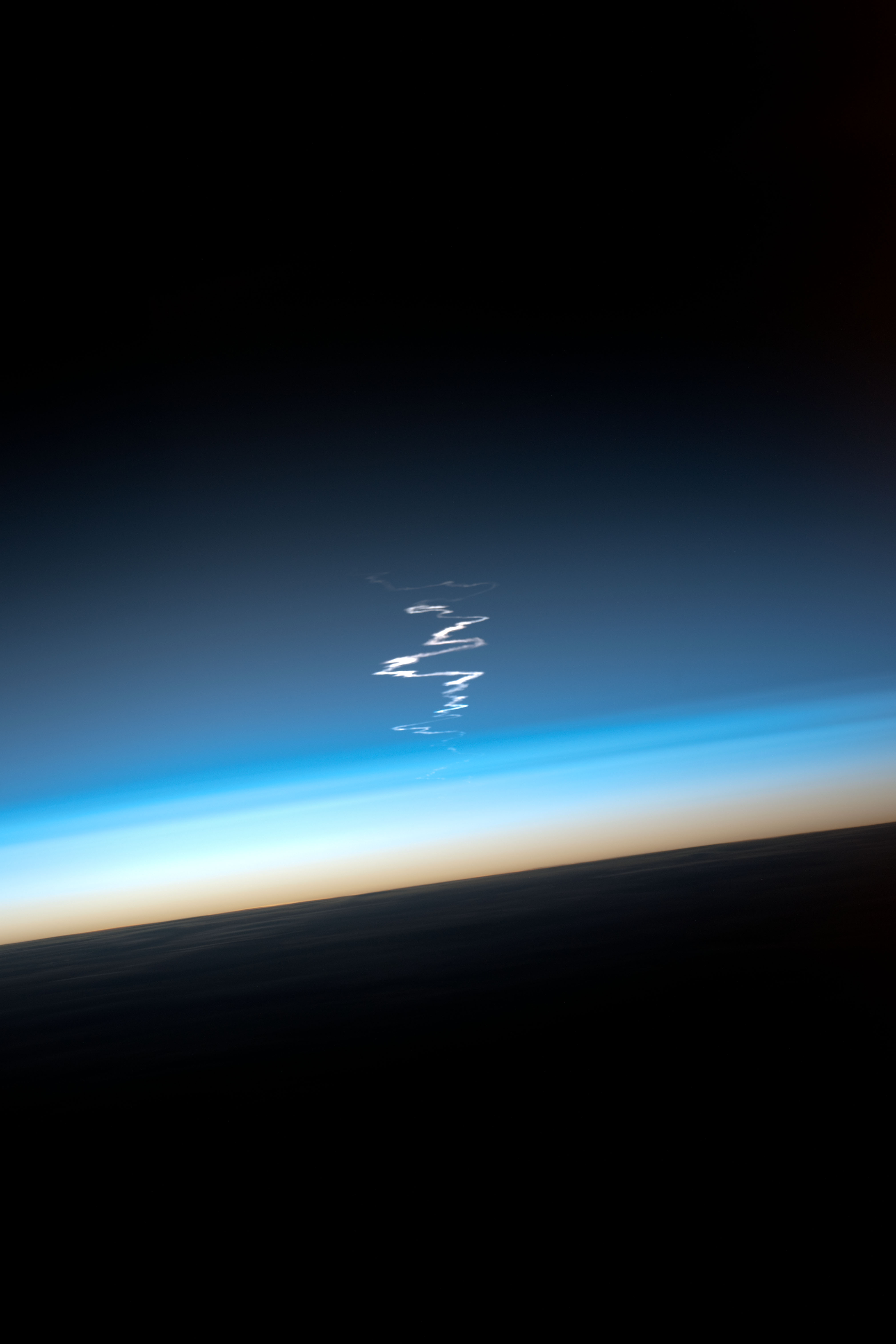
ISS033-E-15373
| NASA Photo ID | ISS033-E-15373 |
| Focal Length | 650mm |
| Date taken | 2012.10.23 |
| Time taken | 11:09:25 GMT |
Resolutions offered for this image:
4032 x 6048 pixels 720 x 480 pixels 4032 x 6048 pixels 427 x 640 pixels
4032 x 6048 pixels 720 x 480 pixels 4032 x 6048 pixels 427 x 640 pixels

Cloud masks available for this image:
Spacecraft nadir point: 49.9° N, 115.3° E
Photo center point:
Photo center point by machine learning:
Photo center point:
Photo center point by machine learning:
Nadir to Photo Center:
Spacecraft Altitude: 221 nautical miles (409km)
Country or Geographic Name: | ATMOSPHERIC LIMB |
Features: | SOYUZ EXHAUST TRAIL |
| Features Found Using Machine Learning: | PAN- |
Cloud Cover Percentage: | 10 (1-10)% |
Sun Elevation Angle: | -20° |
Sun Azimuth: | 275° |
Camera: | Nikon D3X Electronic Still Camera |
Focal Length: | 650mm |
Camera Tilt: | High Oblique |
Format: | 6048E: 6048 x 4032 pixel CMOS sensor, 35.9mm x 24.0mm, total pixels: 25.72 million, Nikon FX format |
Film Exposure: | |
| Additional Information | |
| Width | Height | Annotated | Cropped | Purpose | Links |
|---|---|---|---|---|---|
| 4032 pixels | 6048 pixels | No | Yes | NASA's Earth Observatory web site | Download Image |
| 720 pixels | 480 pixels | No | Yes | NASA's Earth Observatory web site | Download Image |
| 4032 pixels | 6048 pixels | No | No | Download Image | |
| 427 pixels | 640 pixels | No | No | Download Image |
Download Packaged File
Download a Google Earth KML for this Image
View photo footprint information
Download a GeoTIFF for this photo
Image Caption: none
