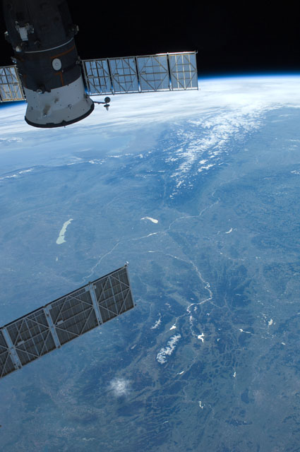
ISS031-E-77977
| NASA Photo ID | ISS031-E-77977 |
| Focal Length | 28mm |
| Date taken | 2012.04.28 |
| Time taken | 13:39:28 GMT |


Spacecraft nadir point: 51.0° N, 25.5° E
Photo center point: 48.0° N, 16.5° E
Photo center point by machine learning:
Photo center point: 48.0° N, 16.5° E
Photo center point by machine learning:
Nadir to Photo Center: West
Spacecraft Altitude: 213 nautical miles (394km)
Country or Geographic Name: | AUSTRIA |
Features: | PAN-EAST ALPS, SLOVAKIA, HUNGARY, ISS |
| Features Found Using Machine Learning: | PAN- |
Cloud Cover Percentage: | 10 (1-10)% |
Sun Elevation Angle: | 35° |
Sun Azimuth: | 247° |
Camera: | Nikon D2Xs Electronic Still Camera |
Focal Length: | 28mm |
Camera Tilt: | High Oblique |
Format: | 4288E: 4288 x 2848 pixel CMOS sensor, RGBG imager color filter |
Film Exposure: | |
| Additional Information | |
| Width | Height | Annotated | Cropped | Purpose | Links |
|---|---|---|---|---|---|
| 2848 pixels | 4288 pixels | No | No | Download Image | |
| 425 pixels | 640 pixels | No | No | Download Image |
Download Packaged File
Download a Google Earth KML for this Image
View photo footprint information
Download a GeoTIFF for this photo
Image Caption: none
