ISS031-E-148455

| NASA Photo ID | ISS031-E-148455 |
| Focal Length | 14mm |
| Date taken | 2012.06.21 |
| Time taken | 11:56:56 GMT |
Resolutions offered for this image:
540 x 360 pixels 1000 x 664 pixels 4288 x 2848 pixels 720 x 480 pixels 720 x 480 pixels 4288 x 2848 pixels 640 x 425 pixels
540 x 360 pixels 1000 x 664 pixels 4288 x 2848 pixels 720 x 480 pixels 720 x 480 pixels 4288 x 2848 pixels 640 x 425 pixels

Cloud masks available for this image:
Spacecraft nadir point: 26.4° N, 34.5° E
Photo center point: 24.5° N, 30.5° E
Photo center point by machine learning:
Photo center point: 24.5° N, 30.5° E
Photo center point by machine learning:
Nadir to Photo Center: West
Spacecraft Altitude: 211 nautical miles (391km)
Country or Geographic Name: | EGYPT |
Features: | L. NASSER, TOSHKA LAKES, DAKHLA OASIS |
| Features Found Using Machine Learning: | |
Cloud Cover Percentage: | 0 (no clouds present) |
Sun Elevation Angle: | 60° |
Sun Azimuth: | 272° |
Camera: | Nikon D2Xs Electronic Still Camera |
Focal Length: | 14mm |
Camera Tilt: | 52 degrees |
Format: | 4288E: 4288 x 2848 pixel CMOS sensor, RGBG imager color filter |
Film Exposure: | |
| Additional Information | |
| Width | Height | Annotated | Cropped | Purpose | Links |
|---|---|---|---|---|---|
| 540 pixels | 360 pixels | Yes | Yes | Earth From Space collection | Download Image |
| 1000 pixels | 664 pixels | No | No | NASA's Earth Observatory web site | Download Image |
| 4288 pixels | 2848 pixels | Yes | Yes | Download Image | |
| 720 pixels | 480 pixels | Yes | Yes | NASA's Earth Observatory web site | Download Image |
| 720 pixels | 480 pixels | Yes | Yes | Download Image | |
| 4288 pixels | 2848 pixels | No | No | Download Image | |
| 640 pixels | 425 pixels | No | No | Download Image |
Download Packaged File
Download a Google Earth KML for this Image
View photo footprint information
Download a GeoTIFF for this photo
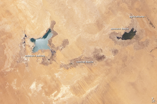
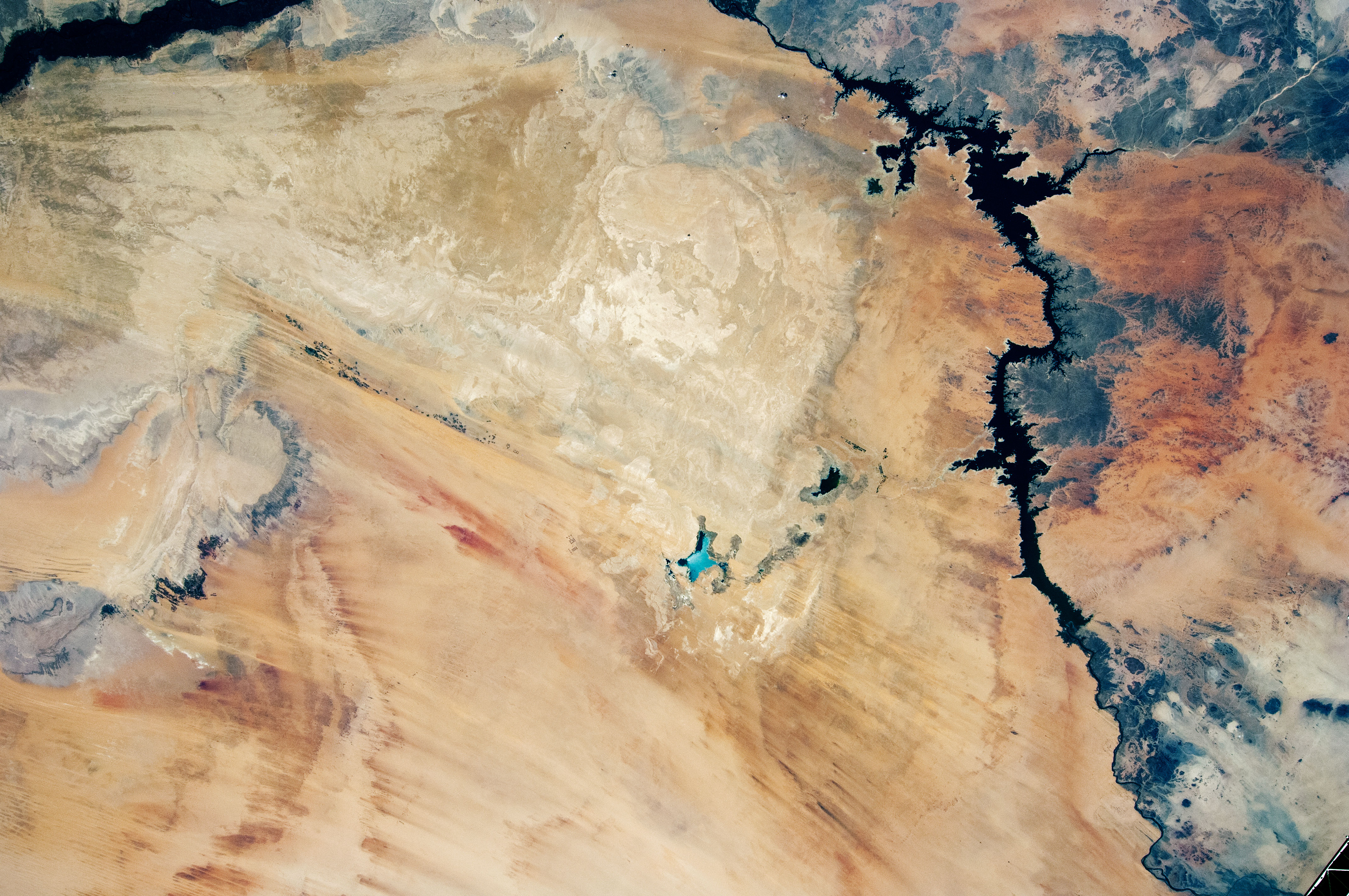
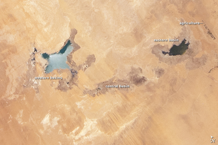
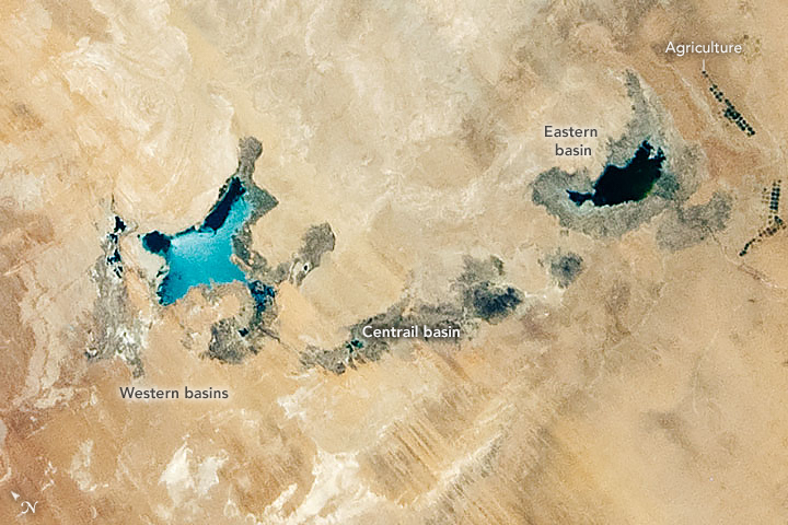
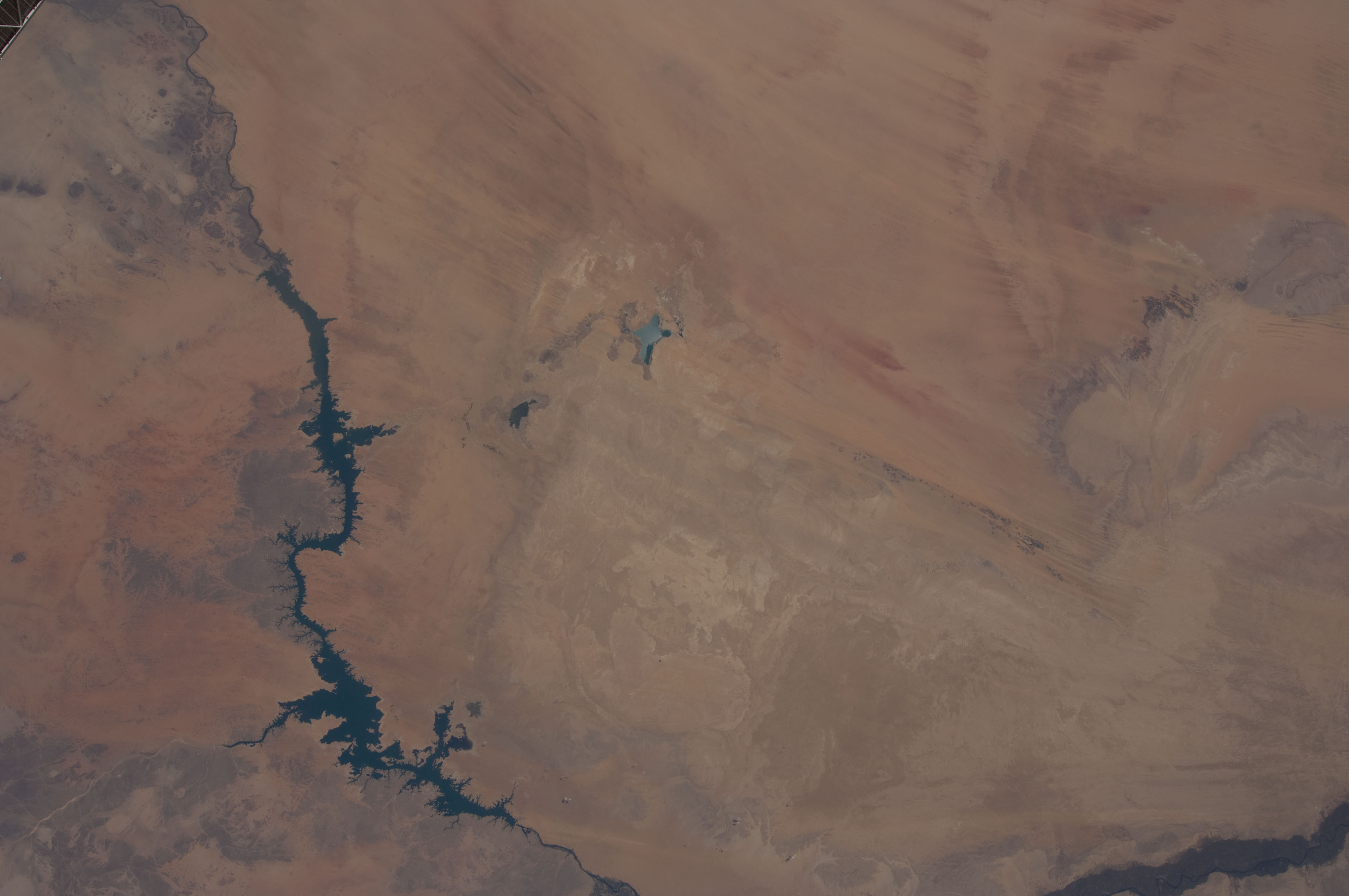
Image Caption: Toshka Lakes 2002-2012, southern Egypt
The Toshka Lakes were formed in the Sahara Desert of Egypt by water from the River Nile conveyed from Lake Nasser by a canal to the Toshka Depression. Flooding of the Toshka Depression had created the four main lakes with a maximum surface area in 2002 of ~1450 km2 -- around 25.26 billion cubic meters of water. By 2006 the stored water was reduced by 50% and by 2012, this image shows open water only in the lowest parts of the main western and eastern basins--representing a reduction in surface area to 307 km2--nearly 80% smaller than the 2002 surface area. Standing water is almost completely absent from the central basin.
From space, astronauts documented the first lake--the easternmost one--in 1998. The lakes progressively grew in depressions to the west, the westernmost filling between 2000 and 2001. The image shows lines of center-point agricultural fields near the east-basin lake (dark dots at image center) nearest Lake Nasser. Sunglint on the western lake makes the water surface appear both light and dark, depending on which parts of the surface were ruffled by the wind at the moment the image was taken.
