ISS031-E-146397
| NASA Photo ID | ISS031-E-146397 |
| Focal Length | 18mm |
| Date taken | 2012.06.27 |
| Time taken | 20:40:30 GMT |
Cloud masks available for this image:
Spacecraft nadir point: 49.8° N, 88.8° W
Photo center point: 40.5° N, 113.5° W
Photo center point by machine learning:
Photo center point: 40.5° N, 113.5° W
Photo center point by machine learning:
Nadir to Photo Center: West
Spacecraft Altitude: 208 nautical miles (385km)
Country or Geographic Name: | USA-UTAH |
Features: | GREAT SALT LAKE, FONTANELLE FIRE |
| Features Found Using Machine Learning: | |
Cloud Cover Percentage: | 10 (1-10)% |
Sun Elevation Angle: | 49° |
Sun Azimuth: | 245° |
Camera: | Nikon D2Xs Electronic Still Camera |
Focal Length: | 18mm |
Camera Tilt: | High Oblique |
Format: | 4288E: 4288 x 2848 pixel CMOS sensor, RGBG imager color filter |
Film Exposure: | |
| Additional Information | |
| Width | Height | Annotated | Cropped | Purpose | Links |
|---|---|---|---|---|---|
| 4288 pixels | 2848 pixels | No | No | Download Image | |
| 640 pixels | 425 pixels | No | No | Download Image |
Download Packaged File
Download a Google Earth KML for this Image
View photo footprint information
Download a GeoTIFF for this photo
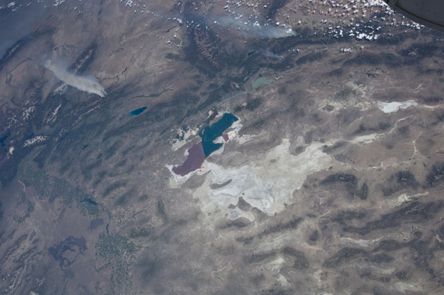
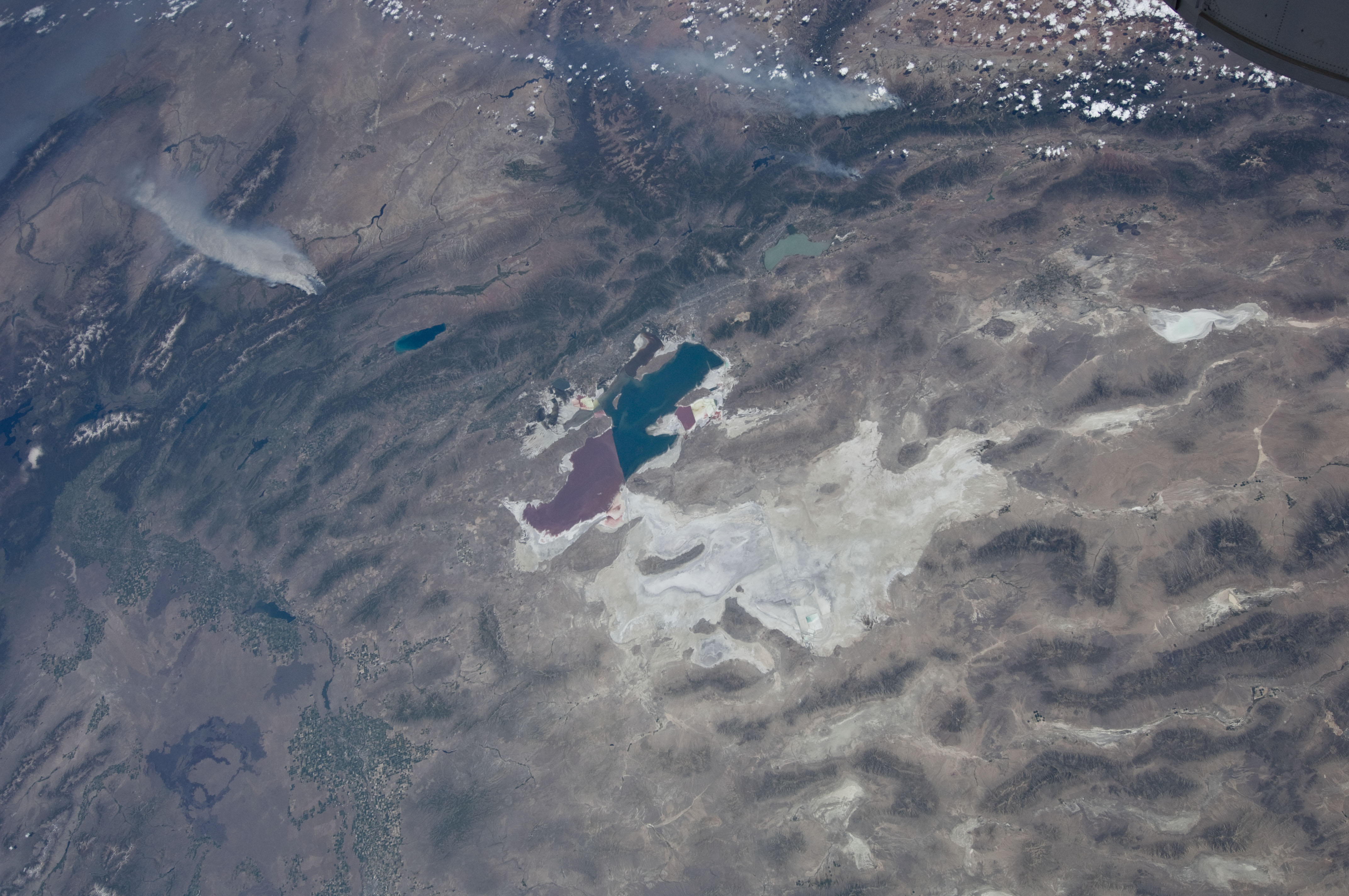
Image Caption: ISS031-E-146397 (27 June 2012) --- An Expedition 31 crew member aboard the International Space Station, flying approximately 240 miles above Earth, recorded a series of images of the current wild fires in the western and southwestern United States. These particular fires, of unknown cause, are burning at the south end of the Wyoming Range in southwestern Wyoming, and have affected 17,000 acres. The fires have produced two major smoke plumes, seen at upper left of the 18mm frame. Winds transport the smoke in a northeasterly direction. Utah's Great Salt Lake (center) is about 120 miles away. Bear Lake and Utah Lake (very light blue or gray) are also visible in the frame.
