ISS031-E-146306
| NASA Photo ID | ISS031-E-146306 |
| Focal Length | 180mm |
| Date taken | 2012.06.27 |
| Time taken | 20:41:49 GMT |
Resolutions offered for this image:
1000 x 773 pixels 720 x 480 pixels 4288 x 2848 pixels 640 x 425 pixels
1000 x 773 pixels 720 x 480 pixels 4288 x 2848 pixels 640 x 425 pixels
Cloud masks available for this image:
Spacecraft nadir point: 51.0° N, 81.3° W
Photo center point: 42.5° N, 110.5° W
Photo center point by machine learning:
Photo center point: 42.5° N, 110.5° W
Photo center point by machine learning:
Nadir to Photo Center: West
Spacecraft Altitude: 208 nautical miles (385km)
Country or Geographic Name: | USA-WYOMING |
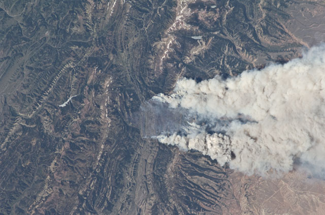
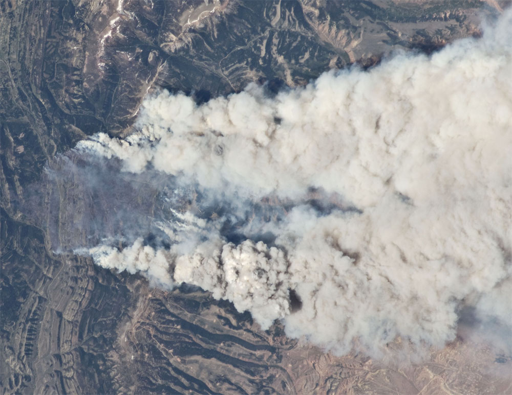
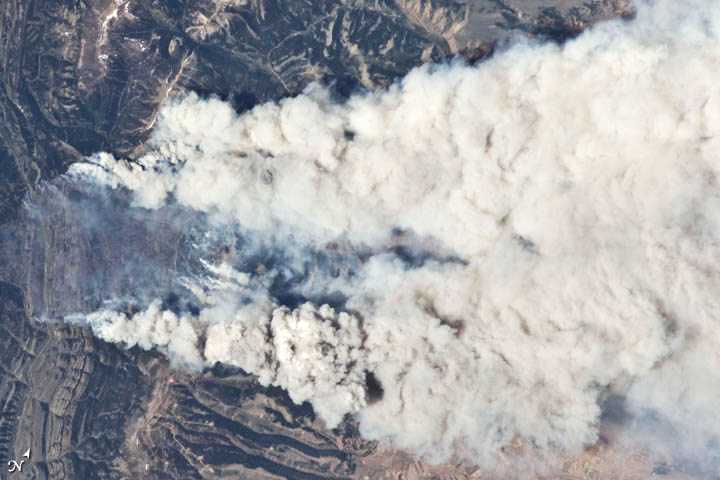
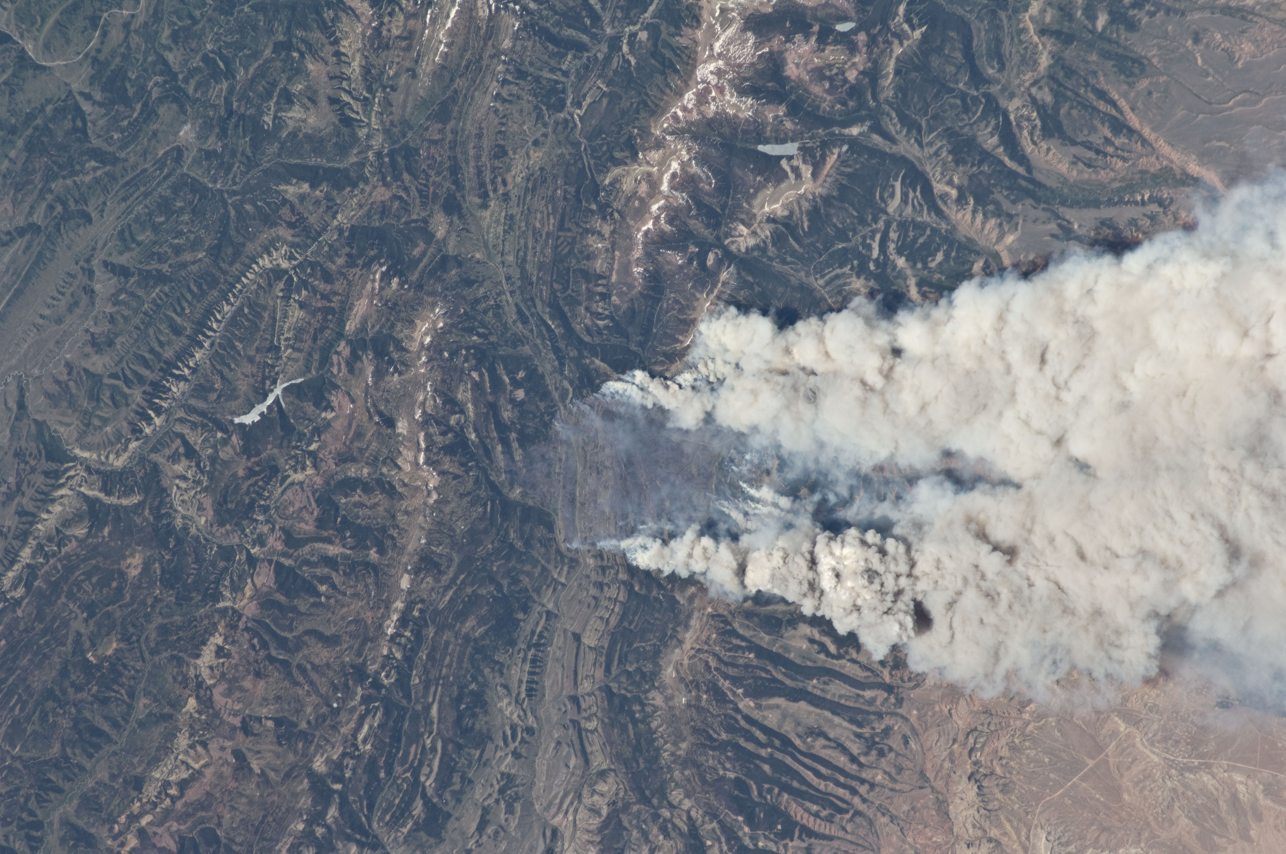
Features: | FONTANELLE FIRE, WYOMING RA. |
| Features Found Using Machine Learning: | |
Cloud Cover Percentage: | 10 (1-10)% |
Sun Elevation Angle: | 44° |
Sun Azimuth: | 252° |
Camera: | Nikon D2Xs Electronic Still Camera |
Focal Length: | 180mm |
Camera Tilt: | High Oblique |
Format: | 4288E: 4288 x 2848 pixel CMOS sensor, RGBG imager color filter |
Film Exposure: | |
| Additional Information | |
| Width | Height | Annotated | Cropped | Purpose | Links |
|---|---|---|---|---|---|
| 1000 pixels | 773 pixels | No | Yes | NASA's Earth Observatory web site | Download Image |
| 720 pixels | 480 pixels | Yes | Yes | NASA's Earth Observatory web site | Download Image |
| 4288 pixels | 2848 pixels | No | No | Download Image | |
| 640 pixels | 425 pixels | No | No | Download Image |
Download Packaged File
Download a Google Earth KML for this Image
View photo footprint information
Download a GeoTIFF for this photo
Image Caption: ISS031-E-146306 (27 June 2012) --- An Expedition 31 crew member aboard the International Space Station, flying approximately 240 miles (386 kilometers) above Earth, captured this view of the Fontenelle fire on June 27, 2012. The fire, burning in Wyoming 18 miles (29 kilometers) west of Big Piney, was discovered on June 24. [Editor's update --- By the morning of June 28, the fire had burned 25,000 acres (101 square kilometers). By July 6, the area burned had more than doubled to 57,324 acres (232 square kilometers), and the fire was 25 percent contained].
