ISS030-E-44107

| NASA Photo ID | ISS030-E-44107 |
| Focal Length | 17mm |
| Date taken | 2012.01.04 |
| Time taken | 08:34:23 GMT |
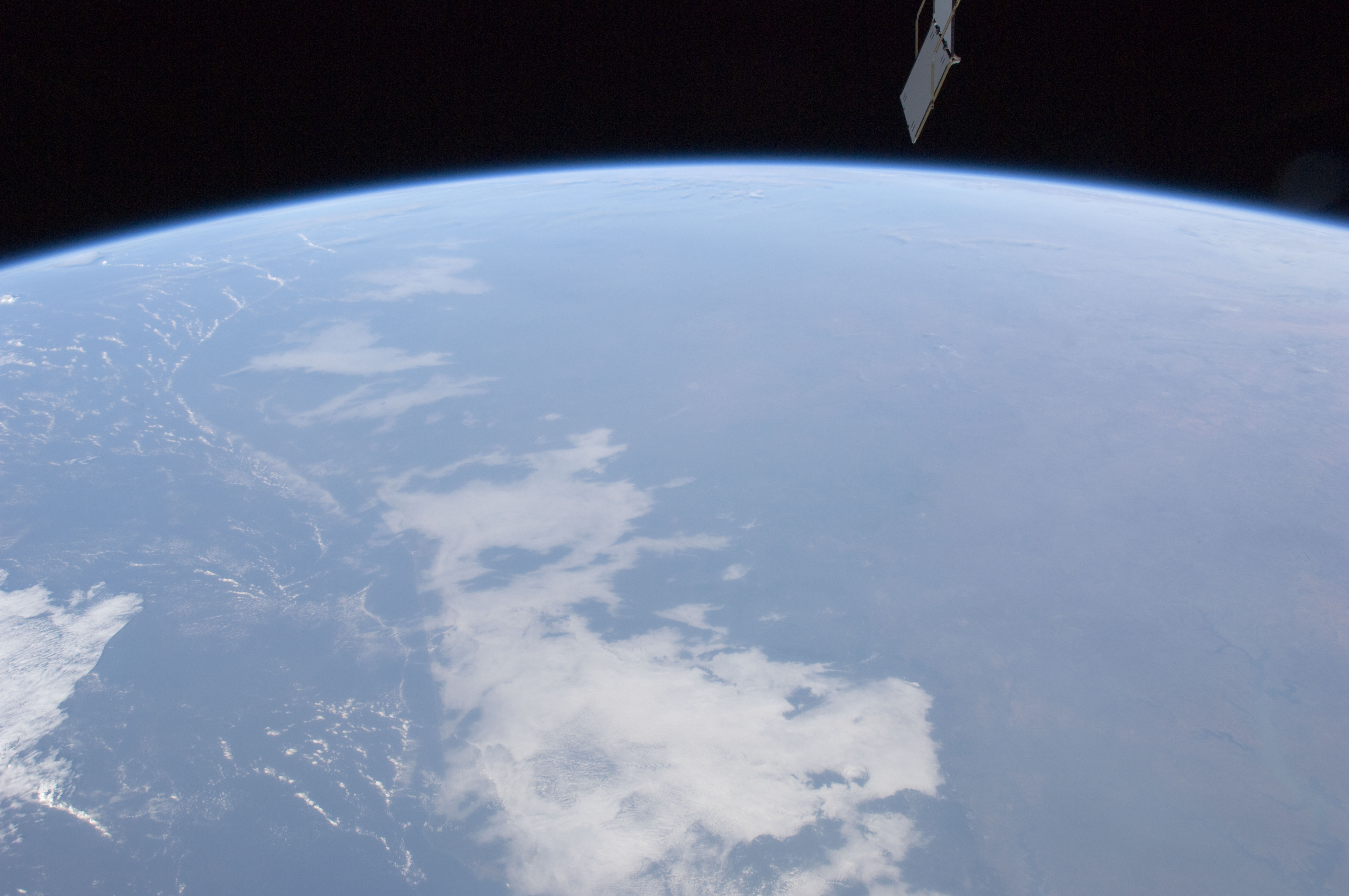

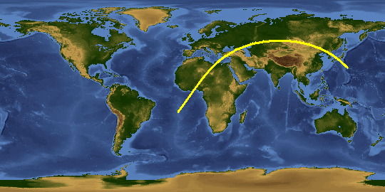
Spacecraft nadir point: 4.5° N, 0.5° E
Photo center point: 5.5° N, 3.5° W
Photo center point by machine learning:
Photo center point: 5.5° N, 3.5° W
Photo center point by machine learning:
Nadir to Photo Center: West
Spacecraft Altitude: 216 nautical miles (400km)
Country or Geographic Name: | IVORY COAST |
Features: | PAN- WESTERN AFRICA, ISS |
| Features Found Using Machine Learning: | PAN- |
Cloud Cover Percentage: | 25 (11-25)% |
Sun Elevation Angle: | 32° |
Sun Azimuth: | 121° |
Camera: | Nikon D2Xs Electronic Still Camera |
Focal Length: | 17mm |
Camera Tilt: | 49 degrees |
Format: | 4288E: 4288 x 2848 pixel CMOS sensor, RGBG imager color filter |
Film Exposure: | |
| Additional Information | |
This photo is one of the photos used to create this time-lapse video:
| Width | Height | Annotated | Cropped | Purpose | Links |
|---|---|---|---|---|---|
| 4288 pixels | 2848 pixels | No | No | Download Image | |
| 640 pixels | 425 pixels | No | No | Download Image |
Download Packaged File
Download a Google Earth KML for this Image
View photo footprint information
Download a GeoTIFF for this photo
Image Caption: none
