ISS030-E-279383
| NASA Photo ID | ISS030-E-279383 |
| Focal Length | 24mm |
| Date taken | 2012.03.30 |
| Time taken | 01:38:07 GMT |
Cloud masks available for this image:
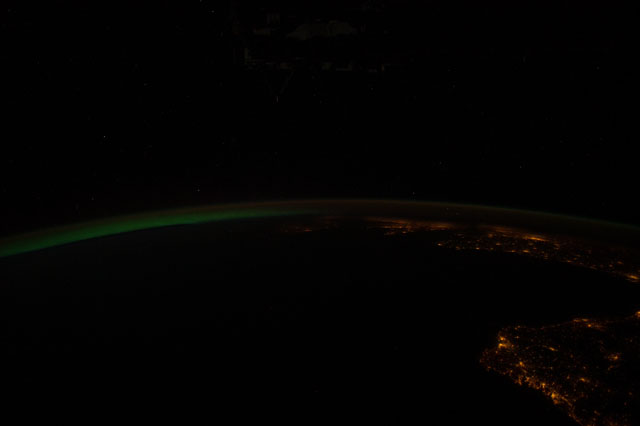
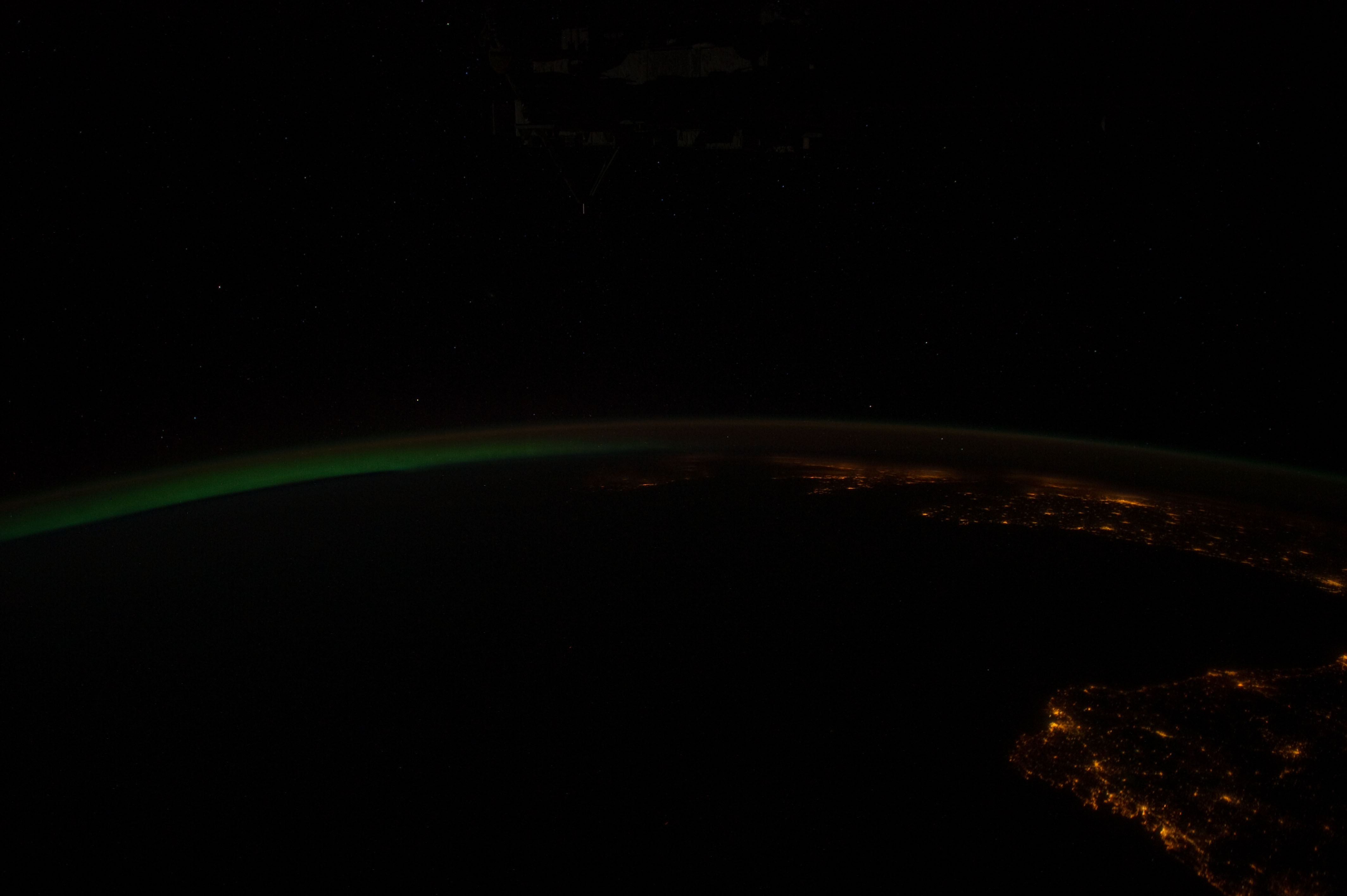
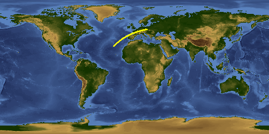
Spacecraft nadir point: 39.6° N, 13.1° W
Photo center point: 43.1° N, 8.8° W
Photo center point by machine learning:
Photo center point: 43.1° N, 8.8° W
Photo center point by machine learning:
Nadir to Photo Center: Northeast
Spacecraft Altitude: 212 nautical miles (393km)
Country or Geographic Name: | |
Features: | |
| Features Found Using Machine Learning: | AURORA, PAN- |
Cloud Cover Percentage: | 0 (no clouds present) |
Sun Elevation Angle: | -46° |
Sun Azimuth: | 15° |
Camera: | Nikon D3S Electronic Still Camera |
Focal Length: | 24mm |
Camera Tilt: | High Oblique |
Format: | 4256E: 4256 x 2832 pixel CMOS sensor, 36.0mm x 23.9mm, total pixels: 12.87 million, Nikon FX format |
Film Exposure: | |
| Additional Information | |
This photo is one of the photos used to create this time-lapse video:
| Width | Height | Annotated | Cropped | Purpose | Links |
|---|---|---|---|---|---|
| 4256 pixels | 2832 pixels | No | No | Download Image | |
| 640 pixels | 426 pixels | No | No | Download Image |
Download Packaged File
Download a Google Earth KML for this Image
View photo footprint information
Download a GeoTIFF for this photo
Image Caption: METADATA CONTRIBUTED BY THE CITIES AT NIGHT GROUP; ACCURACY NOT VERIFIED
