ISS028-E-15023
| NASA Photo ID | ISS028-E-15023 |
| Focal Length | 65mm |
| Date taken | 2011.07.08 |
| Time taken | 08:16:11 GMT |
Resolutions offered for this image:
1000 x 734 pixels 540 x 396 pixels 720 x 480 pixels 4288 x 2848 pixels 640 x 425 pixels
1000 x 734 pixels 540 x 396 pixels 720 x 480 pixels 4288 x 2848 pixels 640 x 425 pixels
Cloud masks available for this image:
Spacecraft nadir point: 38.6° N, 43.1° E
Photo center point: 40.0° N, 44.5° E
Photo center point by machine learning:
Photo center point: 40.0° N, 44.5° E
Photo center point by machine learning:
Nadir to Photo Center: Northeast
Spacecraft Altitude: 208 nautical miles (385km)
Country or Geographic Name: | TURKEY |
Features: | MT. ARARAT, L. BALIK, ARAS R. V., AGR., YEREVAN, MTS., FOR. |
| Features Found Using Machine Learning: | |
Cloud Cover Percentage: | 10 (1-10)% |
Sun Elevation Angle: | 70° |
Sun Azimuth: | 139° |
Camera: | Nikon D2Xs Electronic Still Camera |
Focal Length: | 65mm |
Camera Tilt: | 30 degrees |
Format: | 4288E: 4288 x 2848 pixel CMOS sensor, RGBG imager color filter |
Film Exposure: | |
| Additional Information | |
| Width | Height | Annotated | Cropped | Purpose | Links |
|---|---|---|---|---|---|
| 1000 pixels | 734 pixels | No | Yes | Earth From Space collection | Download Image |
| 540 pixels | 396 pixels | Yes | Yes | Earth From Space collection | Download Image |
| 720 pixels | 480 pixels | Yes | Yes | NASA's Earth Observatory web site | Download Image |
| 4288 pixels | 2848 pixels | No | No | Download Image | |
| 640 pixels | 425 pixels | No | No | Download Image |
Download Packaged File
Download a Google Earth KML for this Image
View photo footprint information
Download a GeoTIFF for this photo
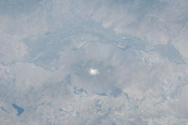
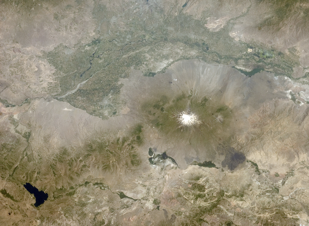
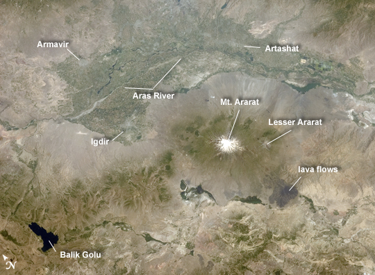
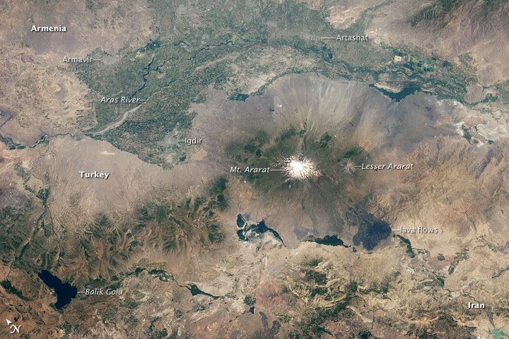
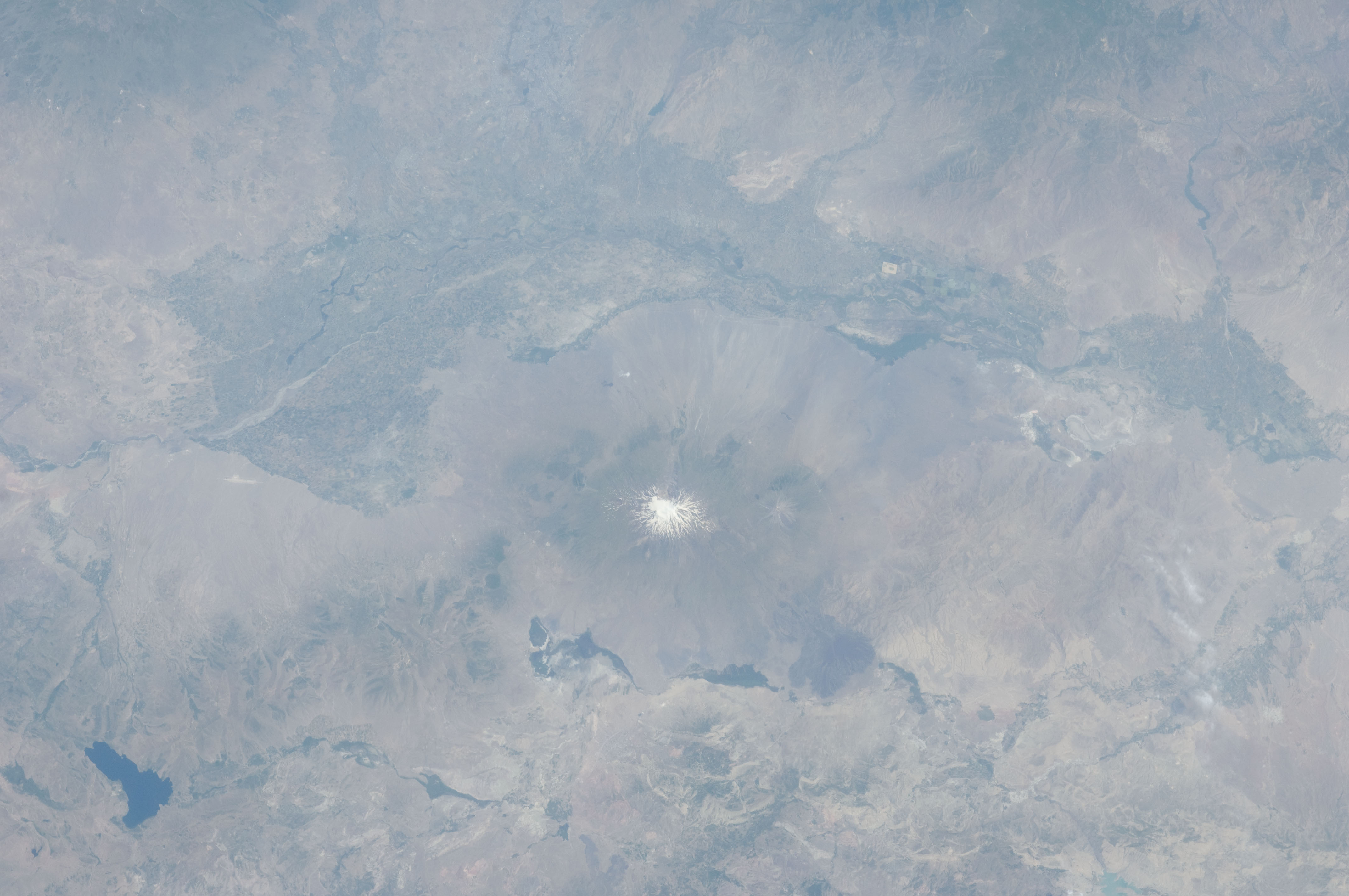
Image Caption: Aras River, Turkey-Armenia -Iran Border Region
This astronaut photograph, taken from the International Space Station, highlights a segment of the international border between Turkey to the south-southwest and Armenia to the north-northeast. The Aras River is the physical expression of the closed border between the two countries. Extensive green agricultural fields are common on both sides of the river (image top), as well as a number of gray to tan urban areas including Artashat and Armavir in Armenia and Igdir in Turkey. While there have been efforts to normalize diplomatic relations between the two countries in recent years, the Armenia-Turkey border remains officially closed.
The dominant geographic feature in the region is Mt. Ararat, also known as Agri Dagi. The peak of Ararat, a large stratovolcano that last erupted in 1840 according to historical records, is located approximately 40 kilometers to the south of the Armenia-Turkey border. A lower peak to the east, known as Lesser or Little Ararat, is also volcanic in origin. Dark gray lava flows to the south of Mt. Ararat are located near the Turkish border with Iran. While this border is also closed along much of its length, official crossing points allow relatively easy travel between the two countries.
The white, glacier-clad peak of Mt. Ararat is evident at image center; dark green areas on the lower slopes indicate where vegetation cover is abundant. A large lake, Balik Golu or Fish Lake, is visible to the west (image lower left).
