ISS027-E-27026
| NASA Photo ID | ISS027-E-27026 |
| Focal Length | 400mm |
| Date taken | 2011.05.12 |
| Time taken | 16:01:40 GMT |
Resolutions offered for this image:
1000 x 664 pixels 540 x 360 pixels 720 x 480 pixels 4288 x 2929 pixels 640 x 437 pixels
1000 x 664 pixels 540 x 360 pixels 720 x 480 pixels 4288 x 2929 pixels 640 x 437 pixels


Cloud masks available for this image:
Spacecraft nadir point: 38.8° N, 88.1° W
Photo center point: 36.6° N, 89.4° W
Photo center point by machine learning:
Photo center point: 36.6° N, 89.4° W
Photo center point by machine learning:
Nadir to Photo Center: Southwest
Spacecraft Altitude: 184 nautical miles (341km)
Country or Geographic Name: | USA-MISSOURI |
Features: | MISSISSIPPI R. IN FLOOD, SED., AGR., WETLANDS, NEW MADRID, HOTCHKISS BEND |
| Features Found Using Machine Learning: | |
Cloud Cover Percentage: | 25 (11-25)% |
Sun Elevation Angle: | 59° |
Sun Azimuth: | 124° |
Camera: | Nikon D2Xs Electronic Still Camera |
Focal Length: | 400mm |
Camera Tilt: | 40 degrees |
Format: | 4288E: 4288 x 2848 pixel CMOS sensor, RGBG imager color filter |
Film Exposure: | |
| Additional Information | |
| Width | Height | Annotated | Cropped | Purpose | Links |
|---|---|---|---|---|---|
| 1000 pixels | 664 pixels | No | Yes | Earth From Space collection | Download Image |
| 540 pixels | 360 pixels | Yes | Yes | Earth From Space collection | Download Image |
| 720 pixels | 480 pixels | Yes | Yes | NASA's Earth Observatory web site | Download Image |
| 4288 pixels | 2929 pixels | No | No | Download Image | |
| 640 pixels | 437 pixels | No | No | Download Image |
Download Packaged File
Download a Google Earth KML for this Image
View photo footprint information
Download a GeoTIFF for this photo
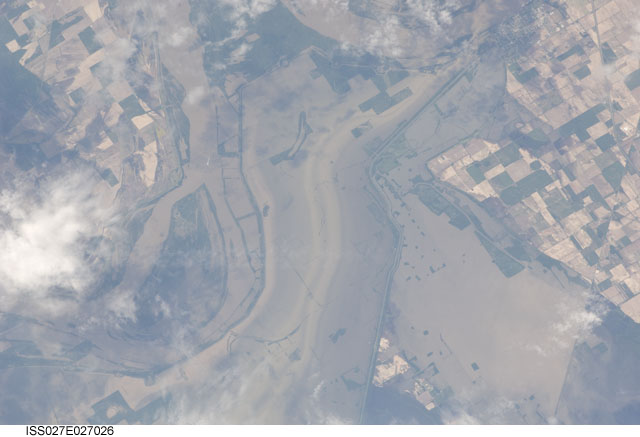
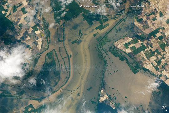
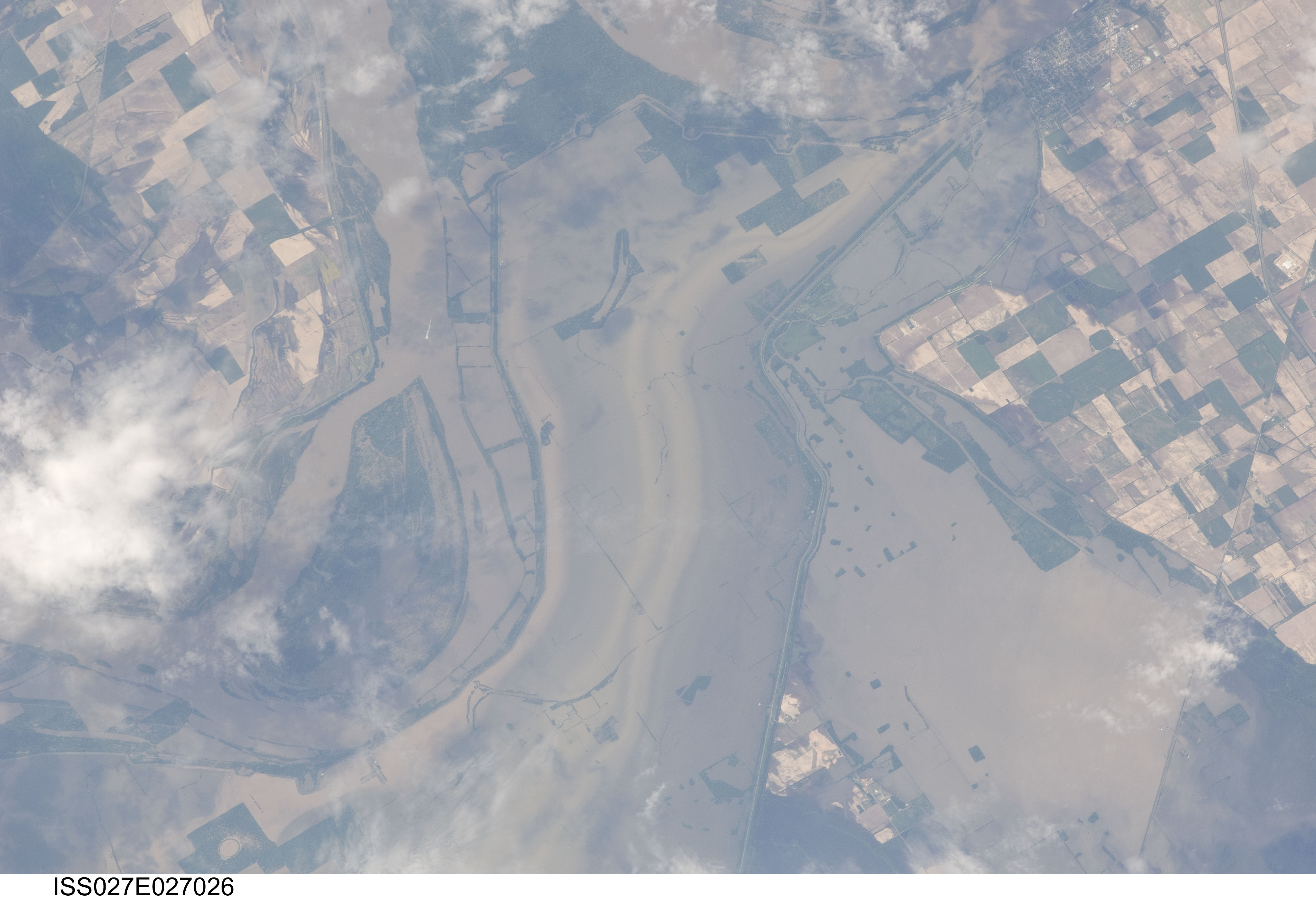
Image Caption: Flooding near New Madrid, Missouri
Note: This caption refers to the image versions labeled "NASA's Earth Observatory web site".
Along a northward loop of the Mississippi River, near the city of New Madrid, flood water rested on agricultural fields in early May 2011. Taken from an altitude of 220 miles (350 kilometers) above the Earth, this astronaut photo shows muddy water filling a broad swath of cropland north of the river bend. In this image, north is toward the lower right.
Crops normally carpet the landscape north of New Madrid. This portion of Missouri, however, lies near the Birds Point-New Madrid Floodway. On May 2, 2011, the U.S. Army Corps of Engineers breached a levee near the confluence of the Ohio and Mississippi Rivers. The move spared the residents of Cairo, Illinois, but filled the floodway.
