ISS027-E-21740
| NASA Photo ID | ISS027-E-21740 |
| Focal Length | 28mm |
| Date taken | 2011.05.03 |
| Time taken | 20:16:33 GMT |
Cloud masks available for this image:
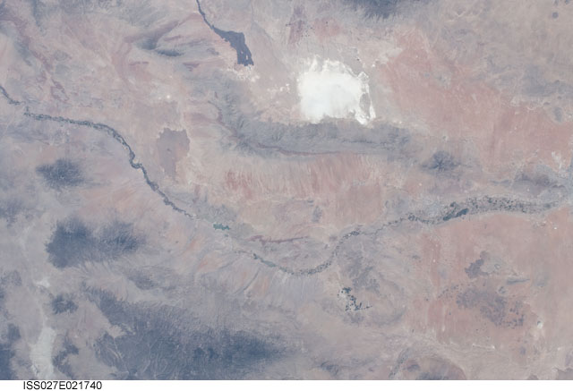
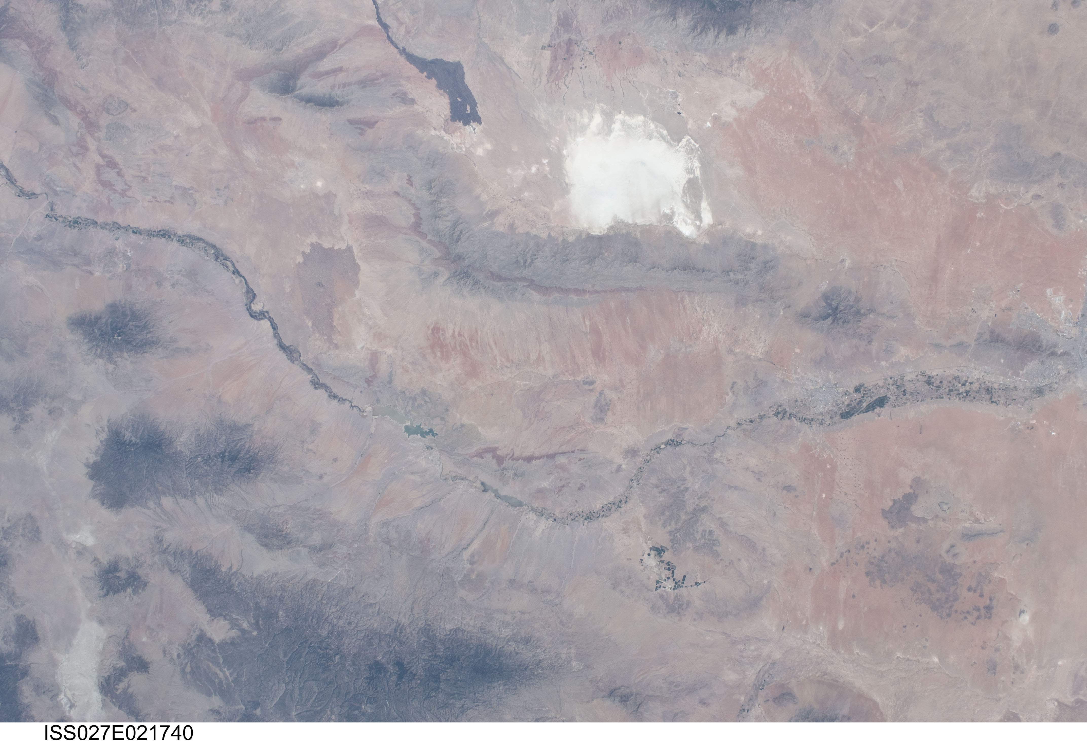
Spacecraft nadir point: 32.0° N, 107.6° W
Photo center point: 33.0° N, 107.0° W
Photo center point by machine learning:
Photo center point: 33.0° N, 107.0° W
Photo center point by machine learning:
Nadir to Photo Center: Northeast
Spacecraft Altitude: 185 nautical miles (343km)
Country or Geographic Name: | USA-NEW MEXICO |
Features: | RIO GRANDE R. V., WHITE SANDS, SAN ANDRES MTS., BLACK RA., LAS CRUCES, AGR. |
| Features Found Using Machine Learning: | |
Cloud Cover Percentage: | 10 (1-10)% |
Sun Elevation Angle: | 68° |
Sun Azimuth: | 228° |
Camera: | Nikon D2Xs Electronic Still Camera |
Focal Length: | 28mm |
Camera Tilt: | 21 degrees |
Format: | 4288E: 4288 x 2848 pixel CMOS sensor, RGBG imager color filter |
Film Exposure: | |
| Additional Information | |
| Width | Height | Annotated | Cropped | Purpose | Links |
|---|---|---|---|---|---|
| 4288 pixels | 2929 pixels | No | No | Download Image | |
| 640 pixels | 437 pixels | No | No | Download Image |
Download Packaged File
Download a Google Earth KML for this Image
View photo footprint information
Download a GeoTIFF for this photo
Image Caption: none
