ISS027-E-20129
| NASA Photo ID | ISS027-E-20129 |
| Focal Length | 80mm |
| Date taken | 2011.04.06 |
| Time taken | 05:19:21 GMT |
Resolutions offered for this image:
1000 x 665 pixels 540 x 359 pixels 720 x 480 pixels 4256 x 2913 pixels 640 x 438 pixels
1000 x 665 pixels 540 x 359 pixels 720 x 480 pixels 4256 x 2913 pixels 640 x 438 pixels
Cloud masks available for this image:
Spacecraft nadir point: 33.2° N, 72.8° W
Photo center point: 39.0° N, 76.0° W
Photo center point by machine learning:
Photo center point: 39.0° N, 76.0° W
Photo center point by machine learning:
Nadir to Photo Center: Northwest
Spacecraft Altitude: 186 nautical miles (344km)
Country or Geographic Name: | USA-MARYLAND |
Features: | EASTERN SEABOARD AT NIGHT, PHILADELPHIA, NEW YORK, BALTIMORE, WASHINGTON |
| Features Found Using Machine Learning: | |
Cloud Cover Percentage: | 10 (1-10)% |
Sun Elevation Angle: | -50° |
Sun Azimuth: | 10° |
Camera: | Nikon D3S Electronic Still Camera |
Focal Length: | 80mm |
Camera Tilt: | High Oblique |
Format: | 4256E: 4256 x 2832 pixel CMOS sensor, 36.0mm x 23.9mm, total pixels: 12.87 million, Nikon FX format |
Film Exposure: | |
| Additional Information | |
| Width | Height | Annotated | Cropped | Purpose | Links |
|---|---|---|---|---|---|
| 1000 pixels | 665 pixels | No | Yes | Earth From Space collection | Download Image |
| 540 pixels | 359 pixels | Yes | Yes | Earth From Space collection | Download Image |
| 720 pixels | 480 pixels | Yes | Yes | NASA's Earth Observatory web site | Download Image |
| 4256 pixels | 2913 pixels | No | No | Download Image | |
| 640 pixels | 438 pixels | No | No | Download Image |
Download Packaged File
Download a Google Earth KML for this Image
View photo footprint information
Download a GeoTIFF for this photo
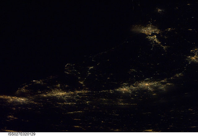
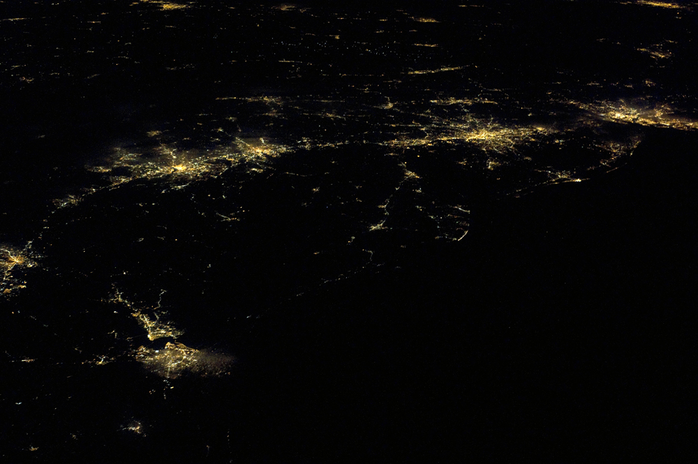
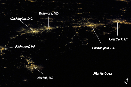
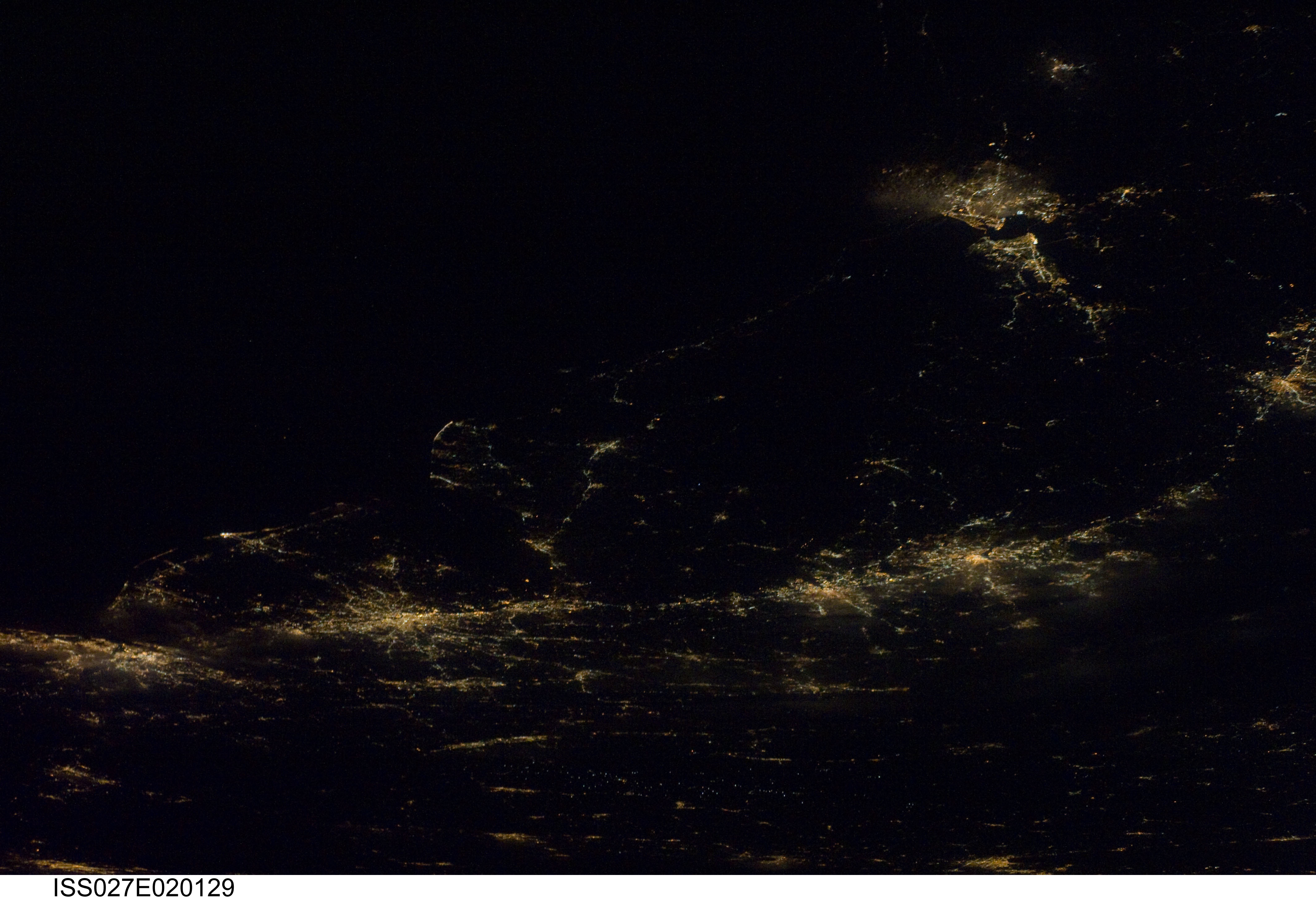
Image Caption: Atlantic Seaboard Conurbation at Night, United States of America
Note: This caption refers to the image versions labeled "NASA's Earth Observatory web site".
As regional metropolitan areas expand in both physical area and population, they typically aggregate to form economically, politically, and to some extent socially linked entities known as conurbations - the term "megalopolis" has also been used. One of the largest conurbations in the world is located along the eastern coastline of the United States, and has been termed the Atlantic Seaboard Conurbation (ASC). The ASC extends over 1000 kilometers and includes the major economic, governmental, and cultural centers of Boston, MA; New York, NY; Philadelphia, PA; Baltimore, MD; and Washington, D.C.
This astronaut photograph includes every metropolitan area in the ASC except for Boston, MA (located off the image to the northeast of New York, NY). The image was taken during local night, which highlights the position and extent of each metropolitan area along the eastern seaboard by their urban lighting patterns. The establishment and growth of the conurbation was facilitated by transportation networks (railroads, highways, and air travel routes) for transfer of goods, materials, and population between the metropolitan areas.
Two other large metropolitan areas are visible in the image - Norfolk, VA and Richmond, VA at image lower left - but these are not considered to be part of the ASC. In contrast to the city lights that mark metropolitan areas and smaller communities along the sea coast and interior, the Atlantic Ocean appears as a featureless dark region occupying the lower right quarter of the image.
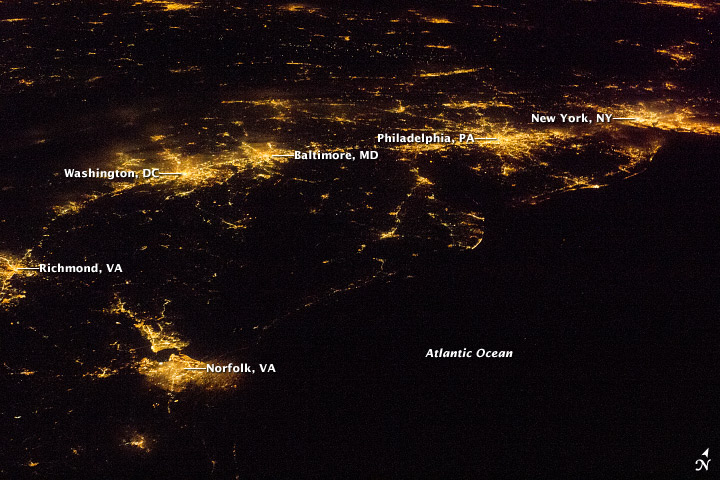
