ISS027-E-14244

| NASA Photo ID | ISS027-E-14244 |
| Focal Length | 400mm |
| Date taken | 2011.04.19 |
| Time taken | 13:12:17 GMT |
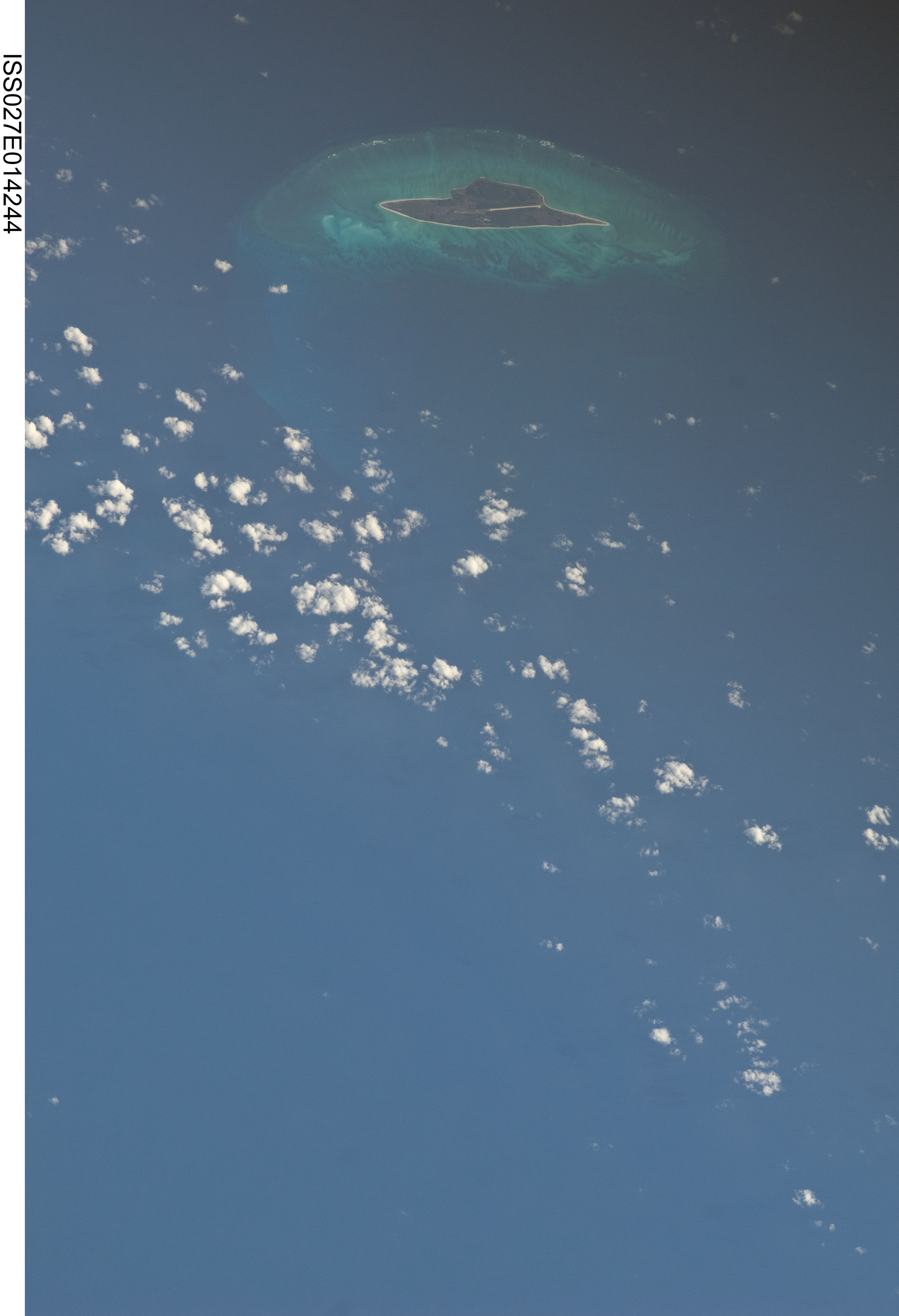

Spacecraft nadir point: 13.7° S, 45.5° E
Photo center point: 16.8° S, 42.8° E
Photo center point by machine learning:
Photo center point: 16.8° S, 42.8° E
Photo center point by machine learning:
Nadir to Photo Center: Southwest
Spacecraft Altitude: 190 nautical miles (352km)
Country or Geographic Name: | MOZAMBIQUE CHANNEL |
Features: | JUAN DE NOVA ISLAND AND REEF |
| Features Found Using Machine Learning: | |
Cloud Cover Percentage: | 10 (1-10)% |
Sun Elevation Angle: | 22° |
Sun Azimuth: | 288° |
Camera: | Nikon D2Xs Electronic Still Camera |
Focal Length: | 400mm |
Camera Tilt: | 52 degrees |
Format: | 4288E: 4288 x 2848 pixel CMOS sensor, RGBG imager color filter |
Film Exposure: | |
| Additional Information | |
| Width | Height | Annotated | Cropped | Purpose | Links |
|---|---|---|---|---|---|
| 2929 pixels | 4288 pixels | No | No | Download Image | |
| 437 pixels | 640 pixels | No | No | Download Image |
Download Packaged File
Download a Google Earth KML for this Image
View photo footprint information
Download a GeoTIFF for this photo
Image Caption: none
