ISS026-E-20611

| NASA Photo ID | ISS026-E-20611 |
| Focal Length | 200mm |
| Date taken | 2011.01.26 |
| Time taken | 10:31:47 GMT |
Cloud masks available for this image:
Spacecraft nadir point: 30.2° N, 88.4° W
Photo center point: 30.1° N, 90.0° W
Photo center point by machine learning: 30.06° N, 90.08° W
Photo center point: 30.1° N, 90.0° W
Photo center point by machine learning: 30.06° N, 90.08° W
Nadir to Photo Center: West
Spacecraft Altitude: 190 nautical miles (352km)

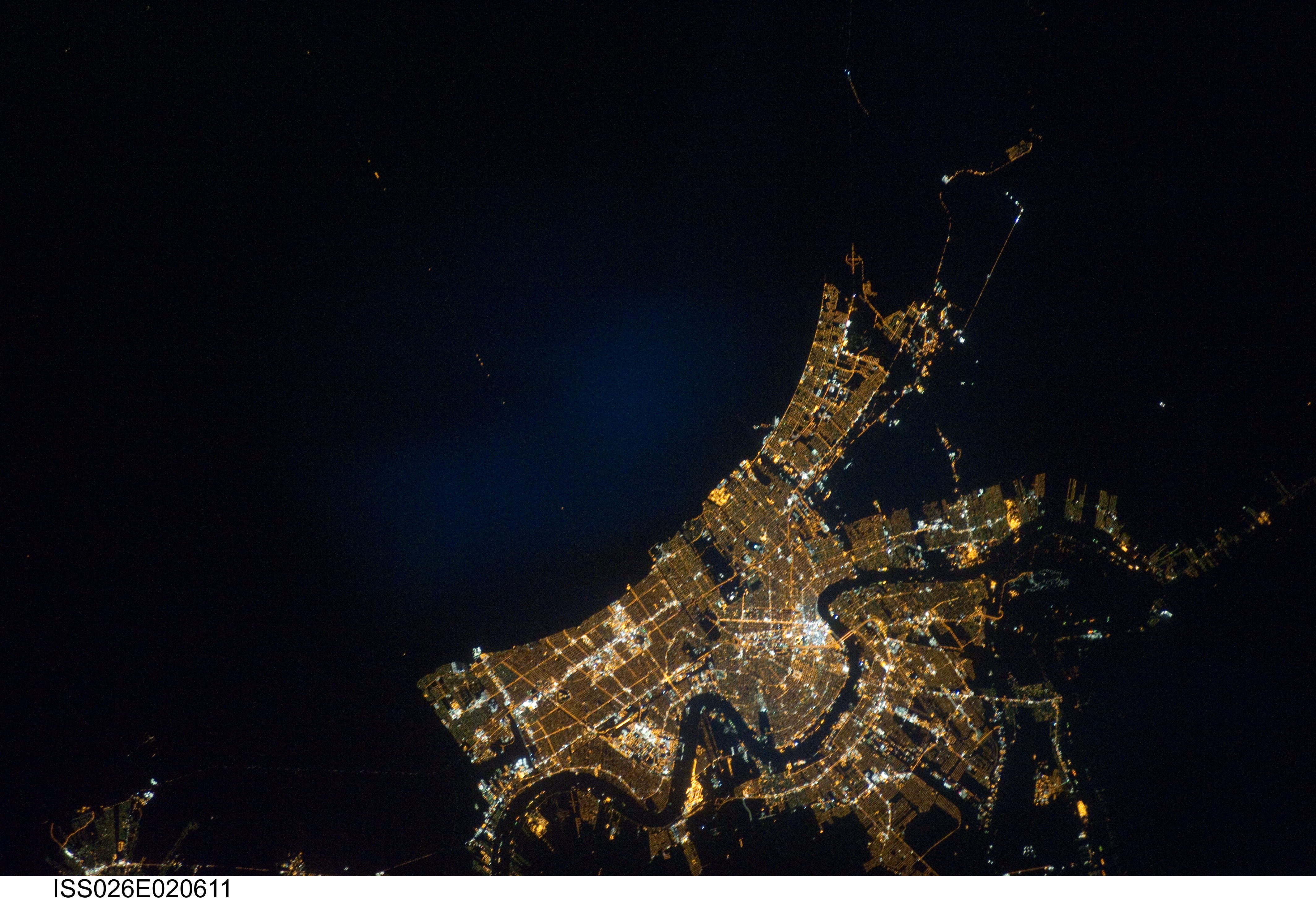
Country or Geographic Name: | USA-LOUISIANA |
Features: | NEW ORLEANS AREA AT NIGHT |
| Features Found Using Machine Learning: | |
Cloud Cover Percentage: | 0 (no clouds present) |
Sun Elevation Angle: | -29° |
Sun Azimuth: | 96° |
Camera: | Nikon D3S Electronic Still Camera |
Focal Length: | 200mm |
Camera Tilt: | 27 degrees |
Format: | 4256E: 4256 x 2832 pixel CMOS sensor, 36.0mm x 23.9mm, total pixels: 12.87 million, Nikon FX format |
Film Exposure: | |
| Additional Information | |
| Width | Height | Annotated | Cropped | Purpose | Links |
|---|---|---|---|---|---|
| 4256 pixels | 2913 pixels | No | No | Download Image | |
| 640 pixels | 438 pixels | No | No | Download Image |
Download Packaged File
Download a Google Earth KML for this Image
View photo footprint information
Download a GeoTIFF for this photo
Image Caption: ISS026-E-020611 (26 Jan. 2011) --- From approximately 220 miles above Earth, one of the
Expedition 26 crew members aboard the Earth-orbiting International Space Station recorded this night time image of the greater New Orleans area. A 200-mm focal length was utilized to capture the image.
Expedition 26 crew members aboard the Earth-orbiting International Space Station recorded this night time image of the greater New Orleans area. A 200-mm focal length was utilized to capture the image.
