ISS025-E-9840

| NASA Photo ID | ISS025-E-9840 |
| Focal Length | 16mm |
| Date taken | 2010.10.28 |
| Time taken | 23:35:11 GMT |
Cloud masks available for this image:
Spacecraft nadir point: 32.7° N, 24.7° E
Photo center point: 39.5° N, 17.0° E
Photo center point by machine learning:
Photo center point: 39.5° N, 17.0° E
Photo center point by machine learning:
Nadir to Photo Center: Northwest
Spacecraft Altitude: 185 nautical miles (343km)
Camera: | Nikon D3S Electronic Still Camera |
Focal Length: | 16mm |
Camera Tilt: | High Oblique |
Format: | 4256E: 4256 x 2832 pixel CMOS sensor, 36.0mm x 23.9mm, total pixels: 12.87 million, Nikon FX format |
Film Exposure: | |
| Additional Information | |
| Width | Height | Annotated | Cropped | Purpose | Links |
|---|---|---|---|---|---|
| 4256 pixels | 2913 pixels | No | No | Download Image | |
| 640 pixels | 438 pixels | No | No | Download Image |
Download Packaged File
Download a Google Earth KML for this Image
View photo footprint information
Download a GeoTIFF for this photo
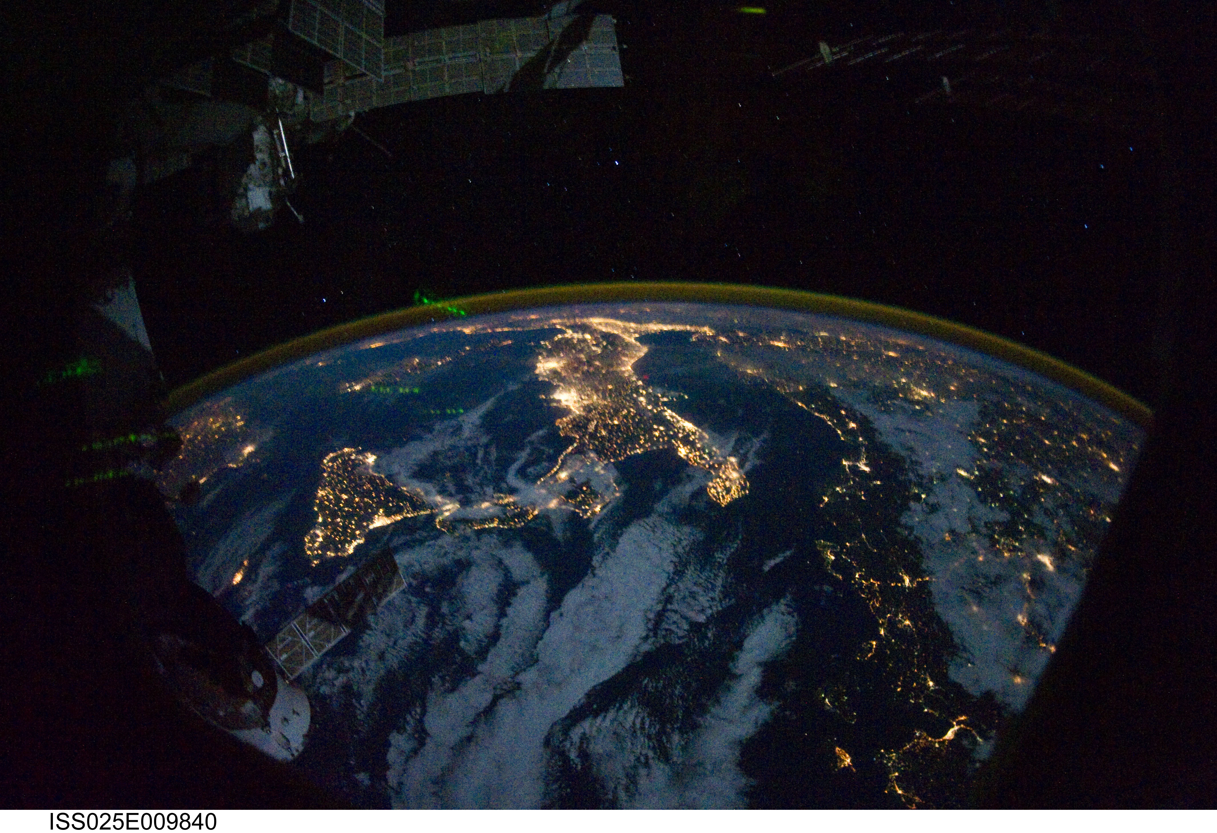
Image Caption: ISS025-E-009840 (28 Oct. 2010) --- Parts of Europe and Africa are very easily recognizable in this night time image shot by one of the Expedition 25 crew members aboard the International Space Station flying 220 miles above Earth on Oct. 28. The view "looks" northward over Sicily and the "boot" of Italy, with the Mediterranean Sea representing most of the visible water in the view and the Adriatic Sea to the right of center. Tunisia is partially visible at left. Part of a docked Russian spacecraft and other components of the ISS are in the foreground.
