ISS025-E-6163
| NASA Photo ID | ISS025-E-6163 |
| Focal Length | 180mm |
| Date taken | 2010.10.06 |
| Time taken | 17:50:30 GMT |
Resolutions offered for this image:
1000 x 705 pixels 540 x 381 pixels 720 x 480 pixels 4288 x 2929 pixels 640 x 437 pixels
1000 x 705 pixels 540 x 381 pixels 720 x 480 pixels 4288 x 2929 pixels 640 x 437 pixels


Cloud masks available for this image:
Spacecraft nadir point: 13.6° S, 72.0° W
Photo center point: 15.5° S, 72.6° W
Photo center point by machine learning:
Photo center point: 15.5° S, 72.6° W
Photo center point by machine learning:
Nadir to Photo Center: South
Spacecraft Altitude: 194 nautical miles (359km)
Country or Geographic Name: | PERU |
Features: | COROPUNA VOLCANO, LAVA FLOWS, GLACIERS |
| Features Found Using Machine Learning: | |
Cloud Cover Percentage: | 10 (1-10)% |
Sun Elevation Angle: | 70° |
Sun Azimuth: | 293° |
Camera: | Nikon D2Xs Electronic Still Camera |
Focal Length: | 180mm |
Camera Tilt: | 32 degrees |
Format: | 4288E: 4288 x 2848 pixel CMOS sensor, RGBG imager color filter |
Film Exposure: | |
| Additional Information | |
| Width | Height | Annotated | Cropped | Purpose | Links |
|---|---|---|---|---|---|
| 1000 pixels | 705 pixels | No | Yes | Earth From Space collection | Download Image |
| 540 pixels | 381 pixels | Yes | Yes | Earth From Space collection | Download Image |
| 720 pixels | 480 pixels | Yes | Yes | NASA's Earth Observatory web site | Download Image |
| 4288 pixels | 2929 pixels | No | No | Download Image | |
| 640 pixels | 437 pixels | No | No | Download Image |
Download Packaged File
Download a Google Earth KML for this Image
View photo footprint information
Download a GeoTIFF for this photo
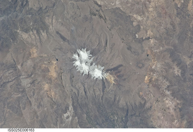
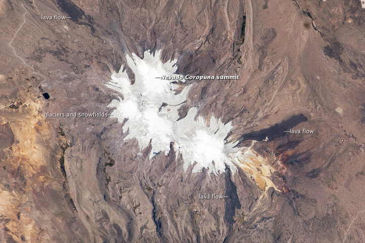
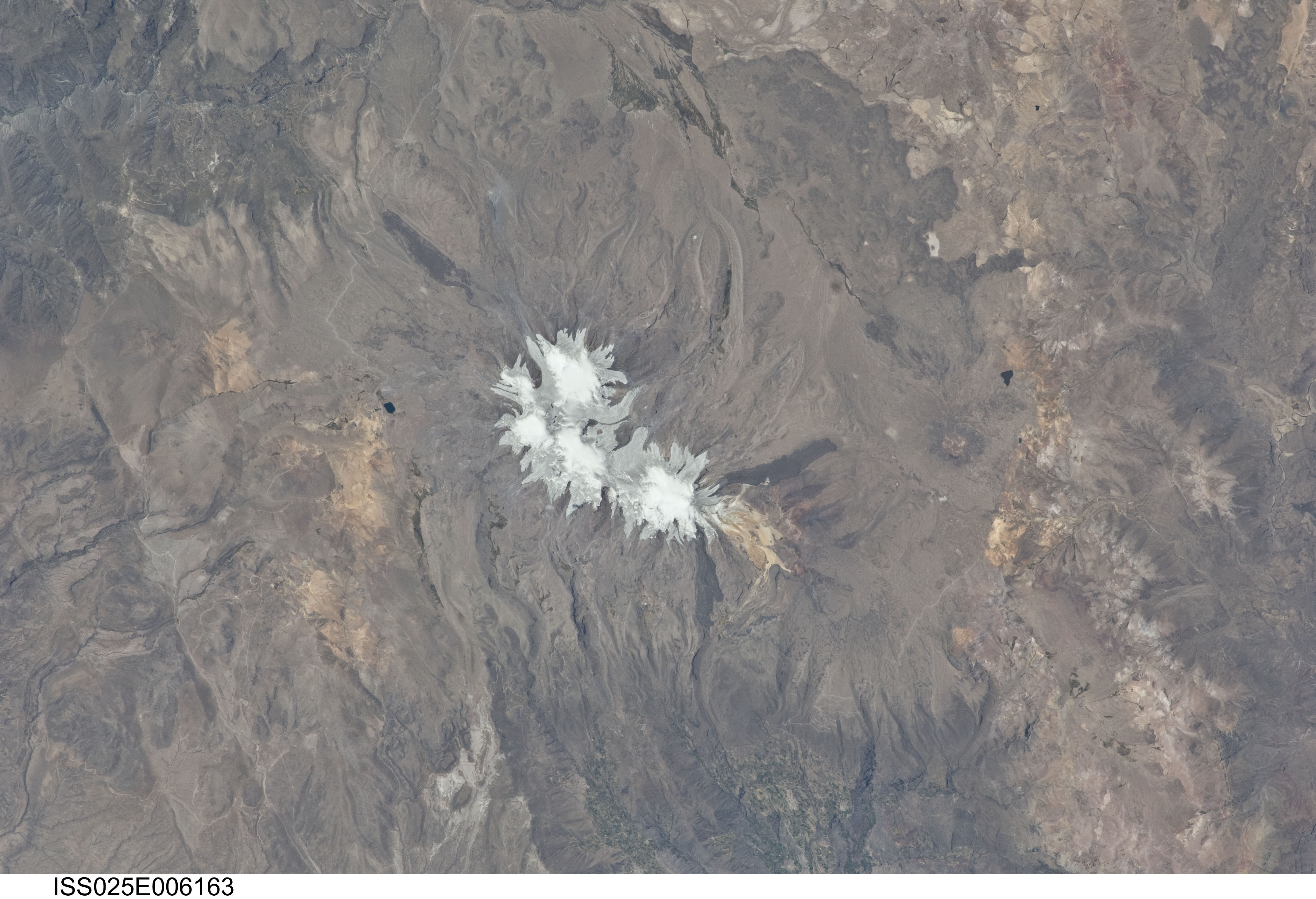
Image Caption: Nevado Coropuna, Peru
Nevado ("snowy" or "snowy peak" in Spanish) Coropuna is the highest volcanic peak in Peru; the summit elevation is 6,377 meters (20,900 feet) above sea level. Rather than being a single stratovolcano, Coropuna is a complex of numerous summit cones. The complex covers an area of 240 square kilometers (92.6 square miles) within the Ampato mountain range (Cordillera Ampato) in southeast-central Peru. While the exact date of the volcano's last eruption is not known, lava flows along the northern, southern, and western flanks are thought to have been placed during the early Holocene Epoch--the current geologic time, which began approximately 12,000 years ago.
Coropuna also hosts several summit glaciers and ice fields that contrast sharply with the dark rock outcrops and surface deposits at lower elevations. Glacial deposits and lateral moraines on the flanks of Coropuna indicate that glaciers once extended to much lower elevations than observed today. Careful mapping and surface exposure age-dating of these deposits and landforms provides data on the timing of ice advances and retreats in the tropics near the end of the Pleistocene Epoch (extending from about 2.5 million to 12,000 years ago). This information can be compared with other paleoclimate records to obtain a better understanding of how Earth's climate has changed over geologic time.
