ISS024-E-8396
| NASA Photo ID | ISS024-E-8396 |
| Focal Length | 400mm |
| Date taken | 2010.07.15 |
| Time taken | 14:07:40 GMT |
Resolutions offered for this image:
658 x 1000 pixels 355 x 540 pixels 720 x 960 pixels 4288 x 2929 pixels 640 x 437 pixels
658 x 1000 pixels 355 x 540 pixels 720 x 960 pixels 4288 x 2929 pixels 640 x 437 pixels

Cloud masks available for this image:
Spacecraft nadir point: 15.7° S, 72.8° W
Photo center point: 15.8° S, 71.8° W
Photo center point by machine learning:
Photo center point: 15.8° S, 71.8° W
Photo center point by machine learning:
Nadir to Photo Center: East
Spacecraft Altitude: 192 nautical miles (356km)
Country or Geographic Name: | PERU |
Features: | SABANCAYA VOLCANO, LAVA FLOWS, AMPATO VOLCANO, HUALCA HUALCA VOLCANO |
| Features Found Using Machine Learning: | |
Cloud Cover Percentage: | 10 (1-10)% |
Sun Elevation Angle: | 34° |
Sun Azimuth: | 49° |
Camera: | Nikon D2Xs Electronic Still Camera |
Focal Length: | 400mm |
Camera Tilt: | 17 degrees |
Format: | 4288E: 4288 x 2848 pixel CMOS sensor, RGBG imager color filter |
Film Exposure: | |
| Additional Information | |
| Width | Height | Annotated | Cropped | Purpose | Links |
|---|---|---|---|---|---|
| 658 pixels | 1000 pixels | No | Yes | Earth From Space collection | Download Image |
| 355 pixels | 540 pixels | Yes | Yes | Earth From Space collection | Download Image |
| 720 pixels | 960 pixels | Yes | Yes | NASA's Earth Observatory web site | Download Image |
| 4288 pixels | 2929 pixels | No | No | Download Image | |
| 640 pixels | 437 pixels | No | No | Download Image |
Download Packaged File
Download a Google Earth KML for this Image
View photo footprint information
Download a GeoTIFF for this photo
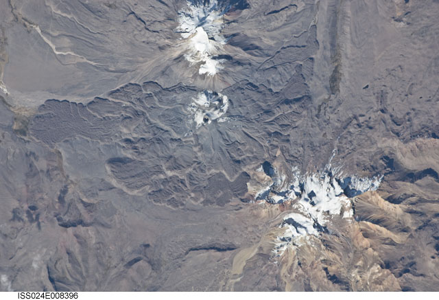
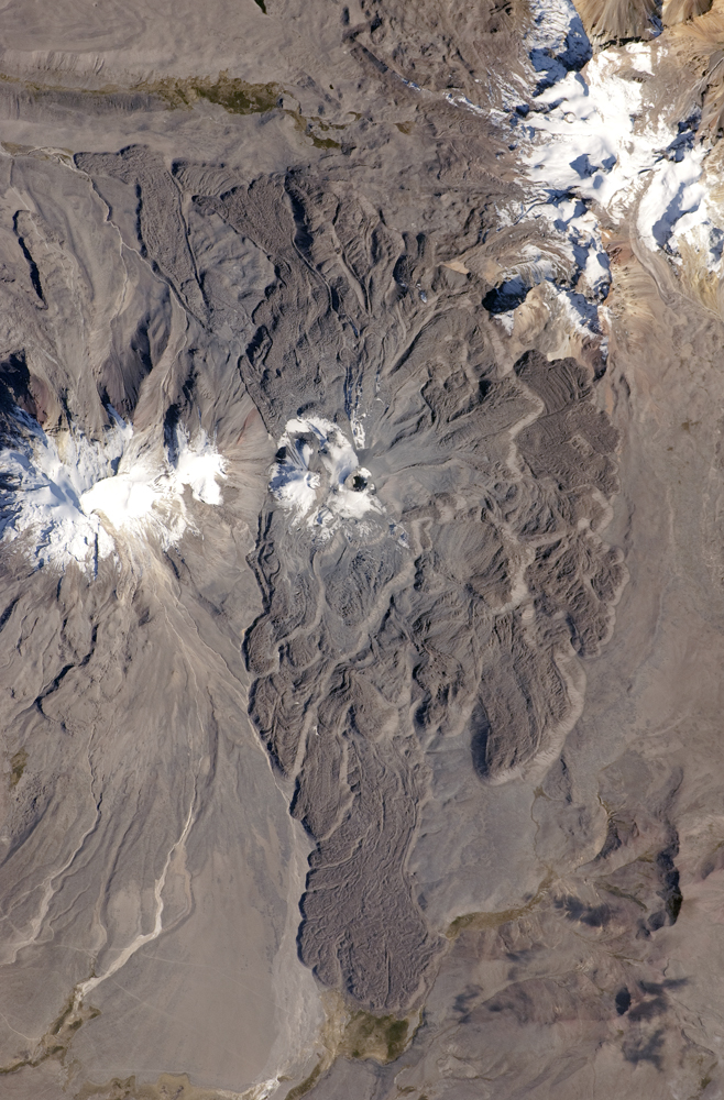
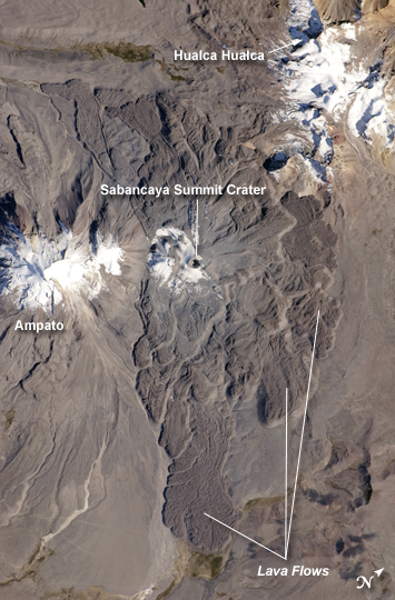
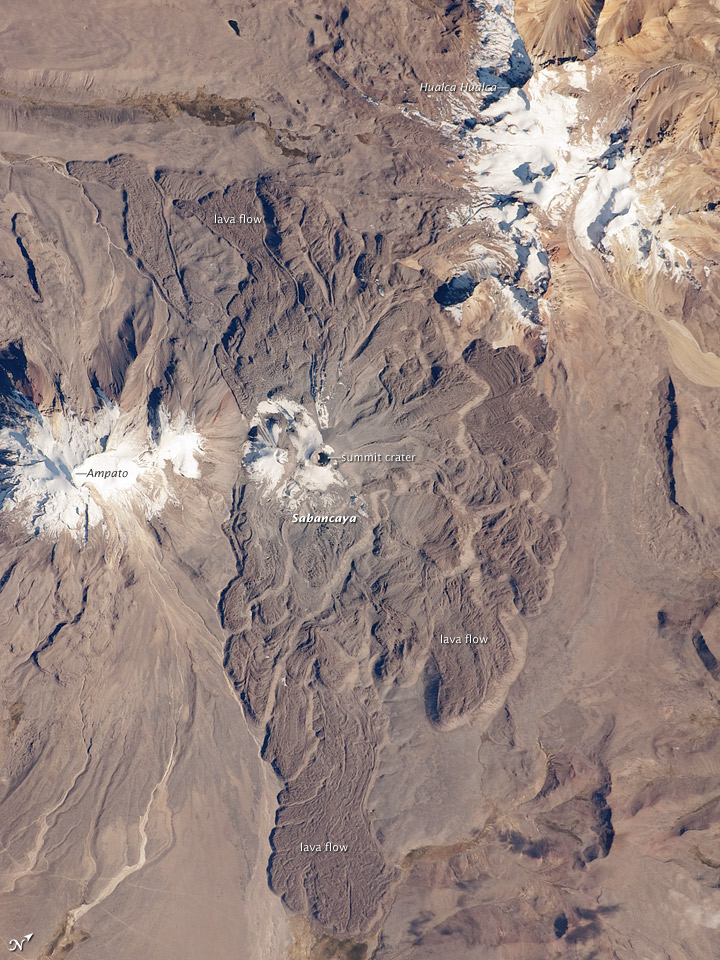
Image Caption: Sabancaya Volcano, Peru
The 5,967-meter- (19,577-foot-) high Sabancaya stratovolcano (Nevado Sabancaya in the local language) is located in southern Peru, approximately 70 kilometers (40 miles) northwest of the city of Arequipa. The name Sabancaya means "tongue of fire" in the Quechua Indian language.
Sabancaya is part of a volcanic complex that includes two other nearby (and older) volcanoes, neither of which has been active historically. In this detailed astronaut photograph, Nevado Ampato is visible to the south (image left), and the lower flanks of Nevado Hualca Hualca are visible to the north (image top right). The snowy peaks of the three volcanoes provide a stark contrast to the surrounding desert of the Puna Plateau.
Sabancaya's first historical record of an eruption dates to 1750. The most recent eruptive activity at the volcano occurred in July 2003, and it deposited ash on the volcano's summit and northeastern flank. Volcanism at Sabancaya is fueled by magma generated at the subduction zone between the Nazca and South American tectonic plates.
Magma can erupt to the surface and form lava flows through the volcano's summit (frequently forming a crater), but it can also erupt from lava domes and flank vents along the volcano's sides. Lava has issued from all of these points at Sabancaya, forming numerous gray to dark brown scalloped lobes that extend in all directions except southwards (image center).
