ISS024-E-14580
| NASA Photo ID | ISS024-E-14580 |
| Focal Length | 50mm |
| Date taken | 2010.09.14 |
| Time taken | 13:56:33 GMT |
Resolutions offered for this image:
1000 x 663 pixels 540 x 358 pixels 720 x 480 pixels 4288 x 2929 pixels 640 x 437 pixels
1000 x 663 pixels 540 x 358 pixels 720 x 480 pixels 4288 x 2929 pixels 640 x 437 pixels


Cloud masks available for this image:
Spacecraft nadir point: 16.5° N, 55.8° W
Photo center point: 18.5° N, 52.5° W
Photo center point by machine learning:
Photo center point: 18.5° N, 52.5° W
Photo center point by machine learning:
Nadir to Photo Center: Northeast
Spacecraft Altitude: 187 nautical miles (346km)
Country or Geographic Name: | ATLANTIC OCEAN |
Features: | HURRICANE IGOR, EYE STRUCTURE, SPIRAL BANDS |
| Features Found Using Machine Learning: | |
Cloud Cover Percentage: | 100 (76-100)% |
Sun Elevation Angle: | 62° |
Sun Azimuth: | 115° |
Camera: | Nikon D2Xs Electronic Still Camera |
Focal Length: | 50mm |
Camera Tilt: | 51 degrees |
Format: | 4288E: 4288 x 2848 pixel CMOS sensor, RGBG imager color filter |
Film Exposure: | |
| Additional Information | |
| Width | Height | Annotated | Cropped | Purpose | Links |
|---|---|---|---|---|---|
| 1000 pixels | 663 pixels | No | Yes | Earth From Space collection | Download Image |
| 540 pixels | 358 pixels | No | Yes | Earth From Space collection | Download Image |
| 720 pixels | 480 pixels | No | No | NASA's Earth Observatory web site | Download Image |
| 4288 pixels | 2929 pixels | No | No | Download Image | |
| 640 pixels | 437 pixels | No | No | Download Image |
Download Packaged File
Download a Google Earth KML for this Image
View photo footprint information
Download a GeoTIFF for this photo
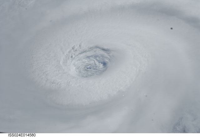
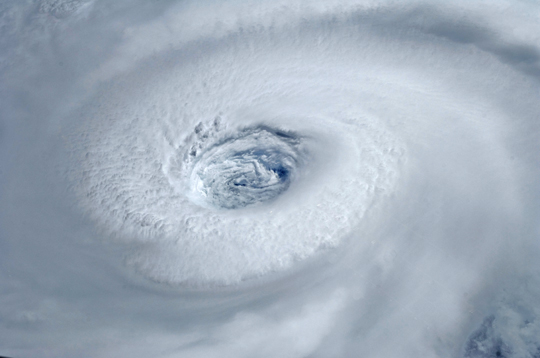
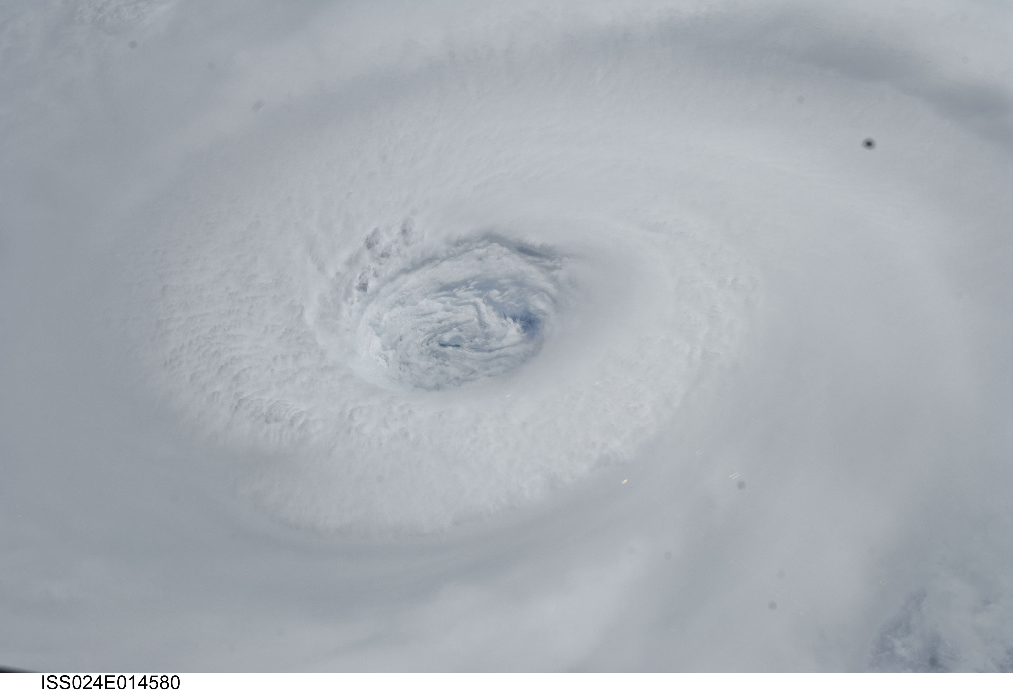
Image Caption: Hurricane Igor from the Space Station
Astronauts aboard the International Space Station took this digital photograph of the eye of Hurricane Igor at 10:56 Atlantic Daylight Time (13:56 UTC) on September 14, 2010. The storm was a category four hurricane on the Saffir-Simpson scale of intensity.
At the time of the image, Igor was centered in the Atlantic Ocean near 18deg N 52deg W and slowly moving west-northwest at 11 kilometers (7 miles) per hour, according to the U.S. National Hurricane Center. Maximum sustained winds of 213 km (132 mi.) per hour, with gusts to 259 km (161 mi.) per hour.
