ISS023-E-51494
| NASA Photo ID | ISS023-E-51494 |
| Focal Length | 800mm |
| Date taken | 2010.05.23 |
| Time taken | 13:18:47 GMT |
Cloud masks available for this image:
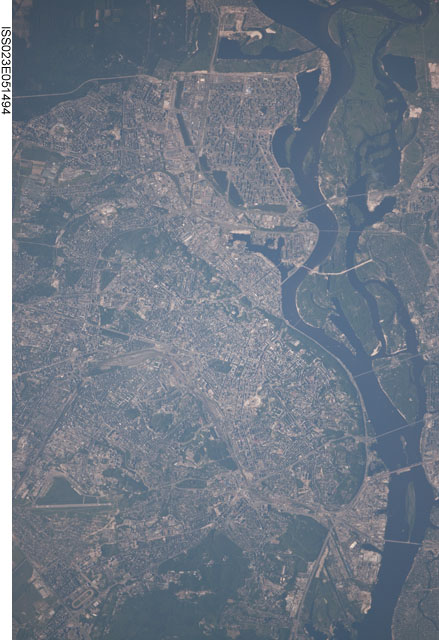
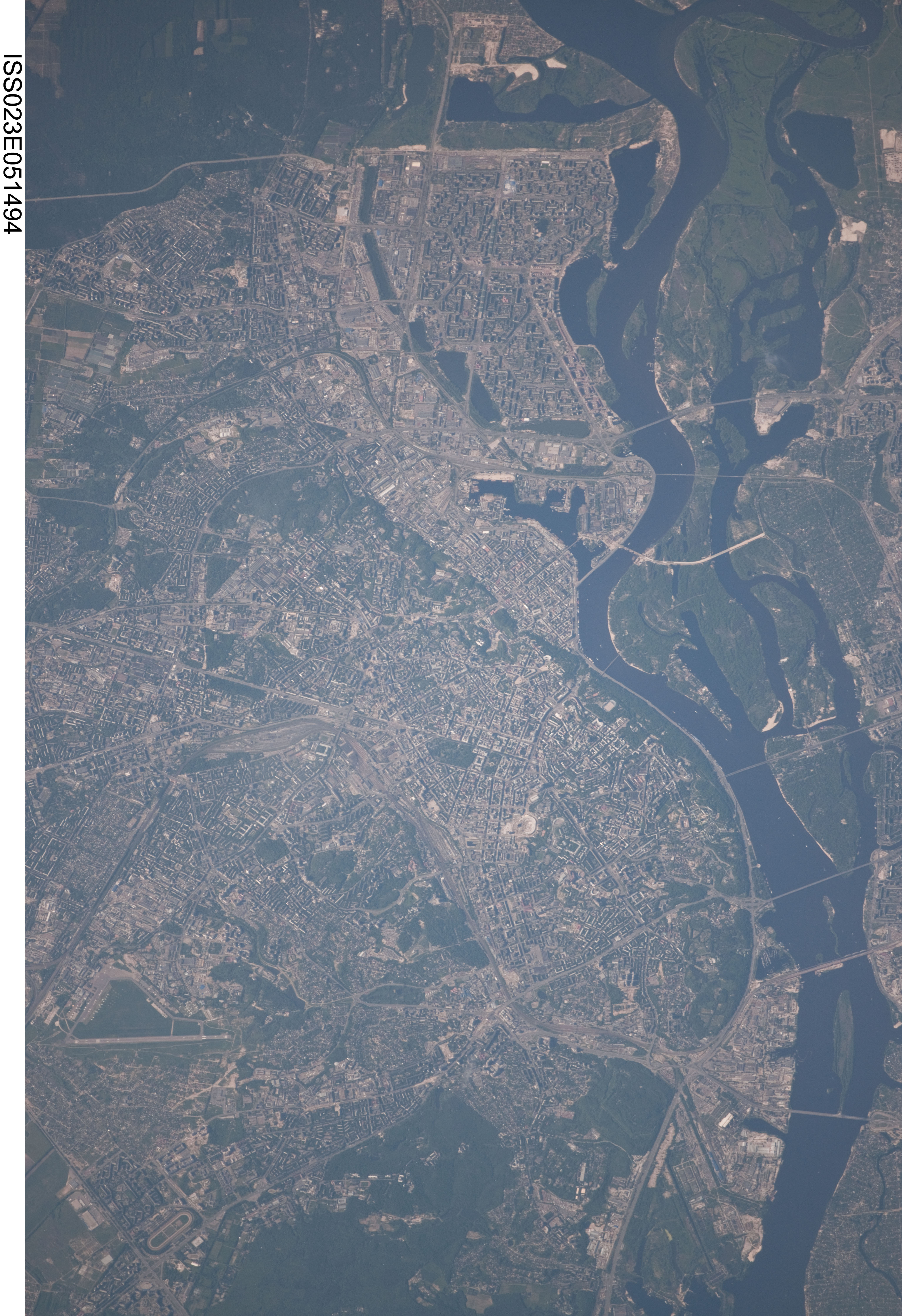
Spacecraft nadir point: 48.6° N, 33.1° E
Photo center point: 50.5° N, 30.5° E
Photo center point by machine learning:
Photo center point: 50.5° N, 30.5° E
Photo center point by machine learning:
Nadir to Photo Center: Northwest
Spacecraft Altitude: 186 nautical miles (344km)
Country or Geographic Name: | UKRAINE |
Features: | KYIV, DNIEPER RIVER, AIRPORT |
| Features Found Using Machine Learning: | |
Cloud Cover Percentage: | 10 (1-10)% |
Sun Elevation Angle: | 39° |
Sun Azimuth: | 257° |
Camera: | Nikon D3X Electronic Still Camera |
Focal Length: | 800mm |
Camera Tilt: | 46 degrees |
Format: | 6048E: 6048 x 4032 pixel CMOS sensor, 35.9mm x 24.0mm, total pixels: 25.72 million, Nikon FX format |
Film Exposure: | |
| Additional Information | |
| Width | Height | Annotated | Cropped | Purpose | Links |
|---|---|---|---|---|---|
| 4147 pixels | 6048 pixels | No | No | Download Image | |
| 439 pixels | 640 pixels | No | No | Download Image |
Download Packaged File
Download a Google Earth KML for this Image
View photo footprint information
Download a GeoTIFF for this photo
Image Caption: none
