ISS020-E-9861
| NASA Photo ID | ISS020-E-9861 |
| Focal Length | 800mm |
| Date taken | 2009.06.14 |
| Time taken | 13:48:49 GMT |
Resolutions offered for this image:
1000 x 733 pixels 540 x 396 pixels 720 x 480 pixels 4256 x 2913 pixels 640 x 438 pixels
1000 x 733 pixels 540 x 396 pixels 720 x 480 pixels 4256 x 2913 pixels 640 x 438 pixels

Cloud masks available for this image:
Spacecraft nadir point: 39.3° N, 109.7° W
Photo center point: 37.7° N, 111.0° W
Photo center point by machine learning:
Photo center point: 37.7° N, 111.0° W
Photo center point by machine learning:
Nadir to Photo Center: Southwest
Spacecraft Altitude: 183 nautical miles (339km)
Country or Geographic Name: | USA-UTAH |
Features: | WATERPOCKET FOLD, BIG THOMSON MESA |
| Features Found Using Machine Learning: | |
Cloud Cover Percentage: | 10 (1-10)% |
Sun Elevation Angle: | 20° |
Sun Azimuth: | 76° |
Camera: | Nikon D3 Electronic Still Camera |
Focal Length: | 800mm |
Camera Tilt: | 34 degrees |
Format: | 4256E: 4256 x 2832 pixel CMOS sensor, 36.0mm x 23.9mm, total pixels: 12.87 million, Nikon FX format |
Film Exposure: | |
| Additional Information | |
| Width | Height | Annotated | Cropped | Purpose | Links |
|---|---|---|---|---|---|
| 1000 pixels | 733 pixels | No | Yes | Earth From Space collection | Download Image |
| 540 pixels | 396 pixels | Yes | Yes | Earth From Space collection | Download Image |
| 720 pixels | 480 pixels | Yes | Yes | NASA's Earth Observatory web site | Download Image |
| 4256 pixels | 2913 pixels | No | No | Download Image | |
| 640 pixels | 438 pixels | No | No | Download Image |
Download Packaged File
Download a Google Earth KML for this Image
View photo footprint information
Download a GeoTIFF for this photo
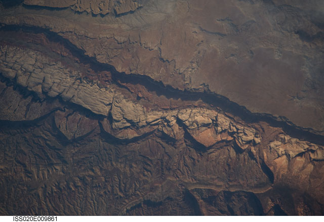
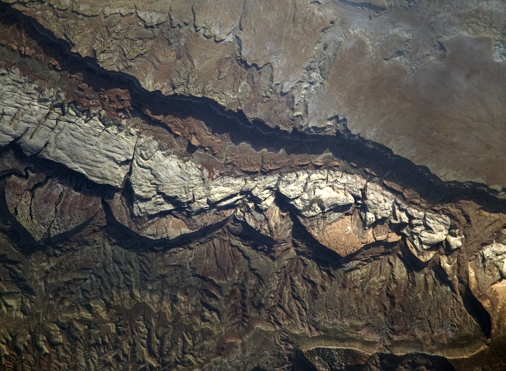
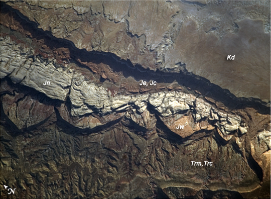
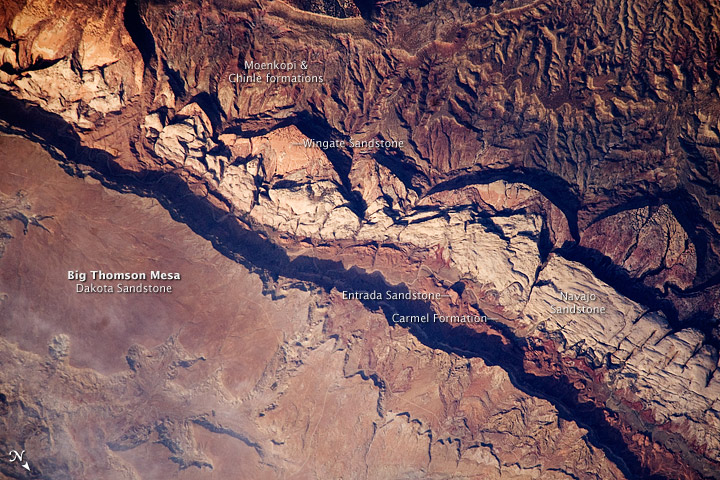
Image Caption: Big Thomson Mesa, Capitol Reef National Park, Utah
This detailed astronaut photograph depicts a portion of Big Thomson Mesa located near the southern end of Capitol Reef National Park. Capitol Reef National Park is located on the Colorado Plateau, a physiographic and geologic province that comprises the adjacent quarters of Arizona, Colorado, New Mexico, and Utah. Big Thomson Mesa (image upper right) is part of a large feature known as the Waterpocket Fold. The Fold is a geologic structure called a monocline, characterized by generally flat-laying sedimentary rock layers with a steep and highly localized flexure- much like a carpet runner draped over a stair step. Monoclines on the Colorado Plateau are thought to be the result of faulting of stratigraphically lower and more brittle crystalline rocks; while the crystalline rocks were broken into raised or lowered blocks, the overlaying, less brittle sedimentary rocks were flexed without breaking.
The portion of the Waterpocket Fold illustrated in this image includes layered rocks formed during the Mesozoic Era (~ 250 - 65 million years ago) - the oldest layers are at the bottom of the sequence (and also, in this view, the image), with each successive layer younger than the preceding one going upwards in the sequence. Not all of the units present are clearly visible, but some of the major units can be easily distinguished. The bottom half of the image includes the oldest rocks in the view: dark brown and dark green Moenkopi (Trm) and Chinle (Trc) Formations. At image center, two strikingly colored units are visible - light red to orange Wingate Sandstone (Jw)and white Navajo Sandstone (Jn). A topographic bench above these units includes reddish brown to brown Carmel Formation (Jc) and Entrada Sandstone (Je). The top of the cliff face above this bench - Big Thomson Mesa - is comprised of brown Dakota Sandstone (Kd). This sequence represents more than 100 million years of deposition. Much younger Quaternary (2.0 million to approximately 10,000 years old) deposits are also present in the view.
The area shown in this astronaut photograph is located approximately 65 kilometers to the southeast of Fruita, UT near the southern end of Capitol Reef National Park.
