ISS020-E-8750
| NASA Photo ID | ISS020-E-8750 |
| Focal Length | 800mm |
| Date taken | 2009.06.12 |
| Time taken | 22:15:55 GMT |
Cloud masks available for this image:
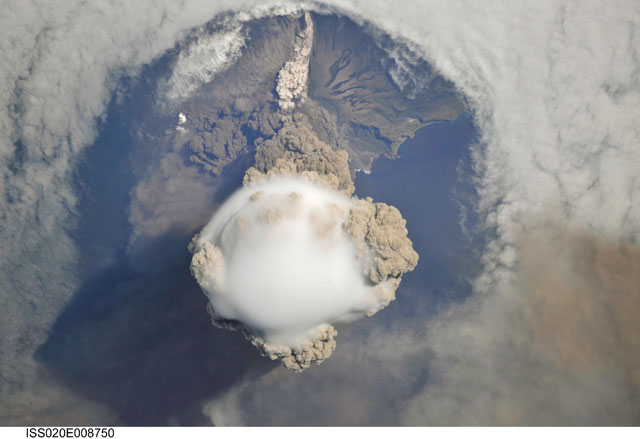
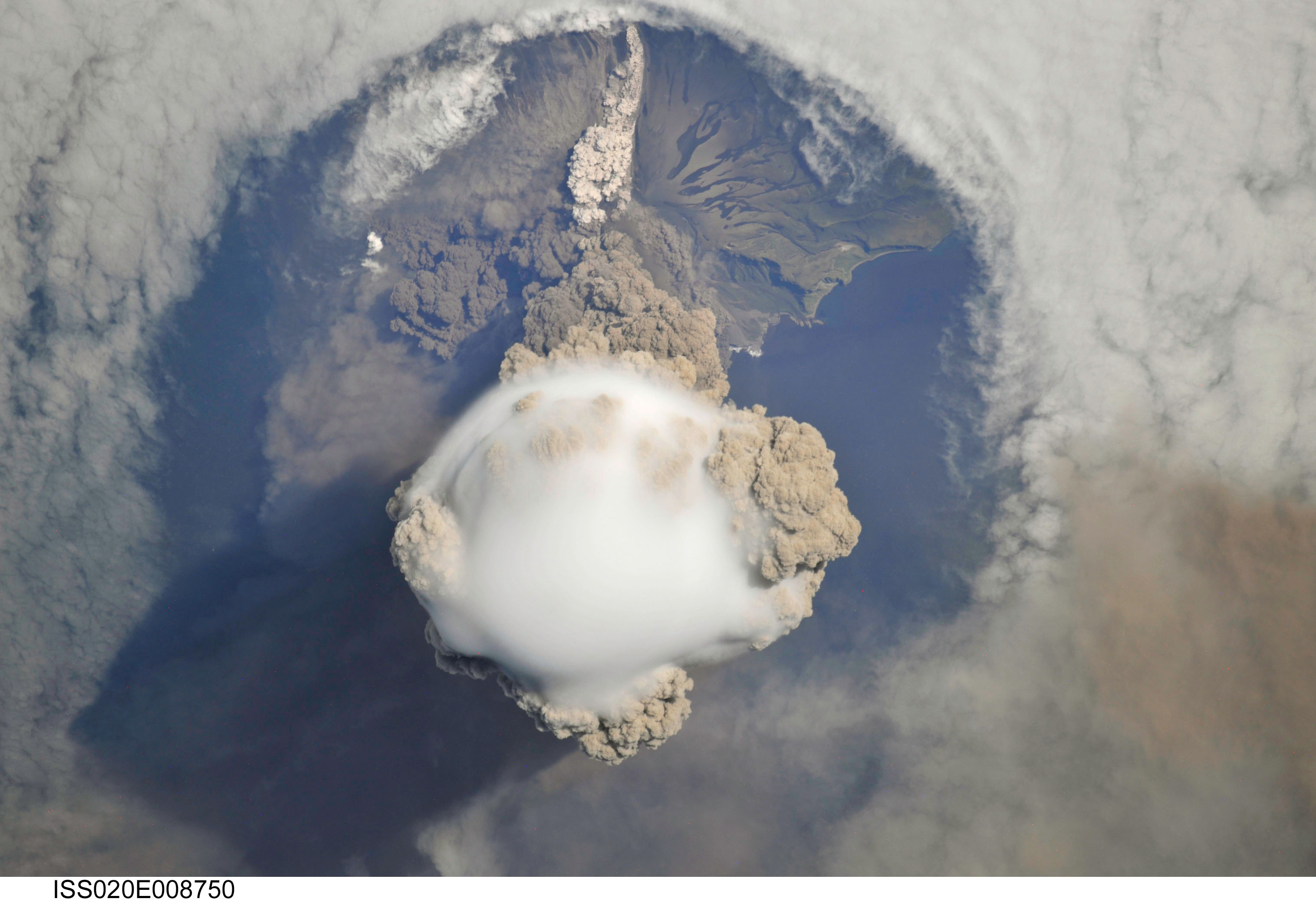
Spacecraft nadir point: 48.4° N, 155.8° E
Photo center point: 48.1° N, 153.2° E
Photo center point by machine learning:
Photo center point: 48.1° N, 153.2° E
Photo center point by machine learning:
Nadir to Photo Center: West
Spacecraft Altitude: 182 nautical miles (337km)
Country or Geographic Name: | RUSSIAN FEDERATION |
Features: | MATUA ISLAND, VOLCANIC PLUME, ASH CLOUD |
| Features Found Using Machine Learning: | |
Cloud Cover Percentage: | 100 (76-100)% |
Sun Elevation Angle: | 43° |
Sun Azimuth: | 104° |
Camera: | Nikon D3X Electronic Still Camera |
Focal Length: | 800mm |
Camera Tilt: | 41 degrees |
Format: | 6048E: 6048 x 4032 pixel CMOS sensor, 35.9mm x 24.0mm, total pixels: 25.72 million, Nikon FX format |
Film Exposure: | |
| Additional Information | |
| Width | Height | Annotated | Cropped | Purpose | Links |
|---|---|---|---|---|---|
| 3032 pixels | 2079 pixels | No | No | Download Image | |
| 640 pixels | 439 pixels | No | No | Download Image |
Download Packaged File
Download a Google Earth KML for this Image
View photo footprint information
Download a GeoTIFF for this photo
Image Caption: none
