ISS020-E-28123

| NASA Photo ID | ISS020-E-28123 |
| Focal Length | 800mm |
| Date taken | 2009.08.05 |
| Time taken | 23:09:29 GMT |
Resolutions offered for this image:
1000 x 660 pixels 540 x 356 pixels 720 x 480 pixels 4256 x 2913 pixels 640 x 438 pixels
1000 x 660 pixels 540 x 356 pixels 720 x 480 pixels 4256 x 2913 pixels 640 x 438 pixels

Cloud masks available for this image:
Spacecraft nadir point: 44.2° N, 120.8° W
Photo center point: 45.4° N, 121.7° W
Photo center point by machine learning:
Photo center point: 45.4° N, 121.7° W
Photo center point by machine learning:
Nadir to Photo Center: Northwest
Spacecraft Altitude: 188 nautical miles (348km)
Country or Geographic Name: | USA-OREGON |
Features: | MOUNT HOOD, WHITE RIVER, GOVERMENT CAMP |
| Features Found Using Machine Learning: | |
Cloud Cover Percentage: | 10 (1-10)% |
Sun Elevation Angle: | 43° |
Sun Azimuth: | 249° |
Camera: | Nikon D3 Electronic Still Camera |
Focal Length: | 800mm |
Camera Tilt: | 26 degrees |
Format: | 4256E: 4256 x 2832 pixel CMOS sensor, 36.0mm x 23.9mm, total pixels: 12.87 million, Nikon FX format |
Film Exposure: | |
| Additional Information | |
| Width | Height | Annotated | Cropped | Purpose | Links |
|---|---|---|---|---|---|
| 1000 pixels | 660 pixels | No | Yes | Earth From Space collection | Download Image |
| 540 pixels | 356 pixels | Yes | Yes | Earth From Space collection | Download Image |
| 720 pixels | 480 pixels | Yes | Yes | NASA's Earth Observatory web site | Download Image |
| 4256 pixels | 2913 pixels | No | No | Download Image | |
| 640 pixels | 438 pixels | No | No | Download Image |
Download Packaged File
Download a Google Earth KML for this Image
View photo footprint information
Download a GeoTIFF for this photo
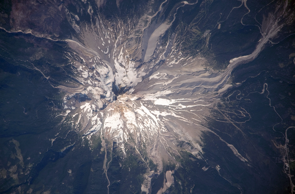
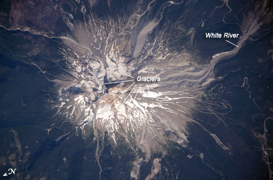
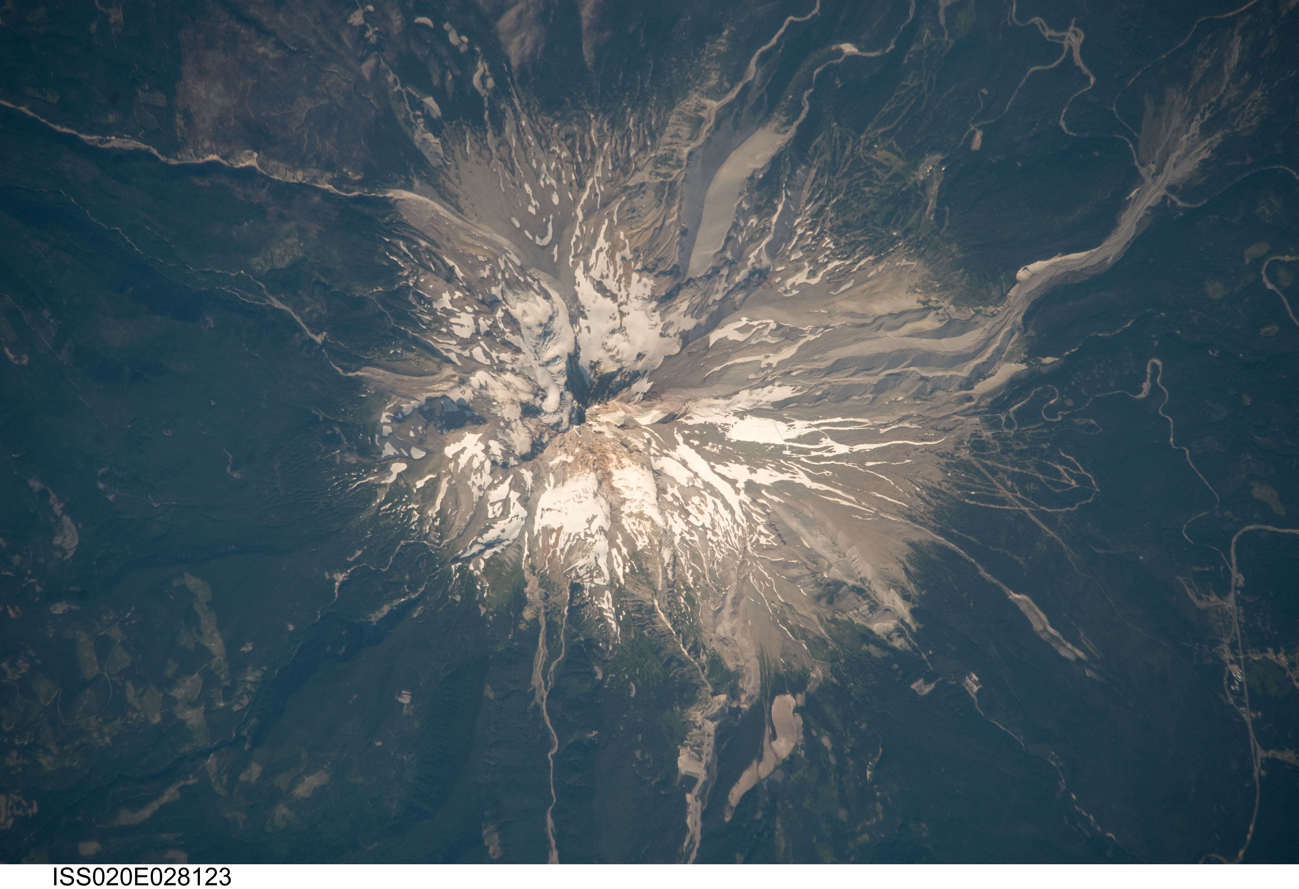
Image Caption: Mount Hood, Oregon
Mount Hood is located within the Cascade Range of the western United States, and it is the highest peak in Oregon (3,426 meters, or 11,240 feet ). The Cascade Range is characterized by a line of volcanoes associated with a slab of oceanic crust that is subducting, or descending underneath, the westward-moving, continental crust of North America. Magma generated by the subduction process rises upward through the crust and feeds a line of active volcanoes that extends from northern California in the United States to southern British Columbia in Canada.
While hot springs and steam vents are still active on Mount Hood, the last eruption from the volcano occurred in 1866. The volcano is considered dormant, but still actively monitored. Separate phases of eruptive activity produced pyroclastic flows and lahars that carried erupted materials down all of the major rivers draining the volcano. Gray volcanic deposits extend southwards along the banks of the White River (image lower left) and form several prominent ridges along the southeast to southwest flanks of the volcano. The deposits contrast sharply with the green vegetation on the lower flanks of the volcano.
The Mount Hood stratovolcano--a typically cone-shaped structure formed by layered lava flows and explosive eruption deposits--hosts twelve mapped glaciers along its upper flanks. Like other glaciers in the Pacific Northwest, the Hood glaciers have been receding due to global warming, and they have lost an estimated 61 percent of their volume over the past century. The predicted loss of glacial meltwater under future warming scenarios will have significant effects on regional hydrology and water supplies.
