ISS018-E-5321
| NASA Photo ID | ISS018-E-5321 |
| Focal Length | 800mm |
| Date taken | 2008.10.24 |
| Time taken | 18:44:38 GMT |
Resolutions offered for this image:
1000 x 629 pixels 540 x 340 pixels 1440 x 960 pixels 720 x 480 pixels 3072 x 2098 pixels 640 x 437 pixels
1000 x 629 pixels 540 x 340 pixels 1440 x 960 pixels 720 x 480 pixels 3072 x 2098 pixels 640 x 437 pixels
Cloud masks available for this image:
Spacecraft nadir point: 44.1° N, 112.3° W
Photo center point: 43.4° N, 112.3° W
Photo center point by machine learning:
Photo center point: 43.4° N, 112.3° W
Photo center point by machine learning:
Nadir to Photo Center: South
Spacecraft Altitude: 188 nautical miles (348km)
Country or Geographic Name: | USA-IDAHO |
Features: | HELLS HALF ACRE, LAVA FLOWS, AGRICULTURE |
| Features Found Using Machine Learning: | |
Cloud Cover Percentage: | 10 (1-10)% |
Sun Elevation Angle: | 34° |
Sun Azimuth: | 172° |
Camera: | Nikon D2Xs Electronic Still Camera |
Focal Length: | 800mm |
Camera Tilt: | 13 degrees |
Format: | 4288E: 4288 x 2848 pixel CMOS sensor, RGBG imager color filter |
Film Exposure: | |
| Additional Information | |
| Width | Height | Annotated | Cropped | Purpose | Links |
|---|---|---|---|---|---|
| 1000 pixels | 629 pixels | No | Yes | Earth From Space collection | Download Image |
| 540 pixels | 340 pixels | Yes | Yes | Earth From Space collection | Download Image |
| 1440 pixels | 960 pixels | No | Yes | NASA's Earth Observatory web site | Download Image |
| 720 pixels | 480 pixels | Yes | Yes | NASA's Earth Observatory web site | Download Image |
| 3072 pixels | 2098 pixels | No | No | Download Image | |
| 640 pixels | 437 pixels | No | No | Download Image |
Download Packaged File
Download a Google Earth KML for this Image
View photo footprint information
Download a GeoTIFF for this photo
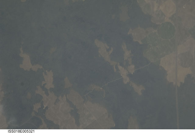
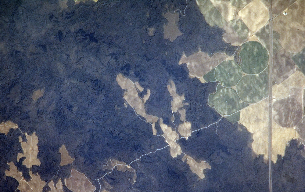
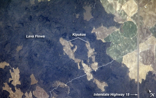
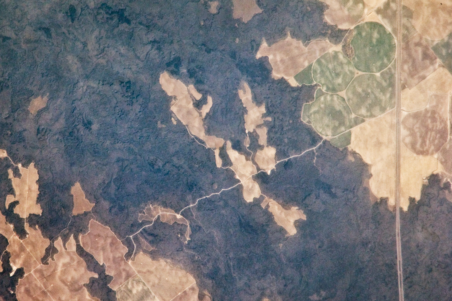
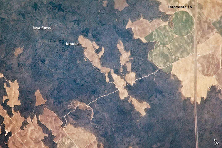
Image Caption: Hell's Half Acre Lava Field, Idaho
Located in eastern Idaho, the Hell's Half Acre Lava Field is the easternmost large field associated with the Snake River Plain, which arcs across the center of the state. Geologists think that the abundant lava flows and other volcanic rocks of the Snake River Plain were created when the North American tectonic plate passed southwest over a mantle plume, a fixed "hotspot" in the Earth's mantle (the layer of Earth below the crust).The hotspot melted the rock of the tectonic plate as the plate passed over it, and magma rose to the surface.
Volcanism attributed to the hotspot began approximately 15 million years ago in the western portion of the Plain, with lava fields becoming younger to the east. With lavas erupted approximately 4,100 years ago, Hell's Half Acre is one of the youngest lava fields. This pattern-older lavas in the west and younger lavas in the east-reveals the direction the plate was moving. (If the plate had been moving the opposite direction over the hotspot, areas to the east would have encountered it first, and the eastern lavas would have been older.) Today, the center of hotspot volcanism is located in Yellowstone National Park, where it feeds the extensive geyser system.
Portions of the Hell's Half Acre Lava Field are a National Natural Landmark and Wilderness Study Area. This detailed astronaut photograph illustrates the forbidding landscape of the basaltic lava field. The complex ridge patterns of the black to grey-green flow surfaces include both smooth, ropy Pahoehoe and blocky 'A'a lava. Regions of tan soil surrounded by lava are known as kipukas. These "islands" are windows onto the older underlying soil surface. The kipukas are used for agriculture (both crops and grazing); several green fields are visible to the northwest of Interstate Highway 15 (image right). Light to dark mottling in the kipukas is most likely due to variations in moisture and disturbance by agricultural activities.
