ISS017-E-15163

| NASA Photo ID | ISS017-E-15163 |
| Focal Length | 28mm |
| Date taken | 2008.09.04 |
| Time taken | 13:43:11 GMT |
Cloud masks available for this image:
Spacecraft nadir point: 23.0° N, 60.2° W
Photo center point: 23.2° N, 57.0° W
Photo center point by machine learning:
Photo center point: 23.2° N, 57.0° W
Photo center point by machine learning:
Nadir to Photo Center: East
Spacecraft Altitude: 188 nautical miles (348km)
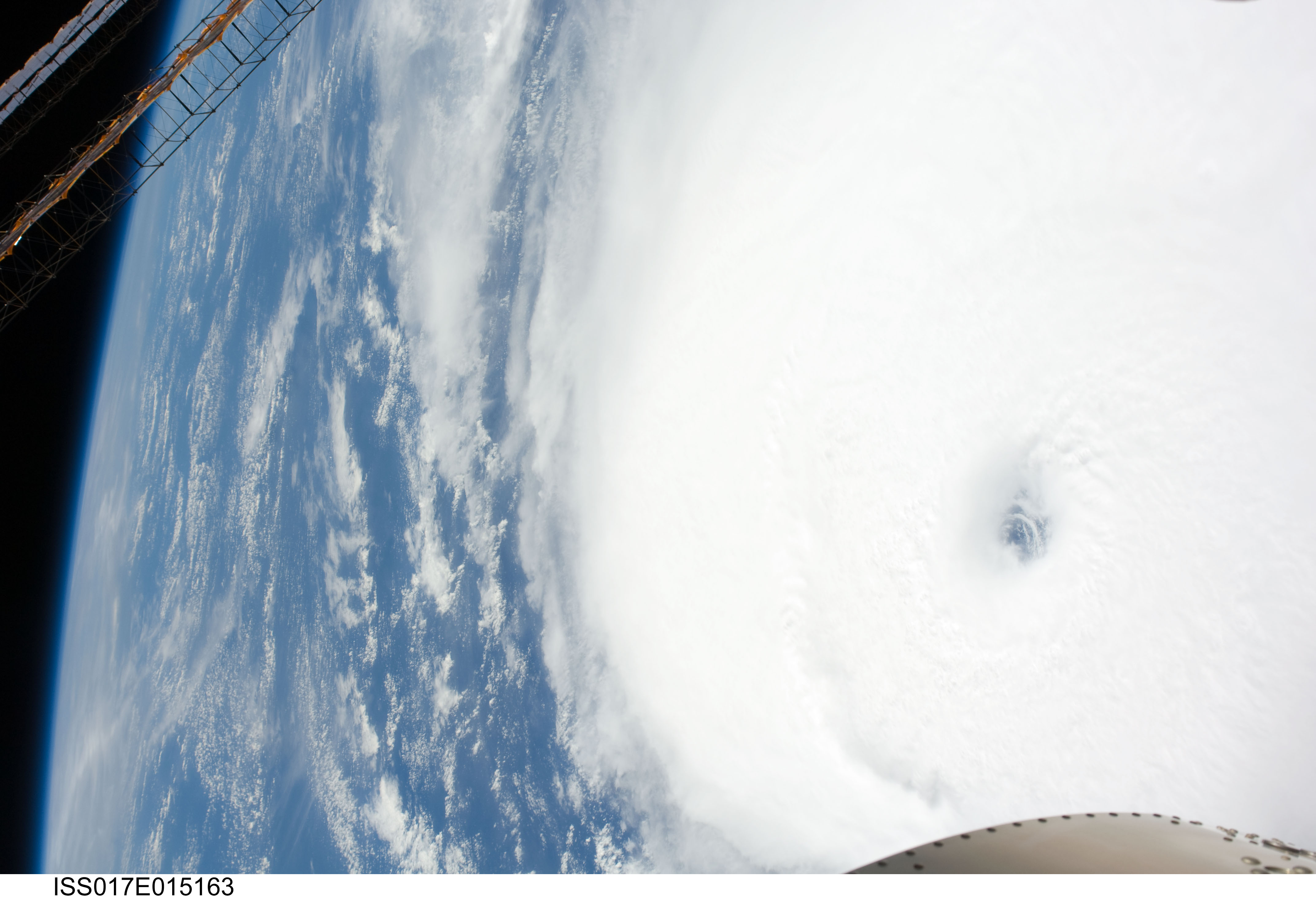
Country or Geographic Name: | ATLANTIC OCEAN |
Features: | PAN-HURRICANE IKE, EYE, ISS |
| Features Found Using Machine Learning: | PAN- |
Cloud Cover Percentage: | 100 (76-100)% |
Sun Elevation Angle: | 54° |
Sun Azimuth: | 110° |
Camera: | Nikon D2Xs Electronic Still Camera |
Focal Length: | 28mm |
Camera Tilt: | 46 degrees |
Format: | 4288E: 4288 x 2848 pixel CMOS sensor, RGBG imager color filter |
Film Exposure: | |
| Additional Information | |
| Width | Height | Annotated | Cropped | Purpose | Links |
|---|---|---|---|---|---|
| 4288 pixels | 2929 pixels | No | No | Download Image | |
| 640 pixels | 437 pixels | No | No | Download Image |
Download Packaged File
Download a Google Earth KML for this Image
View photo footprint information
Download a GeoTIFF for this photo
Image Caption: ISS017-E-015163 (4 Sept. 2008) --- Hurricane Ike was still a Category 4 storm on the morning of Sept. 4 when this photo was taken from the International Space Station's vantage point of 220 miles above the Earth. The season's seventh named storm was churning west-northwestward through the mid-Atlantic Ocean sporting winds of 120 nautical miles per hour with gusts to 145.
