ISS017-E-12583
| NASA Photo ID | ISS017-E-12583 |
| Focal Length | 70mm |
| Date taken | 2008.08.04 |
| Time taken | 20:24:53 GMT |
Resolutions offered for this image:
1000 x 749 pixels 540 x 404 pixels 540 x 405 pixels 3072 x 2098 pixels 640 x 437 pixels
1000 x 749 pixels 540 x 404 pixels 540 x 405 pixels 3072 x 2098 pixels 640 x 437 pixels


Cloud masks available for this image:
Spacecraft nadir point: 51.3° N, 54.5° W
Photo center point: 60.0° N, 44.5° W
Photo center point by machine learning:
Photo center point: 60.0° N, 44.5° W
Photo center point by machine learning:
Nadir to Photo Center: Northeast
Spacecraft Altitude: 183 nautical miles (339km)
Country or Geographic Name: | GREENLAND |
Features: | PAN-C. FAREWELL, ICE CAP, GL. |
| Features Found Using Machine Learning: | PAN- |
Cloud Cover Percentage: | 100 (76-100)% |
Sun Elevation Angle: | 25° |
Sun Azimuth: | 266° |
Camera: | Nikon D2Xs Electronic Still Camera |
Focal Length: | 70mm |
Camera Tilt: | High Oblique |
Format: | 4288E: 4288 x 2848 pixel CMOS sensor, RGBG imager color filter |
Film Exposure: | |
| Additional Information | |
| Width | Height | Annotated | Cropped | Purpose | Links |
|---|---|---|---|---|---|
| 1000 pixels | 749 pixels | No | Yes | Earth From Space collection | Download Image |
| 540 pixels | 404 pixels | Yes | Yes | Earth From Space collection | Download Image |
| 540 pixels | 405 pixels | Yes | Yes | NASA's Earth Observatory web site | Download Image |
| 3072 pixels | 2098 pixels | No | No | Download Image | |
| 640 pixels | 437 pixels | No | No | Download Image |
Download Packaged File
Download a Google Earth KML for this Image
View photo footprint information
Download a GeoTIFF for this photo
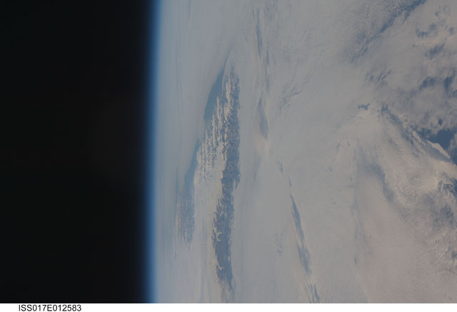
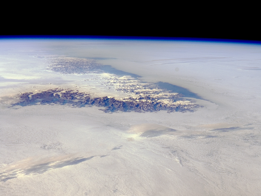
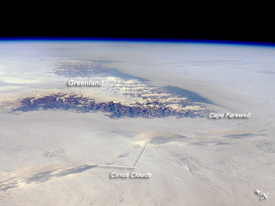
Image Caption: Cape Farewell, Greenland
Greenland is the world's largest island, with an area of over 2 million square kilometers; however, much of the island is covered by an ice cap that can reach thicknesses of 3 kilometers. This astronaut photograph illustrates the southernmost tip of Greenland, known as Kap Farvel in Danish and Nunap Isua in Inuit. The viewing direction is towards the northeast; the image was taken when the International Space Station was located near its most northerly orbital latitude of 52 degrees. The northern coast of Newfoundland was approximately 1,160 kilometers to the southwest.
The image is highly oblique--taken from an angle looking outwards from the ISS, rather than straight down towards the Earth--and this perspective provides a sense of topography along the southern edge of Greenland. The exposed dark grey bedrock along the southwestern coastline has been carved by glaciers into numerous fjords, steep-sided valleys that drain directly into the ocean. The white cloud cover surrounding the island likely mingles with some sea ice and icebergs calved from glaciers. A band of high-altitude cirrus clouds (light grey) casts shadows on the lower stratus cloud deck in the lower third of the image. The thin blue layer of Earth's atmosphere is visible spanning the top third of the image from left to right.
