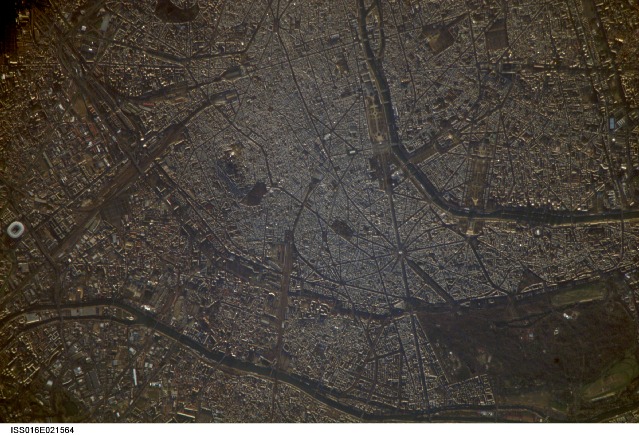
ISS016-E-21564
| NASA Photo ID | ISS016-E-21564 |
| Focal Length | 800mm |
| Date taken | 2008.01.07 |
| Time taken | 09:10:49 GMT |
Resolutions offered for this image:
1000 x 750 pixels 540 x 405 pixels 540 x 405 pixels 3032 x 2064 pixels 639 x 435 pixels
1000 x 750 pixels 540 x 405 pixels 540 x 405 pixels 3032 x 2064 pixels 639 x 435 pixels

Cloud masks available for this image:
Spacecraft nadir point: 49.6° N, 1.1° W
Photo center point: 48.9° N, 2.3° E
Photo center point by machine learning:
Photo center point: 48.9° N, 2.3° E
Photo center point by machine learning:
Nadir to Photo Center: East
Spacecraft Altitude: 177 nautical miles (328km)
Country or Geographic Name: | FRANCE |
Features: | PARIS METROPOLITAN AREA |
| Features Found Using Machine Learning: | |
Cloud Cover Percentage: | 10 (1-10)% |
Sun Elevation Angle: | 8° |
Sun Azimuth: | 139° |
Camera: | Kodak DCS760c Electronic Still Camera |
Focal Length: | 800mm |
Camera Tilt: | 50 degrees |
Format: | 3060E: 3060 x 2036 pixel CCD, RGBG array |
Film Exposure: | |
| Additional Information | |
| Width | Height | Annotated | Cropped | Purpose | Links |
|---|---|---|---|---|---|
| 1000 pixels | 750 pixels | No | Yes | Earth From Space collection | Download Image |
| 540 pixels | 405 pixels | Yes | Yes | Earth From Space collection | Download Image |
| 540 pixels | 405 pixels | Yes | Yes | NASA's Earth Observatory web site | Download Image |
| 3032 pixels | 2064 pixels | No | No | Download Image | |
| 639 pixels | 435 pixels | No | No | Download Image |
Download Packaged File
Download a Google Earth KML for this Image
View photo footprint information
Download a GeoTIFF for this photo
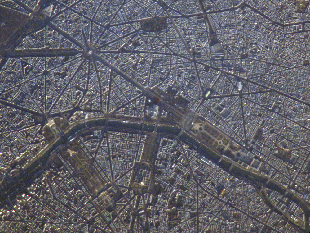
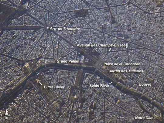
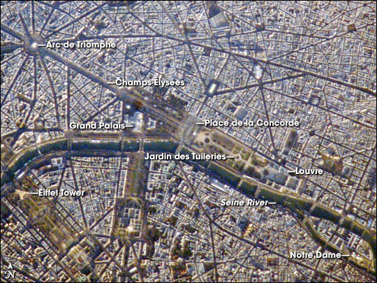
Image Caption: Paris, France
A crisp, clear winter day over France provided the International Space Station a detailed view of the city of Paris. This image, rotated and cropped from the original, shows the recognizable street pattern of the city - and some of the world's most notable landmarks - along the Seine River. One of the main avenues radiating like spokes from the Arc de Triomphe (image upper left) is the Avenue des Champs-Elysees running southeast to the Garden of Tuileries (Jardin des Tuileries).
The garden--recognizable by its light green color relative to the surrounding built materials--was originally commissioned by Catherine de Medici in 1559, and is now bounded by the Place de la Concorde to the northeast and the Louvre museum along the Seine River at the southeast end. Other, similarly colored parks and greenspaces are visible throughout the image. Farther south on the Seine is the Ile de la Cite, location of the famous Notre Dame cathedral. Perhaps most prominent is the characteristic "A" profile of the Eiffel Tower west of the Jardin des Tuileries, highlighted by morning sunlight.
