ISS014-E-7084
| NASA Photo ID | ISS014-E-7084 |
| Focal Length | 400mm |
| Date taken | 2006.11.02 |
| Time taken | 13:47:48 GMT |
Resolutions offered for this image:
1000 x 725 pixels 540 x 392 pixels 540 x 405 pixels 3032 x 2064 pixels 639 x 435 pixels
1000 x 725 pixels 540 x 392 pixels 540 x 405 pixels 3032 x 2064 pixels 639 x 435 pixels
Cloud masks available for this image:
Spacecraft nadir point: 48.0° N, 6.6° E
Photo center point: 46.3° N, 6.2° E
Photo center point by machine learning:
Photo center point: 46.3° N, 6.2° E
Photo center point by machine learning:
Nadir to Photo Center: South
Spacecraft Altitude: 179 nautical miles (332km)
Camera: | Kodak DCS760c Electronic Still Camera |
Focal Length: | 400mm |
Camera Tilt: | 30 degrees |
Format: | 3060E: 3060 x 2036 pixel CCD, RGBG array |
Film Exposure: | |
| Additional Information | |
| Width | Height | Annotated | Cropped | Purpose | Links |
|---|---|---|---|---|---|
| 1000 pixels | 725 pixels | No | Yes | Earth From Space collection | Download Image |
| 540 pixels | 392 pixels | Yes | Yes | Earth From Space collection | Download Image |
| 540 pixels | 405 pixels | Yes | Yes | NASA's Earth Observatory web site | Download Image |
| 3032 pixels | 2064 pixels | No | No | Download Image | |
| 639 pixels | 435 pixels | No | No | Download Image |
Download Packaged File
Download a Google Earth KML for this Image
View photo footprint information
Download a GeoTIFF for this photo
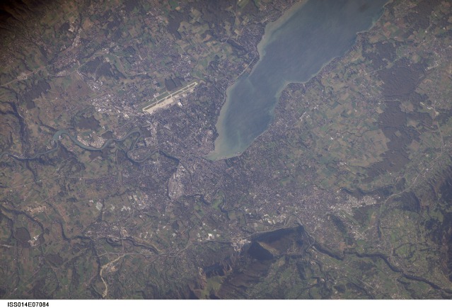
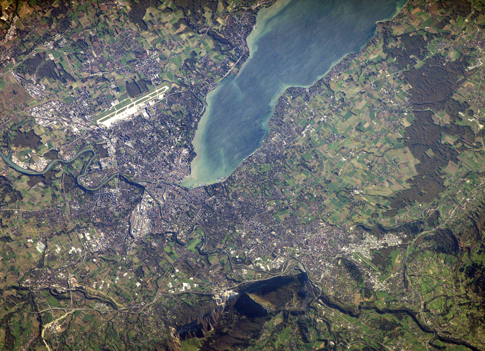
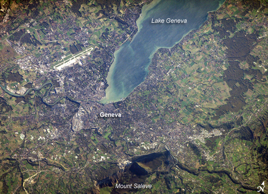
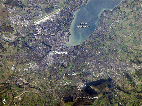
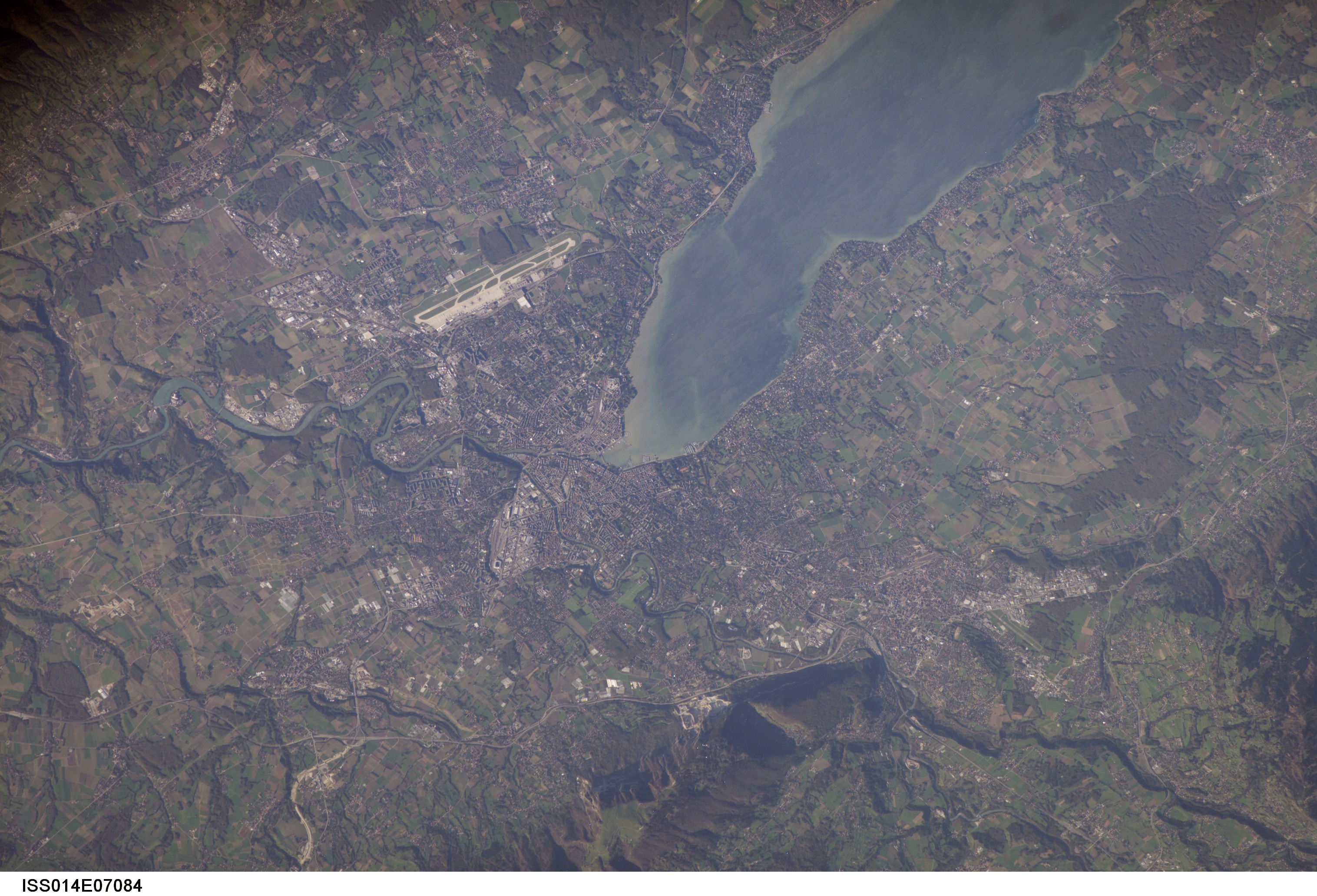
Image Caption: Geneva, Switzerland:
The city of Geneva embraces the southern end of Lake Geneva (also known as Lac Leman). Geneva is tucked between two major mountain ranges, the Jura to the northwest (not shown) and the Alps to the southeast. Mount Saleve, near the bottom of the image, represents the northern foothills of the range.
The city's built-up area, roadways, and airport appear as white to gray surfaces in this astronaut photograph. Urbanized regions are interspersed with agricultural fields (bright green to light brown rectangular regions) and preserved forest stands (dark green) around the lake. In places, the forest stands cast shadows, giving the scene a three-dimensional feel.
The near-shore waters of Lake Geneva are brown with sediment in this scene. The main contributor to Lake Geneva is the Rhone River, which flows in at the northern end and exits in the south. Near the southwestern outskirts of the city, the Rhone is joined by the Arve River, which runs into the city from the southeast. Both rivers have their sources in alpine glaciers.
Geneva is primarily known for being a "world city" of cultural, economic, and political significance because it hosts numerous international organizations and corporations, including the European headquarters of the United Nations.
