ISS013-E-27872

| NASA Photo ID | ISS013-E-27872 |
| Focal Length | 800mm |
| Date taken | 2006.05.28 |
| Time taken | 17:12:46 GMT |
1000 x 827 pixels 540 x 447 pixels 540 x 1006 pixels 540 x 334 pixels 1520 x 1008 pixels 639 x 435 pixels
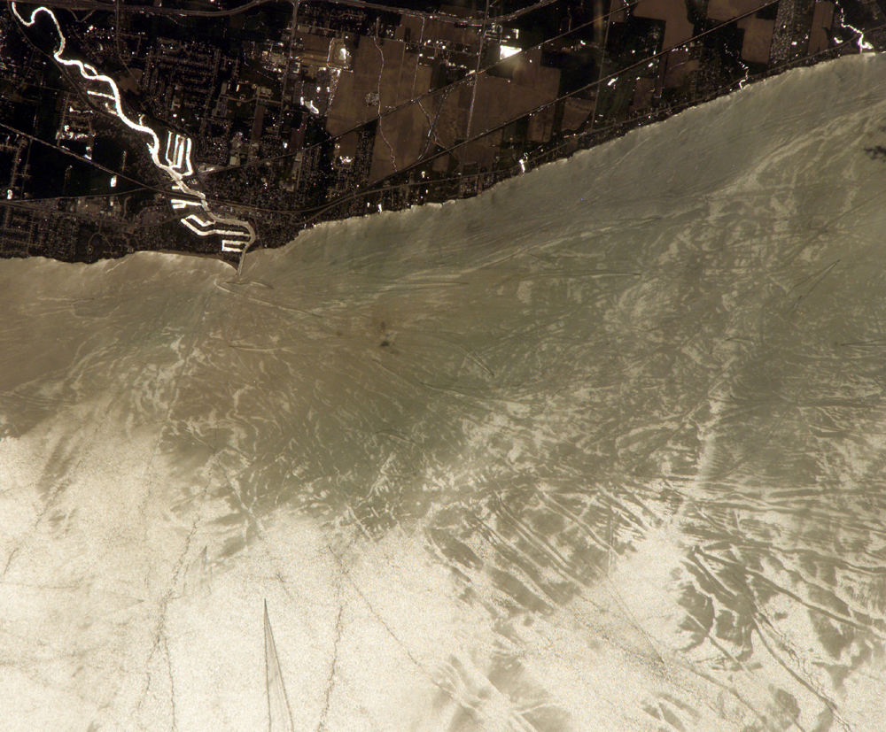
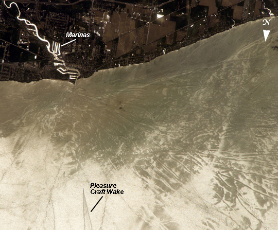
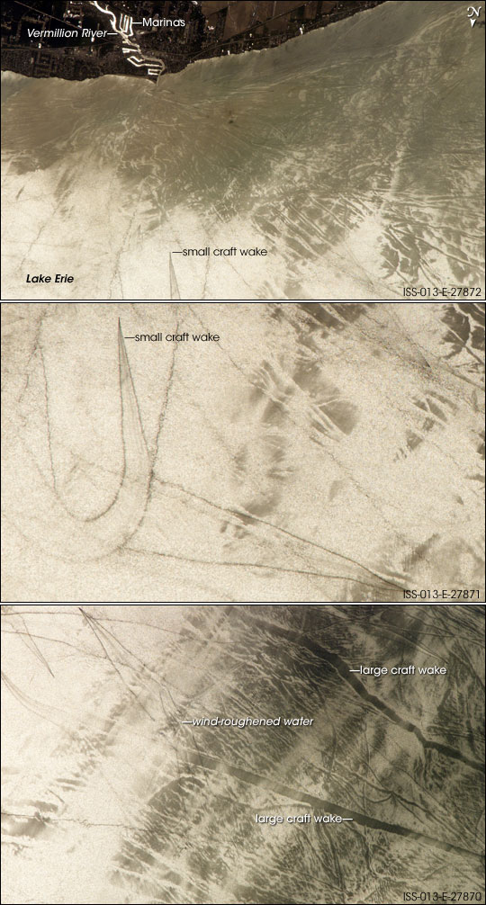
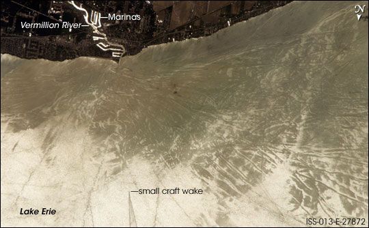
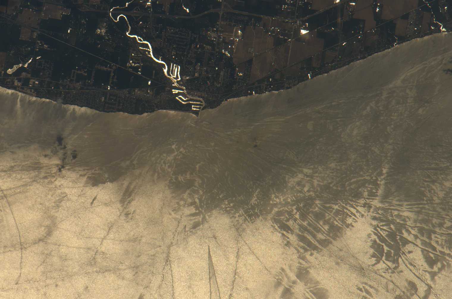
Photo center point: 41.5° N, 82.4° W
Photo center point by machine learning:
Country or Geographic Name: | USA-OHIO |
Features: | VERMILION R., LAKE ERIE, GLINT |
| Features Found Using Machine Learning: | |
Cloud Cover Percentage: | 10 (1-10)% |
Sun Elevation Angle: | 68° |
Sun Azimuth: | 168° |
Camera: | Kodak DCS760c Electronic Still Camera |
Focal Length: | 800mm |
Camera Tilt: | 31 degrees |
Format: | 3060E: 3060 x 2036 pixel CCD, RGBG array |
Film Exposure: | |
| Additional Information | |
| Width | Height | Annotated | Cropped | Purpose | Links |
|---|---|---|---|---|---|
| 1000 pixels | 827 pixels | No | Yes | Earth From Space collection | Download Image |
| 540 pixels | 447 pixels | Yes | Yes | Earth From Space collection | Download Image |
| 540 pixels | 1006 pixels | Yes | Yes | NASA's Earth Observatory web site | Download Image |
| 540 pixels | 334 pixels | Yes | Yes | NASA's Earth Observatory web site | Download Image |
| 1520 pixels | 1008 pixels | No | No | Not enhanced | Download Image |
| 639 pixels | 435 pixels | No | No | Download Image |
Three detailed south-looking images, taken one second apart near noon on May 28th, 2006, show features on the surface of Lake Erie, about 50 kilometers (30 miles) west of Cleveland, Ohio. The three images overlap slightly and are aligned similarly with south at image top. The top image shows the Vermilion River in strong sunglint (top left). Sunglint results when the Sun's light bounces off the water's surface and into the satellite sensor or camera. The angular water bodies along the river are likely marinas. The main part of the image shows numerous ship wakes in the zone of partial glint around the disk of the Sun's reflection point. The wakes radiate from the mouth of the Vermilion River, with many of them heading northwest (towards the lower-right corner) in the direction of Detroit, Michigan.
On the left side of the second image, a thin, V-shaped wake curves back towards the shore (and appears near the lower left in the top image). This type of wake is typically created by a small, light craft such as a speedboat or sailboat under power. The third image shows similar tight-V-shaped wakes of other small craft. It also shows broad patterns of larger craft, probably large freighters carrying cargo, that displace and disturb more water during passage. These larger wakes are aligned with the direct course between Detroit (out of the image at lower right) and Cleveland (out of the image at top left). Some of the broad, ill-defined swaths of light and dark (aligned from lower left to upper right) are streaks of wind-roughened water, which reflect the Sun differently.
