ISS012-E-9567
| NASA Photo ID | ISS012-E-9567 |
| Focal Length | 800mm |
| Date taken | 2005.11.28 |
| Time taken | 21:13:43 GMT |
1000 x 719 pixels 540 x 388 pixels 540 x 814 pixels 1520 x 1008 pixels 639 x 435 pixels
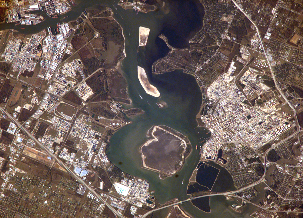
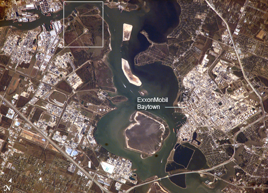
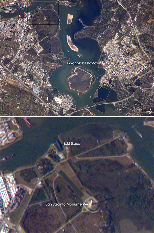
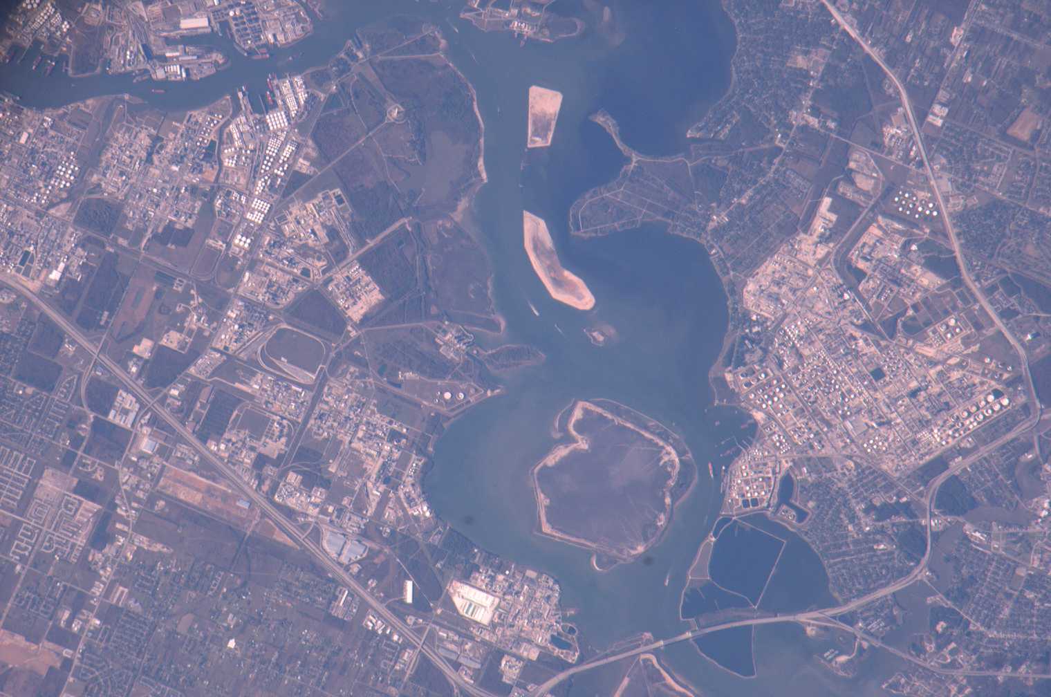
Photo center point: 29.7° N, 95.1° W
Photo center point by machine learning:
Country or Geographic Name: | USA-TEXAS |
Features: | HOUSTON SHIP CHAN., REFINERIES |
| Features Found Using Machine Learning: | |
Cloud Cover Percentage: | 10 (1-10)% |
Sun Elevation Angle: | 23° |
Sun Azimuth: | 228° |
Camera: | Kodak DCS760c Electronic Still Camera |
Focal Length: | 800mm |
Camera Tilt: | 31 degrees |
Format: | 3060E: 3060 x 2036 pixel CCD, RGBG array |
Film Exposure: | |
| Additional Information | |
| Width | Height | Annotated | Cropped | Purpose | Links |
|---|---|---|---|---|---|
| 1000 pixels | 719 pixels | No | Yes | Earth From Space collection | Download Image |
| 540 pixels | 388 pixels | Yes | Yes | Earth From Space collection | Download Image |
| 540 pixels | 814 pixels | Yes | Yes | NASA's Earth Observatory web site | Download Image |
| 1520 pixels | 1008 pixels | No | No | Not enhanced | Download Image |
| 639 pixels | 435 pixels | No | No | Download Image |
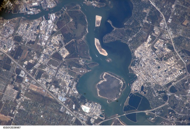
This astronaut photograph depicts the San Jacinto River portion of the Houston Ship Channel, one of the United States' busiest sea ports. The channel is a conduit between the continental interior and the Gulf of Mexico for both petrochemical products and Midwestern grain. The original watercourse for the channel, Buffalo Bayou, has its headwaters thirty miles to the west of the city of Houston. It has been used to move goods to the sea since at least 1836. Wakes of ships traveling along the channel are visible to the south of the Goat Islands (bright, oblong islands at top center of image). The close proximity to Texas oilfields led to the establishment of numerous petrochemical refineries along the waterway, such as the ExxonMobil Baytown installation on the eastern bank of the San Jacinto River.
While much of the Ship Channel is associated with heavy industry, two icons of Texas history are also located along its length. The inset (area denoted by white rectangle) highlights the battleship USS Texas and the San Jacinto Monument. The Texas saw service during both World Wars, and is the last remaining example of a dreadnought-class battleship in existence. The nearby San Jacinto Monument commemorates the 1836 battle in which Texas won its independence from Mexico. The monument itself is a 570-foot-high (173-meter) shaft topped by a 34-foot-high (10-meter) star, making it 15 feet (5 meters) higher than the Washington Monument in Washington, D.C.
The Houston Ship Channel has been periodically widened and deepened to accommodate ever-larger ships, and is currently 530 feet wide by 45 feet deep by 50 miles long (161 meters by 14 meters by 80 kilometers). The islands in the ship channel are part of the ongoing widening and deepening project. The islands are formed from soil pulled up by dredging, and the salt marshes and bird islands are part of the Houston Port Authority's beneficial use and environmental mitigation responsibilities.
