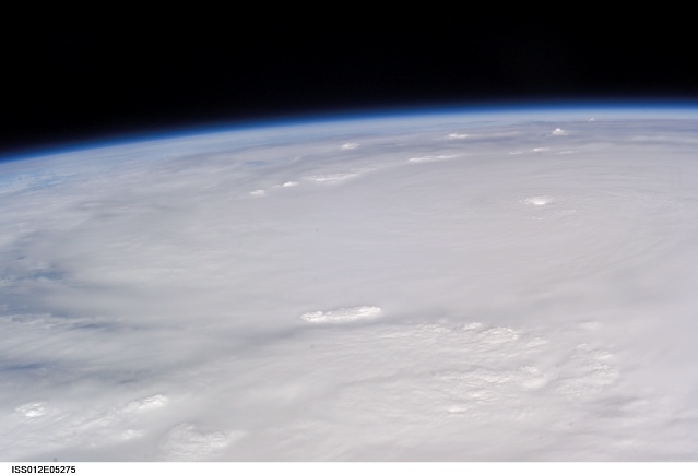
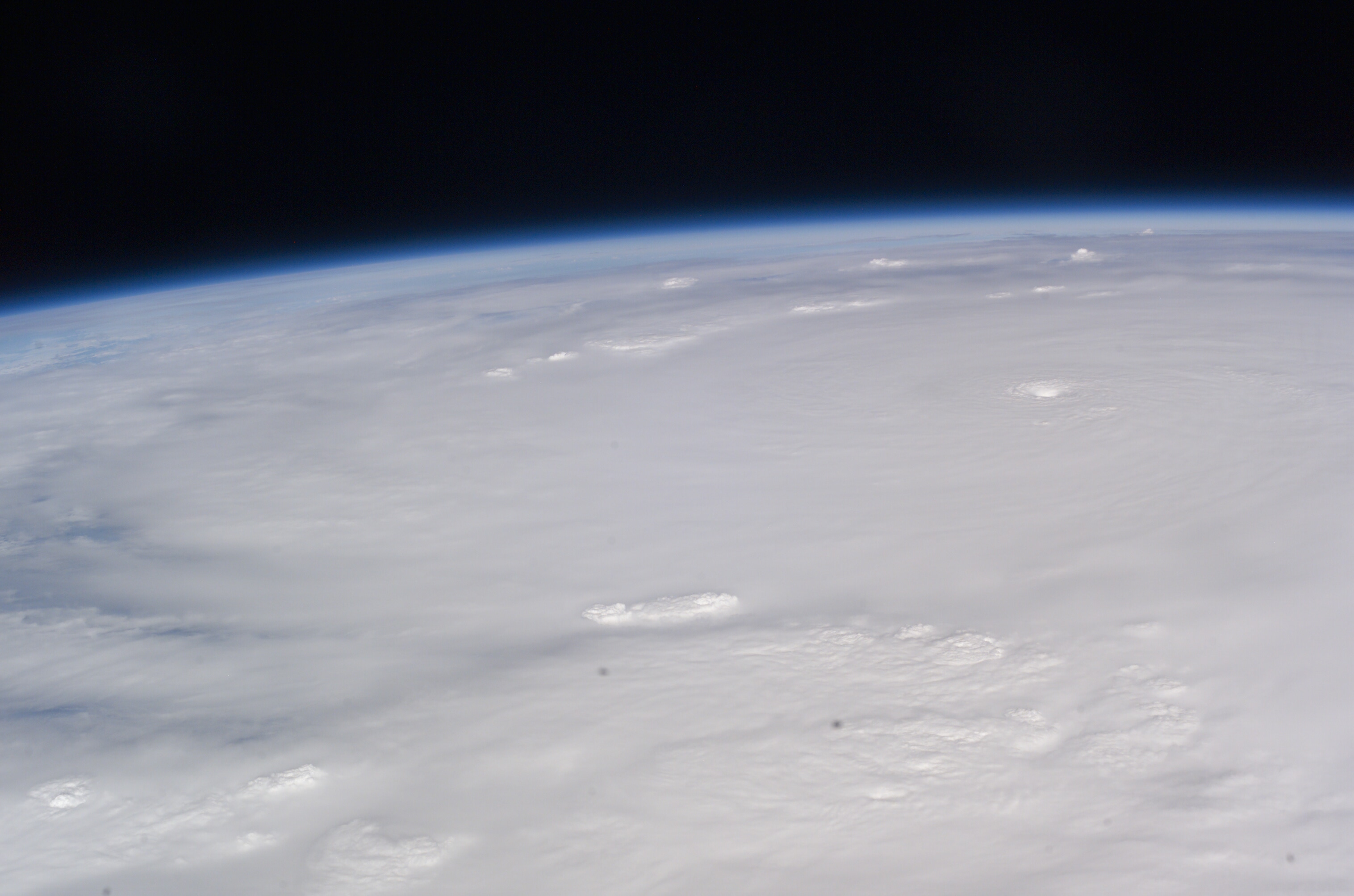
ISS012-E-5275
| NASA Photo ID | ISS012-E-5275 |
| Focal Length | 50mm |
| Date taken | 2005.10.19 |
| Time taken | 13:24:18 GMT |
Cloud masks available for this image:
Spacecraft nadir point: 12.1° N, 75.2° W
Photo center point: 17.2° N, 82.8° W
Photo center point by machine learning:
Photo center point: 17.2° N, 82.8° W
Photo center point by machine learning:
Nadir to Photo Center: Northwest
Spacecraft Altitude: 187 nautical miles (346km)
Country or Geographic Name: | CARIBBEAN SEA |
Features: | PAN-HURRICANE WILMA, BANDING |
| Features Found Using Machine Learning: | PAN- |
Cloud Cover Percentage: | 100 (76-100)% |
Sun Elevation Angle: | 35° |
Sun Azimuth: | 112° |
Camera: | Kodak DCS760c Electronic Still Camera |
Focal Length: | 50mm |
Camera Tilt: | High Oblique |
Format: | 3060E: 3060 x 2036 pixel CCD, RGBG array |
Film Exposure: | |
| Additional Information | |
| Width | Height | Annotated | Cropped | Purpose | Links |
|---|---|---|---|---|---|
| 3032 pixels | 2008 pixels | No | No | Not enhanced | Download Image |
| 639 pixels | 435 pixels | No | No | Download Image |
Download Packaged File
Download a Google Earth KML for this Image
View photo footprint information
Download a GeoTIFF for this photo
Image Caption: ISS012-E-5275 (19 Oct. 2005) --- This image of Hurricane Wilma was taken at 8:24 a.m. CDT Wednesday, Oct. 19, by the crew aboard NASA's international space station as the complex flew 222 miles above the storm. At the time, Wilma was the strongest Atlantic hurricane in history, with winds near 175 miles per hour. The storm was located in the Caribbean Sea, 340 miles southeast of Cozumel, Mexico.
