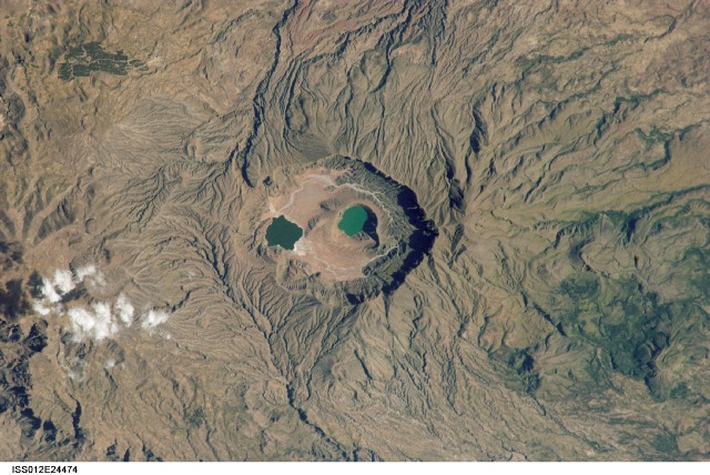
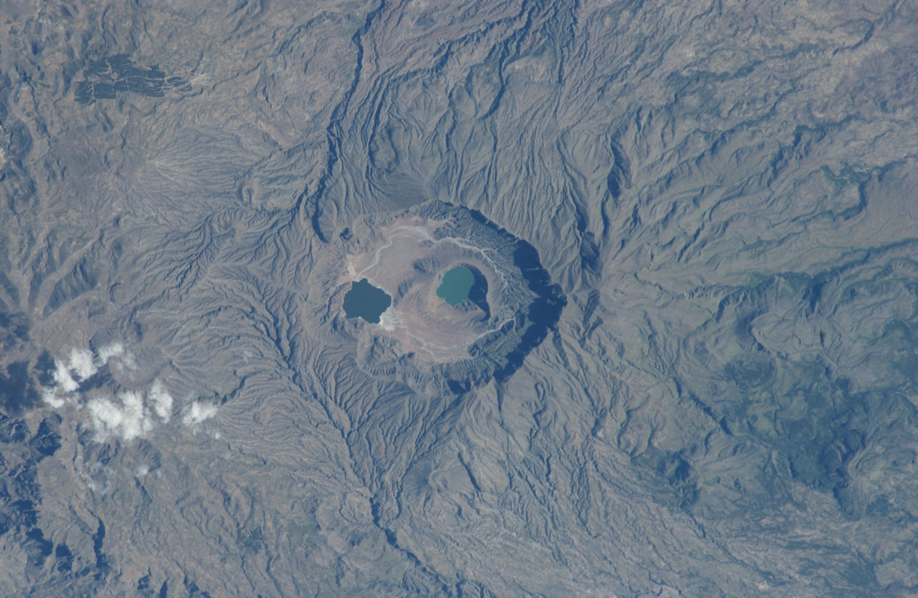
ISS012-E-24474
| NASA Photo ID | ISS012-E-24474 |
| Focal Length | 400mm |
| Date taken | 2005.11.05 |
| Time taken | 13:04:14 GMT |
Cloud masks available for this image:
Spacecraft nadir point: 14.8° N, 27.5° E
Photo center point: 13.0° N, 24.3° E
Photo center point by machine learning:
Photo center point: 13.0° N, 24.3° E
Photo center point by machine learning:
Nadir to Photo Center: Southwest
Spacecraft Altitude: 186 nautical miles (344km)
Country or Geographic Name: | SUDAN |
Features: | MARRAH MTS., DERIBA CALDERA, LAKES, RAVINES, FOREST |
| Features Found Using Machine Learning: | |
Cloud Cover Percentage: | 10 (1-10)% |
Sun Elevation Angle: | 34° |
Sun Azimuth: | 239° |
Camera: | Nikon D1 Electronic Still Camera |
Focal Length: | 400mm |
Camera Tilt: | 50 degrees |
Format: | 2000E: 2000 x 1312 pixel CCD, RGBG imager color filter |
Film Exposure: | |
| Additional Information | |
| Width | Height | Annotated | Cropped | Purpose | Links |
|---|---|---|---|---|---|
| 3008 pixels | 1960 pixels | No | No | Original file from camera | Download Image |
| 640 pixels | 428 pixels | No | No | Download Image |
Download Packaged File
Download a Google Earth KML for this Image
View photo footprint information
Download a GeoTIFF for this photo
Image Caption: none
