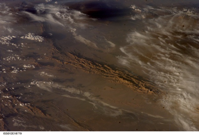
ISS012-E-18779
| NASA Photo ID | ISS012-E-18779 |
| Focal Length | 180mm |
| Date taken | 2006.02.28 |
| Time taken | 13:21:50 GMT |
1000 x 661 pixels 540 x 357 pixels 540 x 405 pixels 1520 x 1008 pixels 639 x 435 pixels
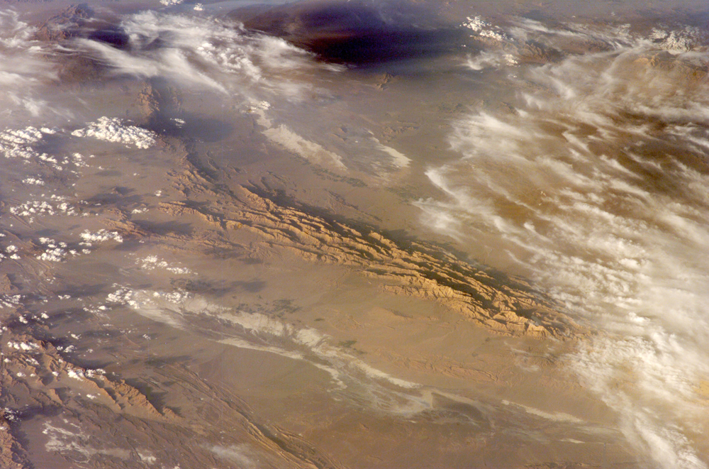

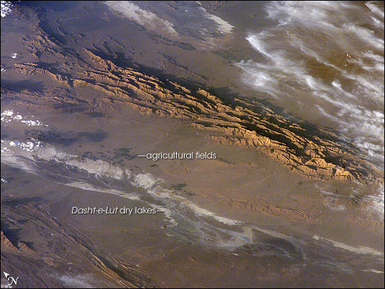
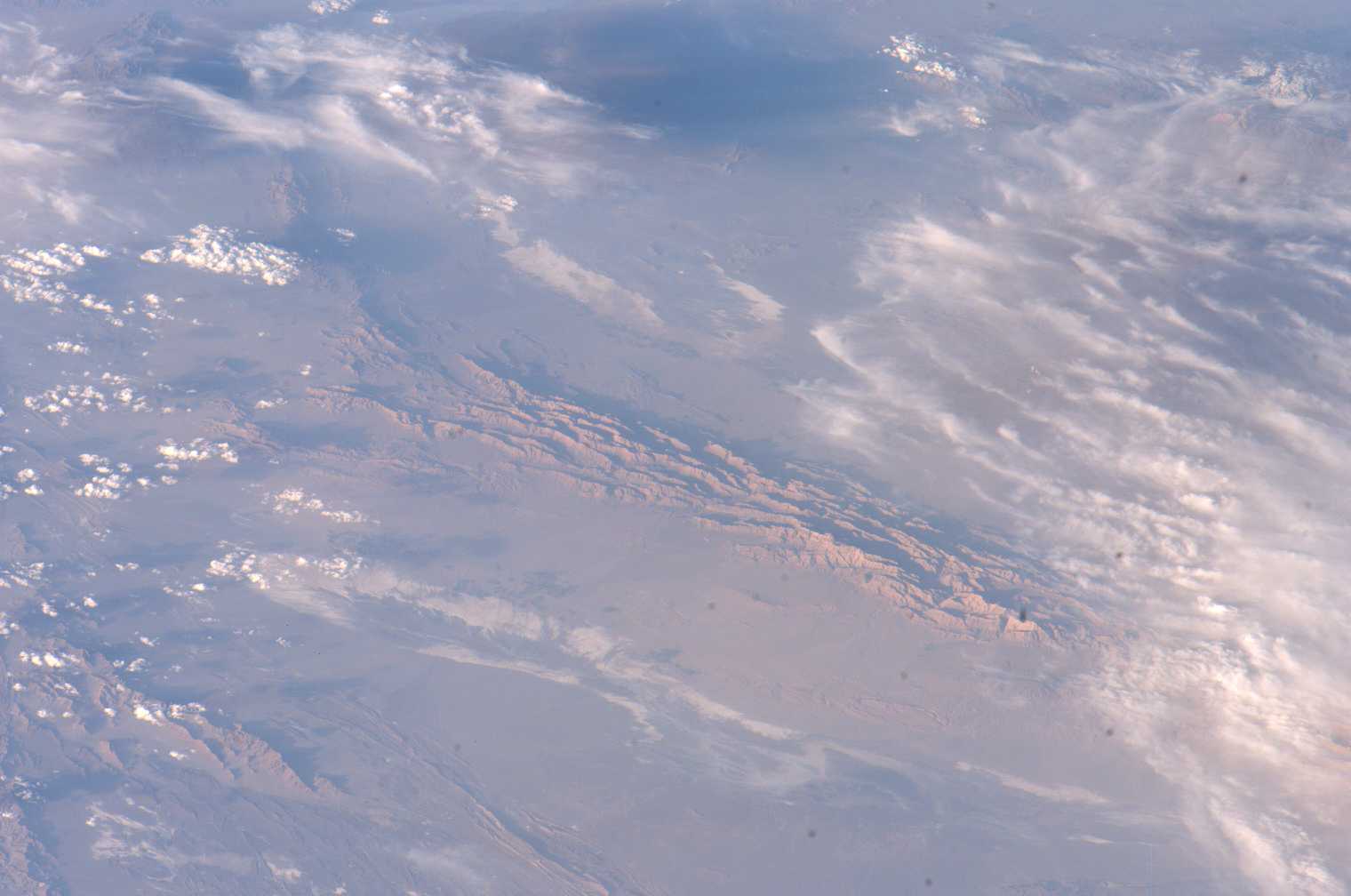
Photo center point: 33.5° N, 57.0° E
Photo center point by machine learning:
Country or Geographic Name: | IRAN |
Features: | LINEAR MTS., DASH-E-LUT SALARS |
| Features Found Using Machine Learning: | |
Cloud Cover Percentage: | 50 (26-50)% |
Sun Elevation Angle: | 15° |
Sun Azimuth: | 253° |
Camera: | Kodak DCS760c Electronic Still Camera |
Focal Length: | 180mm |
Camera Tilt: | High Oblique |
Format: | 3060E: 3060 x 2036 pixel CCD, RGBG array |
Film Exposure: | |
| Additional Information | |
| Width | Height | Annotated | Cropped | Purpose | Links |
|---|---|---|---|---|---|
| 1000 pixels | 661 pixels | No | Yes | Earth From Space collection | Download Image |
| 540 pixels | 357 pixels | Yes | Yes | Earth From Space collection | Download Image |
| 540 pixels | 405 pixels | Yes | Yes | NASA's Earth Observatory web site | Download Image |
| 1520 pixels | 1008 pixels | No | No | Not enhanced | Download Image |
| 639 pixels | 435 pixels | No | No | Download Image |
An International Space Station crew member took this striking photograph one evening in late February. The image takes advantage of the Sun's low angle to reveal linear geological structures of the Iranian mountain range bordering the western edge of the basin known as Dasht-e-Lut. The range rises 1,818 meters (6,000 feet) above sea level and lies 750 kilometers (466 miles) north of the Persian Gulf. The convoluted appearance results from erosion of folded and faulted rocks--softer rocks erode away quickly, leaving more resistant rock to form linear ridges that are perpendicular to the direction of compression. While not a major oil-producing region like the Zagros Fold Belt to the southwest, the mountains of east-central Iran contain economically important deposits of copper and other metals.
Little vegetation can be seen from space in the arid interior basin of the Dasht-e-Lut. Iran is climatically part of the Afro-Asian belt of deserts that stretch from the Cape Verde islands off West Africa all the way to Mongolia near Beijing, China. The patchy, elongated, light-colored feature in the foreground (parallel to the mountain range) is the northernmost of the Dasht dry lakes that stretch southward 300 kilometers (186 miles). In near-tropical deserts, elevated areas capture most precipitation. Agricultural fields that depend on this precipitation appear as small dark patches in this image. They are located downslope, near the margin of the lake's dry, salty soils.
