ISS012-E-16633
| NASA Photo ID | ISS012-E-16633 |
| Focal Length | 400mm |
| Date taken | 2006.01.28 |
| Time taken | 18:56:35 GMT |
1000 x 703 pixels 540 x 380 pixels 540 x 405 pixels 1520 x 1008 pixels 639 x 435 pixels
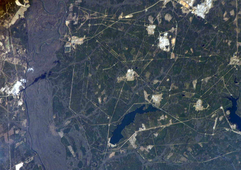
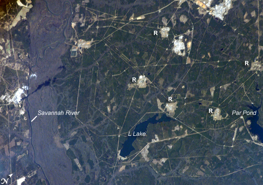
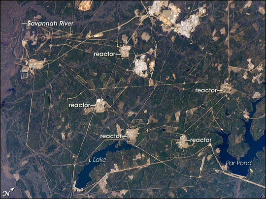
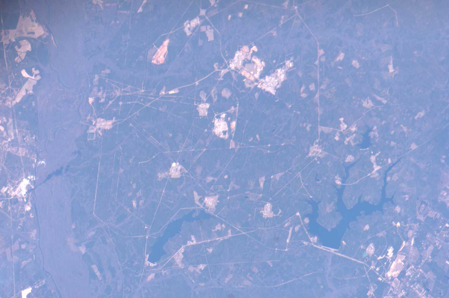
Photo center point: 33.2° N, 81.6° W
Photo center point by machine learning:
Country or Geographic Name: | USA-SOUTH CAROLINA |
Features: | SAVANNAH RIVER PLANT, PAR POND |
| Features Found Using Machine Learning: | |
Cloud Cover Percentage: | 10 (1-10)% |
Sun Elevation Angle: | 34° |
Sun Azimuth: | 204° |
Camera: | Kodak DCS760c Electronic Still Camera |
Focal Length: | 400mm |
Camera Tilt: | 30 degrees |
Format: | 3060E: 3060 x 2036 pixel CCD, RGBG array |
Film Exposure: | |
| Additional Information | |
| Width | Height | Annotated | Cropped | Purpose | Links |
|---|---|---|---|---|---|
| 1000 pixels | 703 pixels | No | Yes | Earth From Space collection | Download Image |
| 540 pixels | 380 pixels | Yes | Yes | Earth From Space collection | Download Image |
| 540 pixels | 405 pixels | Yes | Yes | NASA's Earth Observatory web site | Download Image |
| 1520 pixels | 1008 pixels | No | No | Not enhanced | Download Image |
| 639 pixels | 435 pixels | No | No | Download Image |
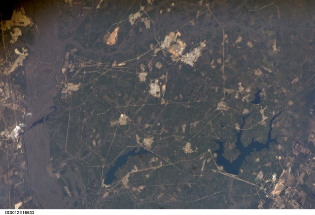
Situated between the South Carolina piedmont and the Atlantic Ocean, the Savannah River Site is an important part of the U.S. Department of Energy's nuclear program. Construction of the site--originally called the Savannah River Plant--began in 1951 for the purpose of generating radioactive materials necessary for nuclear weapons production during the Cold War. A total of five nuclear reactors occupy the central portion of the site and operated throughout 1953-1992. Following the end of the Cold War in 1991, activities at the Savannah River Site are now focused on disposal of nuclear wastes, environmental cleanup of the site itself, and development of advanced remediation technologies.
The Savannah River Site is located in the Sand Hills region of South Carolina and includes an area of 800 square kilometers (about 300 square miles). The southern half of the site (building clusters with reflective white rooftops) is shown in this astronaut photograph. The nearby Savannah River and its tributary creeks provided a ready source of water for the nuclear reactors; to this end, two artificial lakes ("L" Lake and Par Pond) were constructed. The meandering channel of the river and its floodplain, characterized by grey-brown sediments, is visible on the far left of the image. Because the river is so close to the nuclear site and because the underlying geological materials (sand, clay, gravel, and carbonate rocks) are permeable, an extensive and ongoing environmental monitoring and cleanup effort is necessary to reduce potential contamination of local water sources. Final remediation of wastes posing threats to surface and groundwater is scheduled to occur by 2025.
