ISS011-E-8489
| NASA Photo ID | ISS011-E-8489 |
| Focal Length | 400mm |
| Date taken | 2005.06.10 |
| Time taken | 20:08:27 GMT |
Cloud masks available for this image:
Spacecraft nadir point: 19.3° N, 103.9° W
Photo center point: 19.6° N, 103.6° W
Photo center point by machine learning:
Photo center point: 19.6° N, 103.6° W
Photo center point by machine learning:
Nadir to Photo Center: Northeast
Spacecraft Altitude: 188 nautical miles (348km)
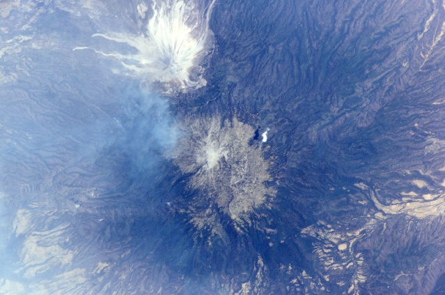
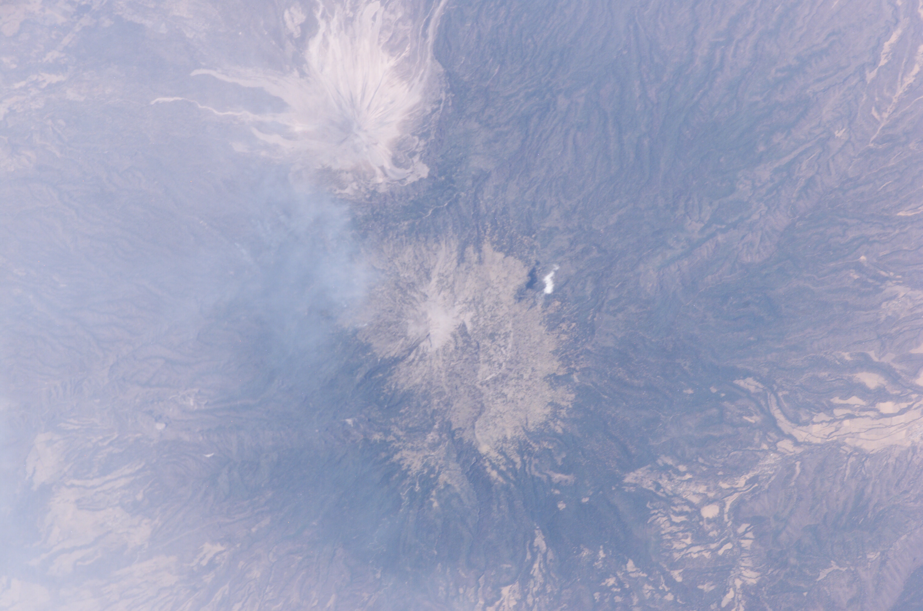
Country or Geographic Name: | MEXICO |
Features: | COLIMA VOLCANO, PLUME |
| Features Found Using Machine Learning: | |
Cloud Cover Percentage: | 10 (1-10)% |
Sun Elevation Angle: | 72° |
Sun Azimuth: | 286° |
Camera: | Kodak DCS760c Electronic Still Camera |
Focal Length: | 400mm |
Camera Tilt: | 8 degrees |
Format: | 3060E: 3060 x 2036 pixel CCD, RGBG array |
Film Exposure: | |
| Additional Information | |
| Width | Height | Annotated | Cropped | Purpose | Links |
|---|---|---|---|---|---|
| 3032 pixels | 2008 pixels | No | No | Not enhanced | Download Image |
| 639 pixels | 423 pixels | No | No | Download Image |
Download Packaged File
Download a Google Earth KML for this Image
View photo footprint information
Download a GeoTIFF for this photo
Image Caption: ISS011-E--8489 (10 June 2005) --- This digital still photograph, taken on June 10 from the Earth-orbiting International Space Station, shows an active Colima, the most prominent volcanic center of the western Mexican Belt. Around 11 p.m. local time, June 6, an explosion from this volcano, for which the summit elevation is approximately 3,850 meters, produced an ash plume to a height of approximately 8.5 kilometers (27,900 feet). The ash plume traveled southwest at a speed of approximately 79 kilometers per hour, and ash fell in and around the cities of Colima, about 30 kilometers away, and Villa de Alvarez. Brief evacuation of some 50 residents in the area was considered a minor undertaking and it was reported some three days after this picture was taken that all were able to return to their homes.
