ISS011-E-8483

| NASA Photo ID | ISS011-E-8483 |
| Focal Length | 180mm |
| Date taken | 2005.06.11 |
| Time taken | 17:27:32 GMT |
Cloud masks available for this image:
Spacecraft nadir point: 24.9° N, 74.6° W
Photo center point:
Photo center point by machine learning:
Photo center point:
Photo center point by machine learning:
Nadir to Photo Center:
Spacecraft Altitude: 188 nautical miles (348km)
Country or Geographic Name: | GULF OF MEXICO |
Features: | PAN-TROPICAL STORM ARLENE |
| Features Found Using Machine Learning: | PAN- |
Cloud Cover Percentage: | 100 (76-100)% |
Sun Elevation Angle: | 83° |
Sun Azimuth: | 258° |
Camera: | Kodak DCS760c Electronic Still Camera |
Focal Length: | 180mm |
Camera Tilt: | High Oblique |
Format: | 3060E: 3060 x 2036 pixel CCD, RGBG array |
Film Exposure: | |
| Additional Information | |
| Width | Height | Annotated | Cropped | Purpose | Links |
|---|---|---|---|---|---|
| 3032 pixels | 2008 pixels | No | No | Not enhanced | Download Image |
| 639 pixels | 423 pixels | No | No | Download Image |
Download Packaged File
Download a Google Earth KML for this Image
View photo footprint information
Download a GeoTIFF for this photo
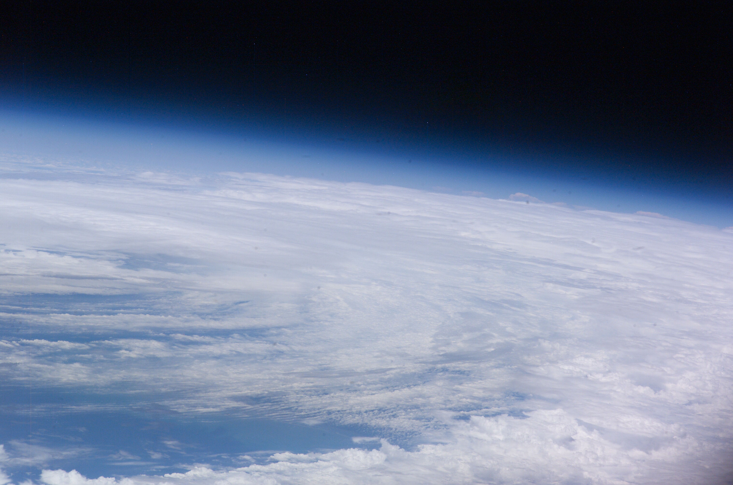
Image Caption: ISS011-E-08483 (11 June 2005) --- From 225 miles above Earth, the crew members aboard the International Space Station captured early tropical activity of the 2005 season, using an Electronic Still Camera. At the time of this photo (17:27:32 GMT, June 11, 2005), tropical storm Arlene was about two hours away from making landfall near Gulf Shores, AL with 60 mph winds. This frame and ISS011-E-08482 together encompass the entire body of the disorganized storm. View is from the southeast over the central Bahamas.
