ISS011-E-7380
| NASA Photo ID | ISS011-E-7380 |
| Focal Length | 400mm |
| Date taken | 2005.05.28 |
| Time taken | 13:04:33 GMT |
1000 x 661 pixels 540 x 357 pixels 540 x 540 pixels 3032 x 2008 pixels 639 x 435 pixels
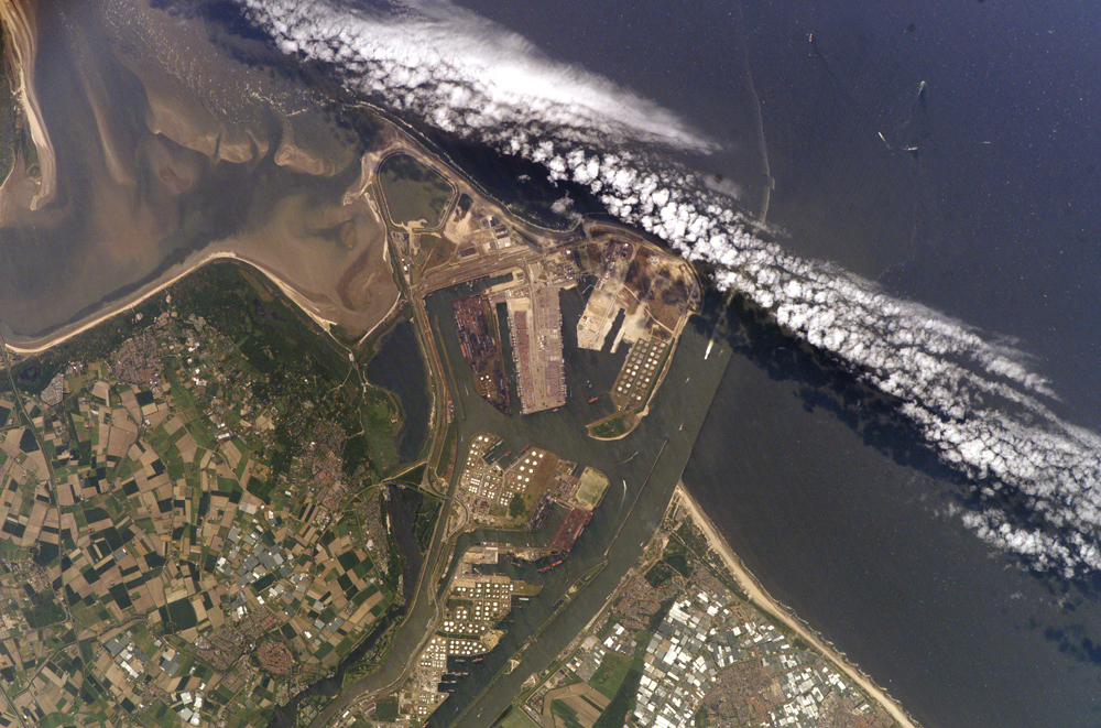
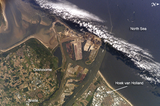
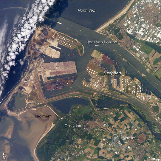
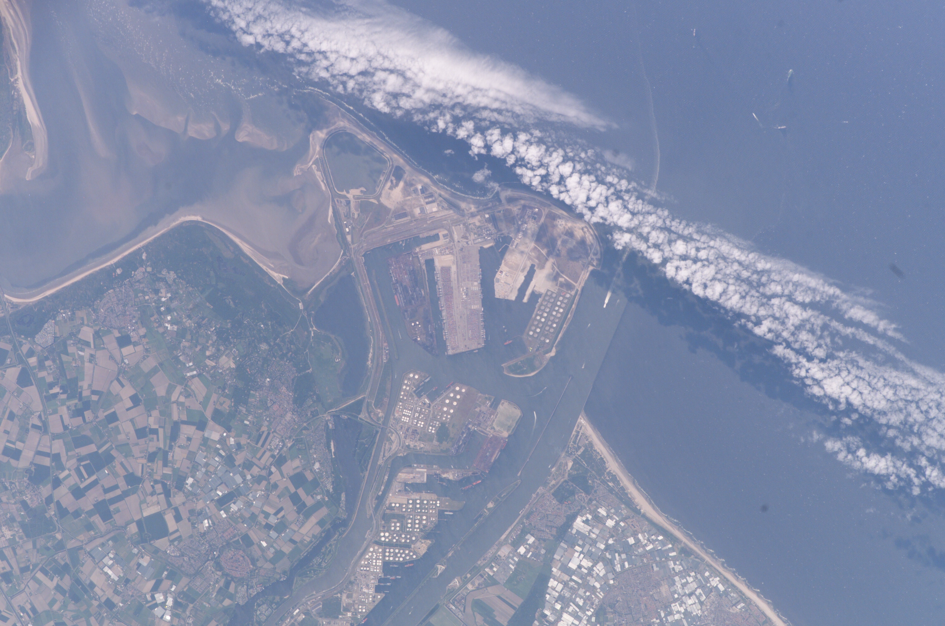
Photo center point: 52.0° N, 4.1° E
Photo center point by machine learning:
Camera: | Kodak DCS760c Electronic Still Camera |
Focal Length: | 400mm |
Camera Tilt: | 33 degrees |
Format: | 3060E: 3060 x 2036 pixel CCD, RGBG array |
Film Exposure: | |
| Additional Information | |
| Width | Height | Annotated | Cropped | Purpose | Links |
|---|---|---|---|---|---|
| 1000 pixels | 661 pixels | No | Yes | Earth From Space collection | Download Image |
| 540 pixels | 357 pixels | Yes | Yes | Earth From Space collection | Download Image |
| 540 pixels | 540 pixels | Yes | Yes | NASA's Earth Observatory web site | Download Image |
| 3032 pixels | 2008 pixels | No | No | Not enhanced | Download Image |
| 639 pixels | 435 pixels | No | No | Download Image |
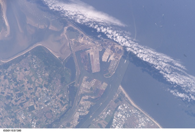
The Port of Rotterdam, also known as Europoort (Eurogate), has been an important trading center since approximately AD 1250. The history of the port reflects the evolution of the world's economic base. Originally serving the North Sea herring fleets, it rapidly grew into a major mercantile port during the Dutch colonial period. The 19th century witnessed the Industrial Revolution, and steel and coal became major commodities passing through the port. Following the development of petroleum as a primary energy resource in the early twentieth century, the port expanded westward to accommodate storage facilities and large oil tankers.
This westward expansion continued beyond the coastline in the 1970s, when a portion of the sea was cordoned off and drained to create the facilities visible in this astronaut photograph. Large petroleum storage tank fields and docks for supertankers occupy the center of the image. In 2004, more than 350 million tons of cargo passed through the port.
The image illustrates the close proximity of the Europoort to the surrounding cities of Hoek van Holland, Oostvoorne, Brielle. Between Oostvoorne and Brielle, a mixture of fertile and fallow agricultural fields create a green and tan checkboard. The presence of the port and its seawalls interrupts southward-flowing coastal currents, leading to accumulation of sediment to the south (lower left of image). Numerous ship wakes are visible within the port complex itself and in the North Sea, in the upper part of the image.
