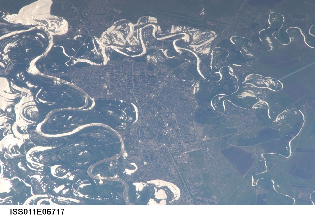
ISS011-E-6717
| NASA Photo ID | ISS011-E-6717 |
| Focal Length | 800mm |
| Date taken | 2005.05.22 |
| Time taken | 12:08:43 GMT |
1000 x 652 pixels 539 x 341 pixels 540 x 352 pixels 1600 x 1098 pixels 1600 x 1042 pixels 640 x 439 pixels
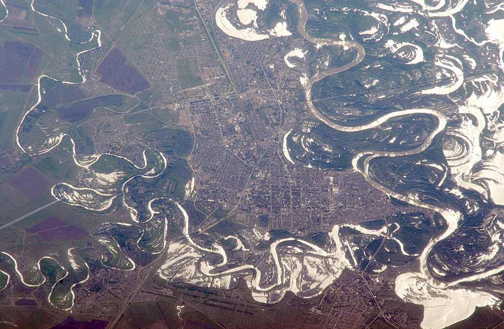
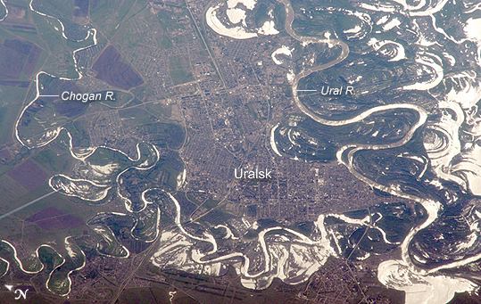
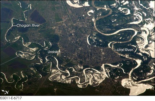

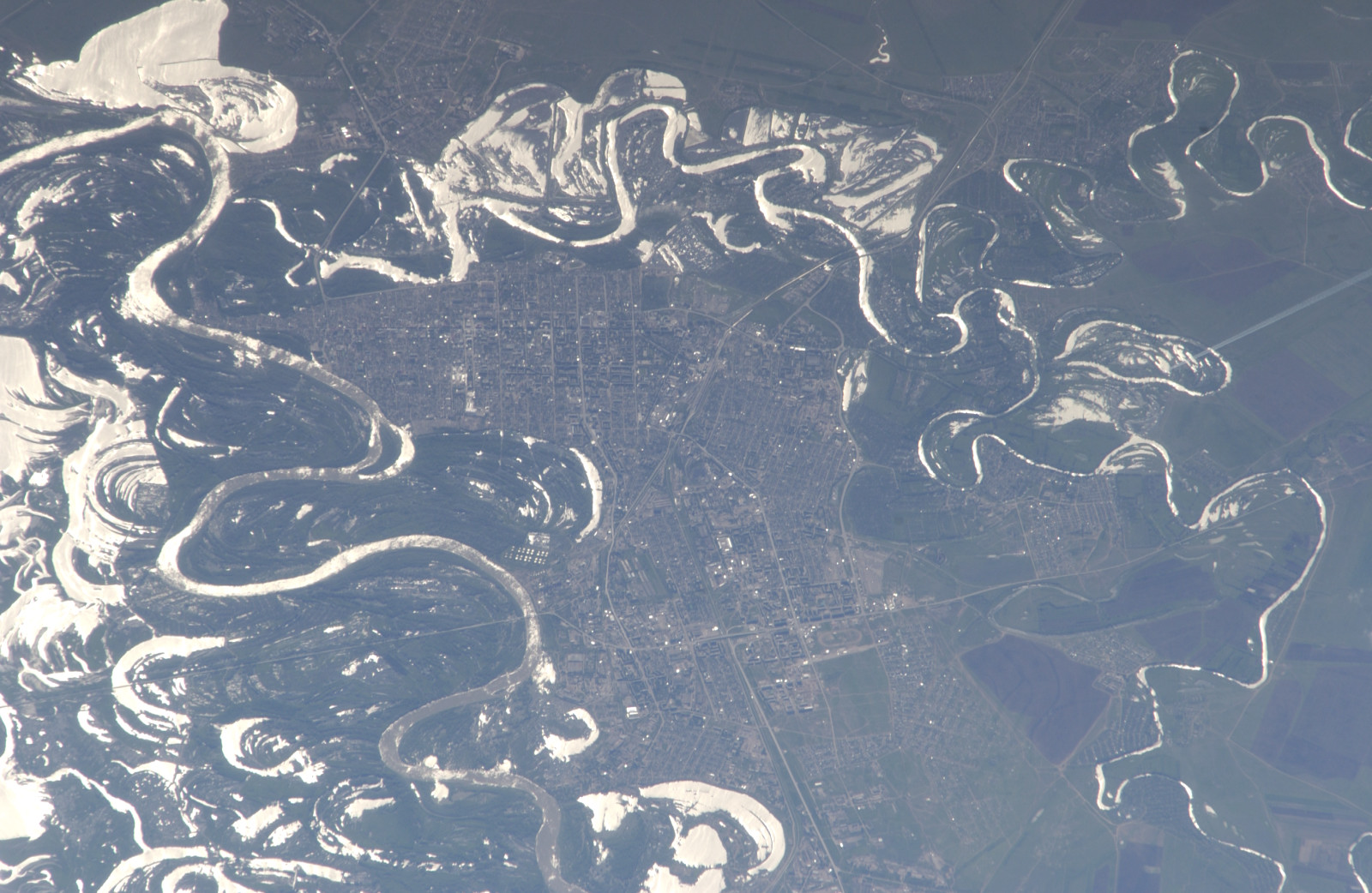
Photo center point: 51.2° N, 51.4° E
Photo center point by machine learning:
Camera: | Nikon D1 Electronic Still Camera |
Focal Length: | 800mm |
Camera Tilt: | High Oblique |
Format: | 2000E: 2000 x 1312 pixel CCD, RGBG imager color filter |
Film Exposure: | |
| Additional Information | |
| Width | Height | Annotated | Cropped | Purpose | Links |
|---|---|---|---|---|---|
| 1000 pixels | 652 pixels | No | Yes | Earth From Space collection | Download Image |
| 539 pixels | 341 pixels | Yes | Yes | Earth From Space collection | Download Image |
| 540 pixels | 352 pixels | Yes | Yes | NASA's Earth Observatory web site | Download Image |
| 1600 pixels | 1098 pixels | No | No | Download Image | |
| 1600 pixels | 1042 pixels | No | No | Original file from camera | Download Image |
| 640 pixels | 439 pixels | No | No | Download Image |
The approximate boundary between Europe and Asia is defined by the Ural River and the Ural Mountains to its north. The Ural River flows to the great, inland Caspian Sea, and gives its name to the city of Uralsk on its banks. Lying just inside the Kazakh border with Russia, Uralsk is an agricultural and industrial center, and has been an important trade stop since the early 1600s. Barge traffic has passed up and down the Ural River between the Caspian Sea and the Ural Mountains for centuries. Today it is one of the major entry points for rail traffic from Europe to Siberia, servicing the many new oil fields in the Caspian basin and the industrial cities of the southern Urals.
International Space Station astronauts acquired a series of images of Uralsk, highlighting the city under different lighting conditions. This view shows the sunglint (light reflected from the water surface towards the observer) on the rivers, lakes, and ponds of the Ural floodplain (right side of image) and that of a tributary, the Chogan River (bottom). The cityscape of Uralsk, on the headland between the two, is relatively difficult to see because the water and sunglint dominate the scene.
